THE ADVENTURE COLLECTIVE® · Independent discovery and booking for outdoor travel

See Multnomah Falls from above on a 30‑minute scenic flight through the Columbia River Gorge. This aerial tour compresses geology, history and sweeping views into one efficient, highly photogenic outing.
See Multnomah Falls from above on a 30‑minute scenic flight through the Columbia River Gorge. This aerial tour compresses geology, history and sweeping views into one efficient, highly photogenic outing.
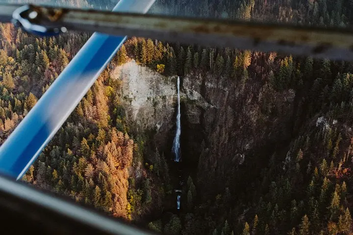
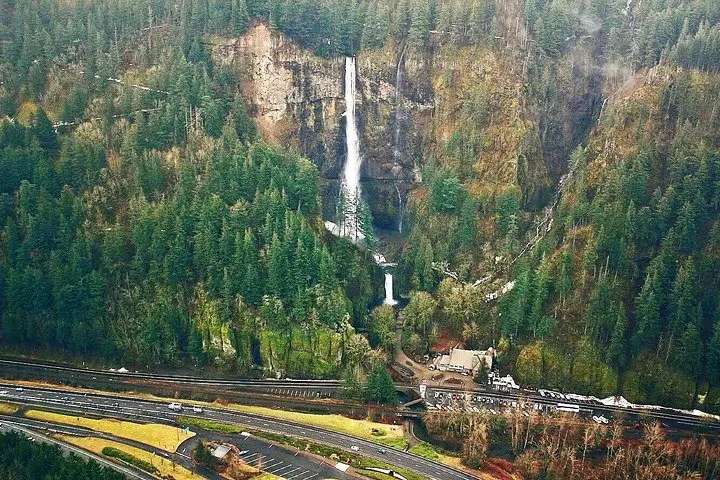
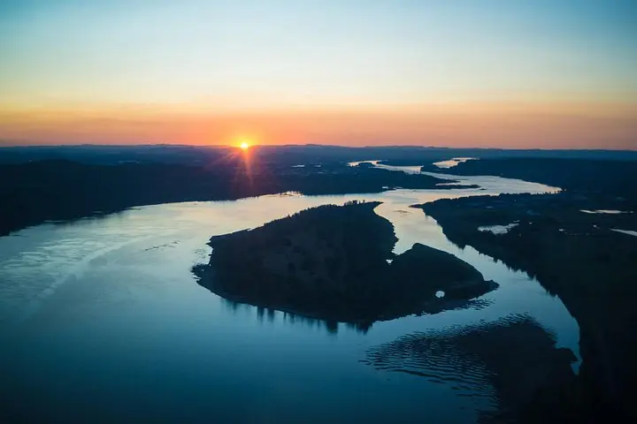
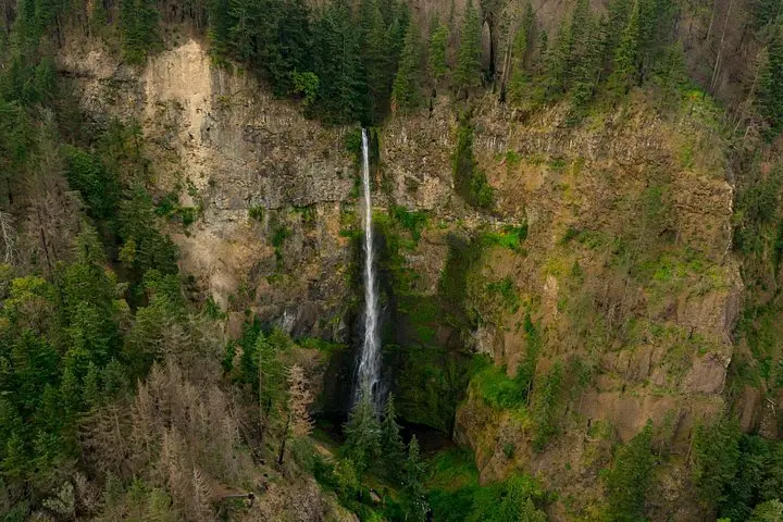
You lift off from the small airfield and the Columbia River immediately asserts itself — a broad, restless ribbon pushing west between steep basalt walls. From your window the gorge opens in layers: terraces cut by ice-age floods, cliffs streaked with scoria, and Multnomah Falls dropping in two distinct tiers, water daring the air as it descends.
Verified experiences and guided adventures in the surrounding area.
Operated by Envi Adventures, LLC · Troutdale, Oregon
You lift off from the small airfield and the Columbia River immediately asserts itself — a broad, restless ribbon pushing west between steep basalt walls. From your window the gorge opens in layers: terraces cut by ice-age floods, cliffs streaked with scoria, and Multnomah Falls dropping in two distinct tiers, water daring the air as it descends.
The falls are fed by springs on Larch Mountain; they look different every season. The gorge’s cliffs were carved and polished by catastrophic Missoula Floods at the end of the last ice age, exposing columnar basalt and rich volcanic deposits. Vista House at Crown Point, visible from above, marks a 20th‑century lookout built to celebrate the new highway and the region’s growing tourism culture.
On a short, thirty‑minute flight you get geology, history and scale — the river’s route, the concentration of waterfalls, and the small towns pinned to the canyon rim. The aircraft’s headset brings your pilot’s narration close while the river and cliffs do the rest.
Practical notes: arrive 20 minutes early, weigh-ins are required (group limits apply), and flights operate year‑round but depend on visibility and wind. Dress for wind and cool temperatures at altitude; even in summer the aircraft can feel sharp. Bring a camera with a fast shutter, expect no landings at the falls, and consider morning departures for the clearest light before afternoon haze or wildfire smoke builds. If you’re prone to motion sickness, choose a window over the wing to stabilize your view. This flight compresses the gorge experience into one aerial sweep — an efficient, unforgettable way to see one of the Pacific Northwest’s most visited natural landmarks.
The flight is approximately 30 minutes from takeoff to landing, covering Multnomah Falls and key Gorge viewpoints.
Flights depend on visibility and wind; while the operator’s policy allows some weather flexibility, poor visibility or unsafe winds will result in cancellation or rescheduling.
The tour notes support wheelchairs and service animals, but contact the operator ahead of time to confirm logistics and boarding assistance.
Yes — individual and group weight limits apply (e.g., up to 250 lb per person with specific group caps); provide accurate weights when booking.
Envi Adventures, LLC operates guided outdoor trips and adventures with an emphasis on safety, stewardship, and memorable experiences.
You lift off from the small airfield and the Columbia River immediately asserts itself — a broad, restless ribbon pushing west between steep basalt walls. From your window the gorge opens in layers: terraces cut by ice-age floods, cliffs streaked with scoria, and Multnomah Falls dropping in two distinct tiers, water daring the air as it descends.
You lift off from the small airfield and the Columbia River immediately asserts itself — a broad, restless ribbon pushing west between steep basalt walls. From your window the gorge opens in layers: terraces cut by ice-age floods, cliffs streaked with scoria, and Multnomah Falls dropping in two distinct tiers, water daring the air as it descends.
The falls are fed by springs on Larch Mountain; they look different every season. The gorge’s cliffs were carved and polished by catastrophic Missoula Floods at the end of the last ice age, exposing columnar basalt and rich volcanic deposits. Vista House at Crown Point, visible from above, marks a 20th‑century lookout built to celebrate the new highway and the region’s growing tourism culture.
On a short, thirty‑minute flight you get geology, history and scale — the river’s route, the concentration of waterfalls, and the small towns pinned to the canyon rim. The aircraft’s headset brings your pilot’s narration close while the river and cliffs do the rest.
Practical notes: arrive 20 minutes early, weigh-ins are required (group limits apply), and flights operate year‑round but depend on visibility and wind. Dress for wind and cool temperatures at altitude; even in summer the aircraft can feel sharp. Bring a camera with a fast shutter, expect no landings at the falls, and consider morning departures for the clearest light before afternoon haze or wildfire smoke builds. If you’re prone to motion sickness, choose a window over the wing to stabilize your view. This flight compresses the gorge experience into one aerial sweep — an efficient, unforgettable way to see one of the Pacific Northwest’s most visited natural landmarks.