THE ADVENTURE COLLECTIVE® · Independent discovery and booking for outdoor travel

Walk the ridge from Nagarkot to Dhulikhel for broad Himalayan panoramas, village tea houses and a mostly downhill 5–6 hour trail. Ideal for hikers who want mountain vistas without remote trekking logistics.
Walk the ridge from Nagarkot to Dhulikhel for broad Himalayan panoramas, village tea houses and a mostly downhill 5–6 hour trail. Ideal for hikers who want mountain vistas without remote trekking logistics.
You step out before breakfast as the ridge lightens, cool air pushing down the slope and the Himalaya holding its line of summits on the horizon. From Nagarkot the trail slips away from the hotel rooftops into terraced fields and scrubby rhododendron, the path mostly descending toward Dhulikhel with repeated outlooks over Panckhal valley and, on clear days, the mid‑Himalaya including distant Everest.
Verified experiences and guided adventures in the surrounding area.
Operated by High Spirit Treks and Expedition Nepal · Nagarkot, Bagmati Province
You step out before breakfast as the ridge lightens, cool air pushing down the slope and the Himalaya holding its line of summits on the horizon. From Nagarkot the trail slips away from the hotel rooftops into terraced fields and scrubby rhododendron, the path mostly descending toward Dhulikhel with repeated outlooks over Panckhal valley and, on clear days, the mid‑Himalaya including distant Everest.
This route follows ancient mule tracks and local footpaths that once linked trading villages around the Kathmandu Valley. Geologically you walk on the valley rim — folded Tertiary rocks carved by centuries of erosion — with village settlements built along water lines and terraces that reflect Newar and Tamang farming traditions. Along the way you’ll pass small tea houses, community groves and stone walls that mark family plots.
Practically, expect a steady 5–6 hour outing covering roughly 10–12 km with about 500–700 m net descent (some short ups and rocky sections). Trails are dirt and stone; sections cross jeep tracks and meet the Arniko Highway near Dhulikhel. Start early for the best light and cooler temperatures, carry water and snacks, and plan your return transportation — many groups finish in Dhulikhel for lunch before heading back to Kathmandu. If you prefer a shorter day, the route can be ended at Banepa to shave off an hour.
Bring solid footwear for loose stone, dress in layers for changing sun and wind, and respect local lanes: these are working landscapes where agriculture and pilgrimage still shape the pace of the day.
Typical group itineraries run 5–6 hours covering about 10–12 km with a net descent of roughly 500–700 m.
No special permits are required for this day hike; organized tours include a government‑licensed English‑speaking guide by default.
Yes — ending at Banepa shortens the route by about an hour and is a common option for a gentler day.
Nagarkot and Dhulikhel are ridge towns around 1,700–2,200 m; altitude effects are minimal for acclimatized visitors but take it slow if you have cardiovascular concerns.
High Spirit Treks and Expedition Nepal operates guided outdoor trips and adventures with an emphasis on safety, stewardship, and memorable experiences.
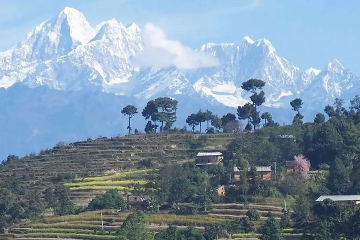
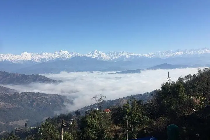
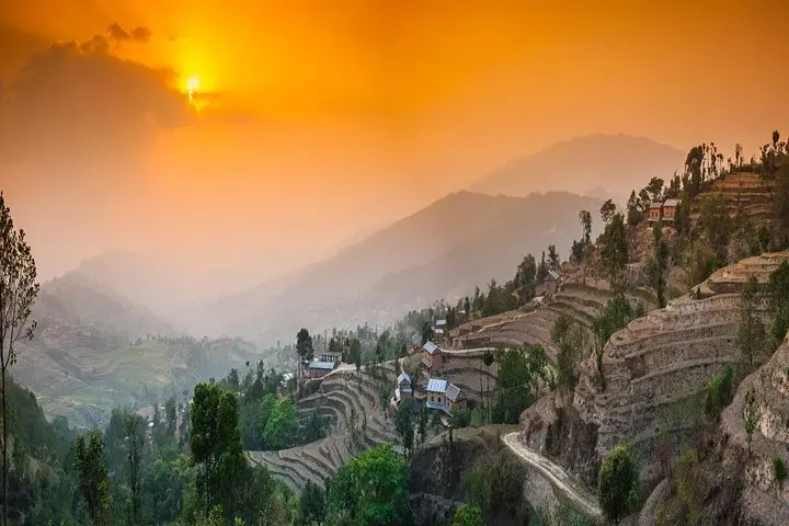
You step out before breakfast as the ridge lightens, cool air pushing down the slope and the Himalaya holding its line of summits on the horizon. From Nagarkot the trail slips away from the hotel rooftops into terraced fields and scrubby rhododendron, the path mostly descending toward Dhulikhel with repeated outlooks over Panckhal valley and, on clear days, the mid‑Himalaya including distant Everest.
You step out before breakfast as the ridge lightens, cool air pushing down the slope and the Himalaya holding its line of summits on the horizon. From Nagarkot the trail slips away from the hotel rooftops into terraced fields and scrubby rhododendron, the path mostly descending toward Dhulikhel with repeated outlooks over Panckhal valley and, on clear days, the mid‑Himalaya including distant Everest.
This route follows ancient mule tracks and local footpaths that once linked trading villages around the Kathmandu Valley. Geologically you walk on the valley rim — folded Tertiary rocks carved by centuries of erosion — with village settlements built along water lines and terraces that reflect Newar and Tamang farming traditions. Along the way you’ll pass small tea houses, community groves and stone walls that mark family plots.
Practically, expect a steady 5–6 hour outing covering roughly 10–12 km with about 500–700 m net descent (some short ups and rocky sections). Trails are dirt and stone; sections cross jeep tracks and meet the Arniko Highway near Dhulikhel. Start early for the best light and cooler temperatures, carry water and snacks, and plan your return transportation — many groups finish in Dhulikhel for lunch before heading back to Kathmandu. If you prefer a shorter day, the route can be ended at Banepa to shave off an hour.
Bring solid footwear for loose stone, dress in layers for changing sun and wind, and respect local lanes: these are working landscapes where agriculture and pilgrimage still shape the pace of the day.