THE ADVENTURE COLLECTIVE® · Independent discovery and booking for outdoor travel

A short metro ride out of central Oslo leads into Oslomarka’s forested slopes and a steady ascent to Vettakollen viewpoint. This 2–3 hour guided hike blends easy trails, local outdoor culture and wide Oslofjord panoramas—ideal for photographers and casual hikers alike.
A short metro ride out of central Oslo leads into Oslomarka’s forested slopes and a steady ascent to Vettakollen viewpoint. This 2–3 hour guided hike blends easy trails, local outdoor culture and wide Oslofjord panoramas—ideal for photographers and casual hikers alike.
The day begins on the metro as the city thins and the track climbs into Oslomarka; spruce and birch slide past the window and the air sharpens. From Frognerseteren the trail unfurls—soft soil underfoot, the occasional boardwalk over boggy patches, and a steady, approachable rise toward the ridge. At the Vettakollen viewpoint the city stretches below and the Oslofjord glitters, a living map of islands and inlets that daring winds sculpt into patterns.
Verified experiences and guided adventures in the surrounding area.
Operated by Opatrip.com Norway · Oslo, Oslo
The day begins on the metro as the city thins and the track climbs into Oslomarka; spruce and birch slide past the window and the air sharpens. From Frognerseteren the trail unfurls—soft soil underfoot, the occasional boardwalk over boggy patches, and a steady, approachable rise toward the ridge. At the Vettakollen viewpoint the city stretches below and the Oslofjord glitters, a living map of islands and inlets that daring winds sculpt into patterns.
Oslomarka is Oslo’s outdoor backyard: a post‑glacial landscape of rounded hills, moraine ridges and small lakes that Norwegians have used for seasonal hunting, timber and recreation for centuries. The routes you’ll follow are well‑worn by generations practicing friluftsliv—the local commitment to spending time outside—so you’ll pass simple huts, trail markers and evidence of old forestry roads that hint at the area’s working past.
Practical guidance: expect 4–6 km round‑trip with roughly 150–300 m elevation gain and a 2–3 hour itinerary including photo stops. Trails are clearly marked from Frognerseteren; take the T‑banen metro (Line 1) from the city center to the top station. Footwear with good grip and a light waterproof layer are wise—weather can shift quickly and muddy sections are common after rain. Hydrate and pack a small snack; mobile signal is intermittent in the trees. This route suits most fitness levels and rewards steady pacing with sweeping fjord views and a clear sense of Oslo slipping away beneath you.
Take the T‑banen Line 1 from Jernbanetorget or Majorstuen to Frognerseteren station; the hike begins a short walk from the station.
Yes—routes are well marked and not technical; families with basic fitness and proper footwear will manage the steady ascent.
Dogs are commonly allowed but should be kept on a leash in areas with wildlife and during busy periods; bring water for your pet.
Signal is generally intermittent in parts of Oslomarka, so download maps or save the route offline before you leave the city.
Opatrip.com Norway operates guided outdoor trips and adventures with an emphasis on safety, stewardship, and memorable experiences.

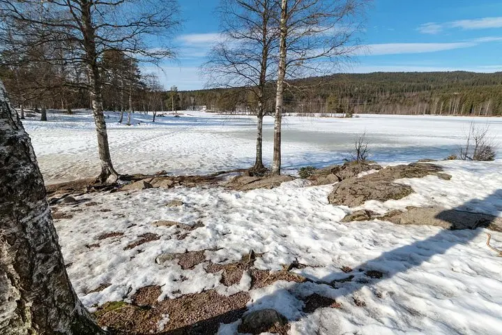
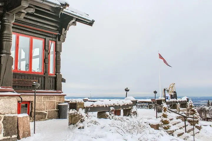

The day begins on the metro as the city thins and the track climbs into Oslomarka; spruce and birch slide past the window and the air sharpens. From Frognerseteren the trail unfurls—soft soil underfoot, the occasional boardwalk over boggy patches, and a steady, approachable rise toward the ridge. At the Vettakollen viewpoint the city stretches below and the Oslofjord glitters, a living map of islands and inlets that daring winds sculpt into patterns.
The day begins on the metro as the city thins and the track climbs into Oslomarka; spruce and birch slide past the window and the air sharpens. From Frognerseteren the trail unfurls—soft soil underfoot, the occasional boardwalk over boggy patches, and a steady, approachable rise toward the ridge. At the Vettakollen viewpoint the city stretches below and the Oslofjord glitters, a living map of islands and inlets that daring winds sculpt into patterns.
Oslomarka is Oslo’s outdoor backyard: a post‑glacial landscape of rounded hills, moraine ridges and small lakes that Norwegians have used for seasonal hunting, timber and recreation for centuries. The routes you’ll follow are well‑worn by generations practicing friluftsliv—the local commitment to spending time outside—so you’ll pass simple huts, trail markers and evidence of old forestry roads that hint at the area’s working past.
Practical guidance: expect 4–6 km round‑trip with roughly 150–300 m elevation gain and a 2–3 hour itinerary including photo stops. Trails are clearly marked from Frognerseteren; take the T‑banen metro (Line 1) from the city center to the top station. Footwear with good grip and a light waterproof layer are wise—weather can shift quickly and muddy sections are common after rain. Hydrate and pack a small snack; mobile signal is intermittent in the trees. This route suits most fitness levels and rewards steady pacing with sweeping fjord views and a clear sense of Oslo slipping away beneath you.