THE ADVENTURE COLLECTIVE® · Independent discovery and booking for outdoor travel

Cross three Andean ecosystems in three days: a pre-dawn 4x4 climb to Santa Isabel’s glacier, a paramo traverse to Laguna del Otún, and a descending forest walk to waterfalls and the La Pastora visitor center. Expect high-altitude terrain, strong winds, and dramatic water-fed landscapes.
Cross three Andean ecosystems in three days: a pre-dawn 4x4 climb to Santa Isabel’s glacier, a paramo traverse to Laguna del Otún, and a descending forest walk to waterfalls and the La Pastora visitor center. Expect high-altitude terrain, strong winds, and dramatic water-fed landscapes.
The morning air bites at 4:00 a.m. as the 4x4 rolls out of Pereira and the city lights shrink behind you. Ahead, the route climbs fast — past coffee farms and into a high, wind-scoured paramo where tussock grass and frailejones lean into the wind. On day one the itinerary pushes toward the snowy flank of Santa Isabel (approx. 4,700 m), a glacial silhouette that marks the headwaters of the Otún River.
Verified experiences and guided adventures in the surrounding area.
Operated by Cattleya SER - Ecoturismo · Pereira, Risaralda
The morning air bites at 4:00 a.m. as the 4x4 rolls out of Pereira and the city lights shrink behind you. Ahead, the route climbs fast — past coffee farms and into a high, wind-scoured paramo where tussock grass and frailejones lean into the wind. On day one the itinerary pushes toward the snowy flank of Santa Isabel (approx. 4,700 m), a glacial silhouette that marks the headwaters of the Otún River.
This crossing threads three ecological bands in quick succession: the exposed paramo, a glacial-fed lagoon, and then descending Andean forest. Laguna del Otún sits near 3,950 m, a glassy natural reservoir that collects melt and feeds communities below; further down, the La Pastora visitor center and the Los Chorros waterfalls sit at about 2,500 m, where humid forest replaces páramo wind.
Culturally, the route passes peasant inns and small Potosí-sector settlements that have long served as waystations for shepherds and water guardians. Geologically, you’re walking on volcanic soils and glacial sculpting from the high Nevado chain — expect sharp elevation shifts and stony footing.
Practical edge: the tour provides bottled water, snacks and meals, and uses 4x4 transfers between trailheads. Altitude is the main challenge — ascend slowly, carry layers, and monitor symptoms of AMS. Sturdy waterproof boots, thermal insulation for nights at the inn and in the paramo, and a headlamp for early starts will make the crossing manageable and memorable. The trail alternates exposed wind and muddy forest paths; keep to defined tracks to protect the fragile páramo and avoid erosion.
No technical mountaineering equipment is required on this tour; the itinerary visits the glacier area but does not involve glacier travel requiring ropes or crampons.
Altitude is a real factor—day one reaches near 4,700 m. Symptoms can appear quickly; bring acetazolamide if prescribed, ascend slowly, hydrate, and notify guides of any severe symptoms.
Nights are spent in a rustic peasant inn (Campoalegre) and a simple forest lodging; expect basic facilities and hearty local meals provided by the operator.
Yes—the tour includes bottled water, snacks, breakfast, lunch, and dinner as listed, but bring personal electrolytes and snacks if you prefer extras.
Cattleya SER - Ecoturismo operates guided outdoor trips and adventures with an emphasis on safety, stewardship, and memorable experiences.
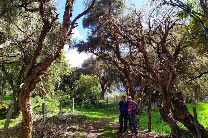

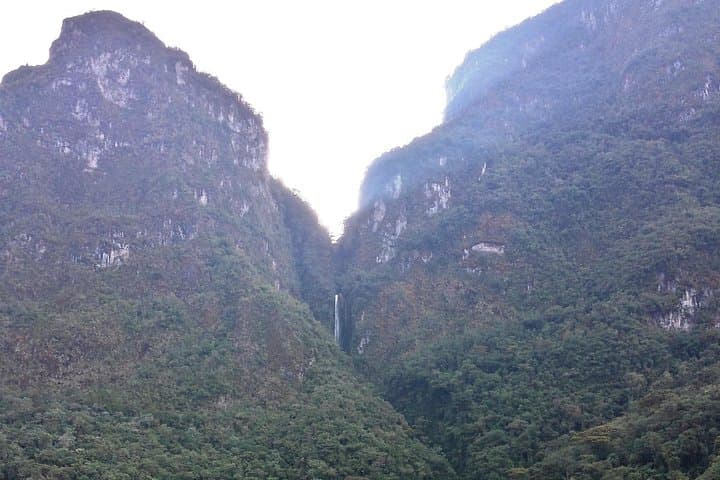

The morning air bites at 4:00 a.m. as the 4x4 rolls out of Pereira and the city lights shrink behind you. Ahead, the route climbs fast — past coffee farms and into a high, wind-scoured paramo where tussock grass and frailejones lean into the wind. On day one the itinerary pushes toward the snowy flank of Santa Isabel (approx. 4,700 m), a glacial silhouette that marks the headwaters of the Otún River.
The morning air bites at 4:00 a.m. as the 4x4 rolls out of Pereira and the city lights shrink behind you. Ahead, the route climbs fast — past coffee farms and into a high, wind-scoured paramo where tussock grass and frailejones lean into the wind. On day one the itinerary pushes toward the snowy flank of Santa Isabel (approx. 4,700 m), a glacial silhouette that marks the headwaters of the Otún River.
This crossing threads three ecological bands in quick succession: the exposed paramo, a glacial-fed lagoon, and then descending Andean forest. Laguna del Otún sits near 3,950 m, a glassy natural reservoir that collects melt and feeds communities below; further down, the La Pastora visitor center and the Los Chorros waterfalls sit at about 2,500 m, where humid forest replaces páramo wind.
Culturally, the route passes peasant inns and small Potosí-sector settlements that have long served as waystations for shepherds and water guardians. Geologically, you’re walking on volcanic soils and glacial sculpting from the high Nevado chain — expect sharp elevation shifts and stony footing.
Practical edge: the tour provides bottled water, snacks and meals, and uses 4x4 transfers between trailheads. Altitude is the main challenge — ascend slowly, carry layers, and monitor symptoms of AMS. Sturdy waterproof boots, thermal insulation for nights at the inn and in the paramo, and a headlamp for early starts will make the crossing manageable and memorable. The trail alternates exposed wind and muddy forest paths; keep to defined tracks to protect the fragile páramo and avoid erosion.