THE ADVENTURE COLLECTIVE® · Independent discovery and booking for outdoor travel

A concise 90-minute guided walk that traces Bridgetown’s reclaimed Pelican Island—visit Fontabelle Road, Kensington Oval, the Indian River site and Rihanna Drive while learning about wartime use and indigenous history.
A concise 90-minute guided walk that traces Bridgetown’s reclaimed Pelican Island—visit Fontabelle Road, Kensington Oval, the Indian River site and Rihanna Drive while learning about wartime use and indigenous history.
The guide waits at the roundabout outside Bridgetown Port and the city opens like a map under your feet: harbor rails, the stretch of Fontabelle Road and the shallow arc where Pelican Island once floated separate from the mainland. In 90 minutes the tour threads reclaimed shoreline, cricket stadium, and an Arawak-era fishing site, folding local stories into concrete and sand.
Verified experiences and guided adventures in the surrounding area.
Operated by Ruthann Discovery Tours · Bridgetown, Saint Michael
The guide waits at the roundabout outside Bridgetown Port and the city opens like a map under your feet: harbor rails, the stretch of Fontabelle Road and the shallow arc where Pelican Island once floated separate from the mainland. In 90 minutes the tour threads reclaimed shoreline, cricket stadium, and an Arawak-era fishing site, folding local stories into concrete and sand.
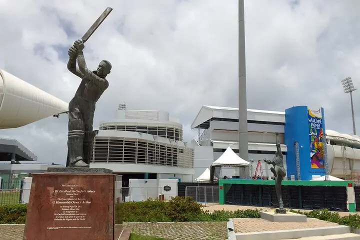
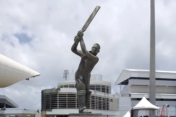
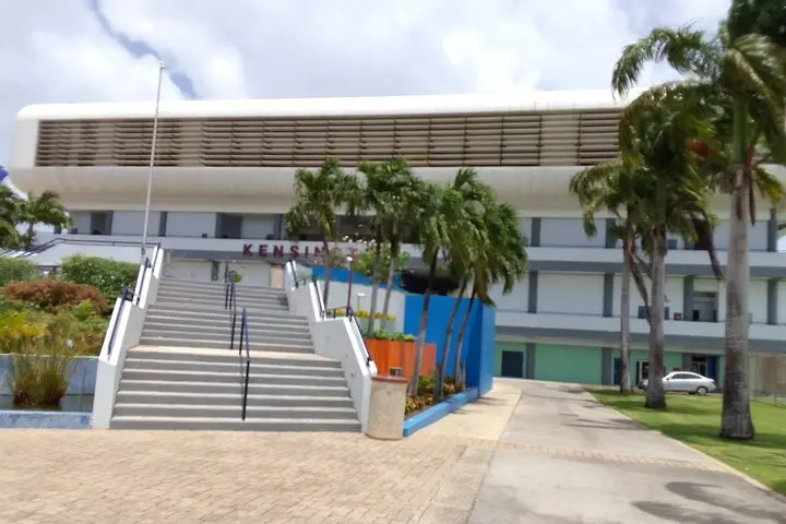
Pelican Island was permanently attached to Bridgetown in the 1950s, adding roughly 90 acres to the deep-water harbor. That fill changed trade routes and the shoreline; during both world wars the area served as an intermittent staging and quarantine site. Kensington Oval on Fontabelle Road marks modern social life—cricket here is more than a sport, it’s a public calendar. Grynner Highway traces older shorelines, and the Indian River points to the island’s pre-colonial users.
Expect mostly flat, paved walking with short stops at viewpoints and cultural sites, plus a detour to Rihanna Drive for a look at a familiar local address. The walking pace is steady but accessible; bring sun protection and water and plan mornings to avoid peak heat. Public transport and port pickup options make logistics simple for cruise passengers. Wear closed-toe shoes for mixed surfaces and be prepared for urban traffic when crossing roads.
This tour is a compact primer in Bridgetown’s coastal engineering, colonial history and living culture—good for travelers who want a short, information-rich walk that connects maps to memory.
The guide meets travelers outside the Bridgetown Port at a small roundabout; the tour returns to the same meeting point.
Yes—pickup is at the port and the 90-minute duration fits typical shore excursion windows, but confirm your ship’s schedule before booking.
Public restrooms are available near the port and at some stops; plan ahead if you need frequent access.
The route is generally stroller-accessible and manageable for those with moderate mobility, but there are street crossings and occasional uneven sidewalks.
Ruthann Discovery Tours operates guided outdoor trips and adventures with an emphasis on safety, stewardship, and memorable experiences.
The guide waits at the roundabout outside Bridgetown Port and the city opens like a map under your feet: harbor rails, the stretch of Fontabelle Road and the shallow arc where Pelican Island once floated separate from the mainland. In 90 minutes the tour threads reclaimed shoreline, cricket stadium, and an Arawak-era fishing site, folding local stories into concrete and sand.
The guide waits at the roundabout outside Bridgetown Port and the city opens like a map under your feet: harbor rails, the stretch of Fontabelle Road and the shallow arc where Pelican Island once floated separate from the mainland. In 90 minutes the tour threads reclaimed shoreline, cricket stadium, and an Arawak-era fishing site, folding local stories into concrete and sand.
Pelican Island was permanently attached to Bridgetown in the 1950s, adding roughly 90 acres to the deep-water harbor. That fill changed trade routes and the shoreline; during both world wars the area served as an intermittent staging and quarantine site. Kensington Oval on Fontabelle Road marks modern social life—cricket here is more than a sport, it’s a public calendar. Grynner Highway traces older shorelines, and the Indian River points to the island’s pre-colonial users.
Expect mostly flat, paved walking with short stops at viewpoints and cultural sites, plus a detour to Rihanna Drive for a look at a familiar local address. The walking pace is steady but accessible; bring sun protection and water and plan mornings to avoid peak heat. Public transport and port pickup options make logistics simple for cruise passengers. Wear closed-toe shoes for mixed surfaces and be prepared for urban traffic when crossing roads.
This tour is a compact primer in Bridgetown’s coastal engineering, colonial history and living culture—good for travelers who want a short, information-rich walk that connects maps to memory.