THE ADVENTURE COLLECTIVE® · Independent discovery and booking for outdoor travel

Short but steep, the Pico da Tijuca hike cracks open Rio’s forested interior and rewards you with sweeping city and bay views. This five-hour tour pairs a visit to Taunay Waterfall with a direct 5 km round-trip ascent to the summit.
Short but steep, the Pico da Tijuca hike cracks open Rio’s forested interior and rewards you with sweeping city and bay views. This five-hour tour pairs a visit to Taunay Waterfall with a direct 5 km round-trip ascent to the summit.
The morning arrives cool and green as the van climbs from Rio’s South Zone into the lungs of the city: Tijuca National Park. The trailhead at Bom Retiro opens into a corridor of Atlantic Rainforest where trunks drip with ferns and the air smells of wet earth; the forest seems to press forward, nudging you up the path toward Pico da Tijuca.
Verified experiences and guided adventures in the surrounding area.
Operated by RioXtreme · Rio de Janeiro, Rio de Janeiro
The morning arrives cool and green as the van climbs from Rio’s South Zone into the lungs of the city: Tijuca National Park. The trailhead at Bom Retiro opens into a corridor of Atlantic Rainforest where trunks drip with ferns and the air smells of wet earth; the forest seems to press forward, nudging you up the path toward Pico da Tijuca.
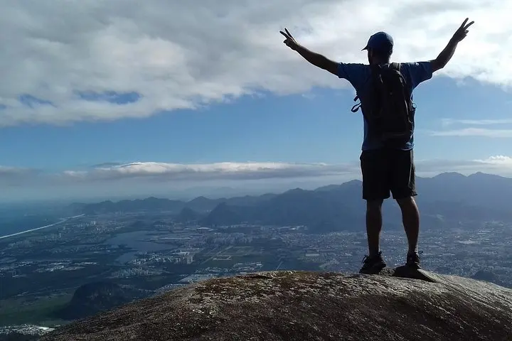
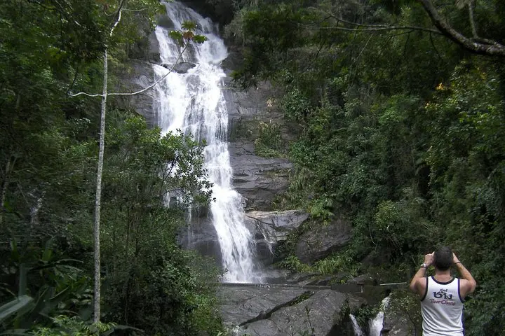
Pico da Tijuca (1,022 m / 3,353 ft) is the highest point in the city and sits amid a reclaimed forest that was largely restored in the 19th century to protect watersheds lost to agriculture. The geology here is granite and gneiss, carved into steep ridgelines and rounded domes that give the trail its short, sometimes steep pitch. Along the way you’ll pass Taunay Waterfall and viewpoints that turn the city into a spread of bays, stadium roofs and distant islands — the land and the Atlantic play off each other.
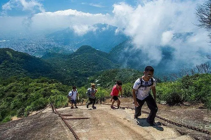
The hike itself is direct: about 5 km round-trip with roughly 450 m (1,476 ft) of elevation gain and a one-hour push to the summit for fit walkers. Expect packed dirt, stone steps and short rocky scrambles; rainfall can make sections slick. Guides typically include transfers, local insight on flora and fauna, and a stop at Vista Chinesa when permitted.
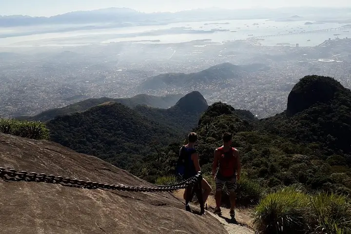
Practical guidance: start early to avoid mid-day heat and crowds, wear grippy hiking shoes, bring 1–2 liters of water, insect repellent and a lightweight rain layer during the wet season. Move at a steady pace on the climb, take breaks to look back over Guanabara Bay, and stay on the marked trail — the park’s biodiversity responds best when visitors keep to established routes.
The trail is about 5 km round-trip with roughly 450 m elevation gain; the climb is rated moderate and typically takes about 1 hour up and 45 minutes down for average hikers.
Guided tours commonly include an accredited guide and private round-trip transfer from Rio’s South Zone; pickups outside that area may incur extra fees.
Visitors pay park entrance or vehicle fees where applicable; organized tours usually cover access but confirm with your operator before departure.
Trails remain open but can become slippery and waterlogged; avoid exposed ridgelines during electrical storms and wear non-slip shoes.
RioXtreme operates guided outdoor trips and adventures with an emphasis on safety, stewardship, and memorable experiences.
The morning arrives cool and green as the van climbs from Rio’s South Zone into the lungs of the city: Tijuca National Park. The trailhead at Bom Retiro opens into a corridor of Atlantic Rainforest where trunks drip with ferns and the air smells of wet earth; the forest seems to press forward, nudging you up the path toward Pico da Tijuca.
The morning arrives cool and green as the van climbs from Rio’s South Zone into the lungs of the city: Tijuca National Park. The trailhead at Bom Retiro opens into a corridor of Atlantic Rainforest where trunks drip with ferns and the air smells of wet earth; the forest seems to press forward, nudging you up the path toward Pico da Tijuca.
Pico da Tijuca (1,022 m / 3,353 ft) is the highest point in the city and sits amid a reclaimed forest that was largely restored in the 19th century to protect watersheds lost to agriculture. The geology here is granite and gneiss, carved into steep ridgelines and rounded domes that give the trail its short, sometimes steep pitch. Along the way you’ll pass Taunay Waterfall and viewpoints that turn the city into a spread of bays, stadium roofs and distant islands — the land and the Atlantic play off each other.
The hike itself is direct: about 5 km round-trip with roughly 450 m (1,476 ft) of elevation gain and a one-hour push to the summit for fit walkers. Expect packed dirt, stone steps and short rocky scrambles; rainfall can make sections slick. Guides typically include transfers, local insight on flora and fauna, and a stop at Vista Chinesa when permitted.
Practical guidance: start early to avoid mid-day heat and crowds, wear grippy hiking shoes, bring 1–2 liters of water, insect repellent and a lightweight rain layer during the wet season. Move at a steady pace on the climb, take breaks to look back over Guanabara Bay, and stay on the marked trail — the park’s biodiversity responds best when visitors keep to established routes.