THE ADVENTURE COLLECTIVE® · Independent discovery and booking for outdoor travel

Traverse Madeira’s highest ridge on the PR1 route from Pico do Areeiro to Pico Ruivo. This 13 km, guided day-hike delivers exposed crestlines, tunneled passes, and sweeping Atlantic views—best started early and with layered protection.
Traverse Madeira’s highest ridge on the PR1 route from Pico do Areeiro to Pico Ruivo. This 13 km, guided day-hike delivers exposed crestlines, tunneled passes, and sweeping Atlantic views—best started early and with layered protection.
You step out of the van into a thin, cool air and the ridge opens—granite and basalt cut against the sky, clouds threading the valleys below. The trail from Pico do Areeiro to Pico Ruivo runs along exposed crestlines, through short tunnels and stone stairways, moving between two of Madeira’s highest summits. The wind has a voice here; it pushes and then hushes as you cross each saddle.
Verified experiences and guided adventures in the surrounding area.
Operated by My Guide Madeira · Funchal, Madeira
You step out of the van into a thin, cool air and the ridge opens—granite and basalt cut against the sky, clouds threading the valleys below. The trail from Pico do Areeiro to Pico Ruivo runs along exposed crestlines, through short tunnels and stone stairways, moving between two of Madeira’s highest summits. The wind has a voice here; it pushes and then hushes as you cross each saddle.
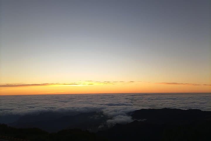
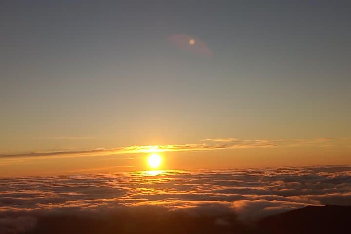
These peaks are the weathered remains of volcanic activity that built Madeira. Over millennia, erosion carved steep amphitheaters and deep valleys; the PR1 route follows a spine where glaciers never were but where water and wind shaped dramatic relief. Locals long used these high paths for shepherding and as routes between settlements; today they draw hikers chasing sunrise above the clouds.
Expect roughly 13 km round-trip and about 5–6 hours on narrow, rocky track with repeated ascents and descents—the technical challenge is exposure and steady footing more than vertical gain. Trails alternate packed earth, stone steps and short metal ladders; mist can reduce visibility. The views reward effort: northern cliffs plunging to the Atlantic and the forested interior folding away beneath you.
Practical notes: start early for stable weather and fewer clouds, carry at least 2–3 liters of water, layered windproof clothing, and headlamp if you’ll be out near dawn. Use sturdy boots with good traction and consider poles for balance. The route is serviced by private-transfer operators and local guides who know microclimates and timing; small-group guided hikes are helpful for route management and brief geological and cultural commentary.
This ridge walk is best undertaken with respect for fragile high-altitude vegetation—stay on marked trail, pack out waste, and be prepared for sudden weather shifts.
The PR1 route is about 13 km round-trip and typically takes 5–6 hours; difficulty is moderate due to exposure, uneven terrain and repeated climbs.
Experienced hikers can do the route independently, but local guides improve safety and route choices in variable weather and provide local context.
Cell coverage is intermittent on the ridgeline; don’t rely on phone connectivity and tell someone your plans before you go.
There are no reliable water refill stations or facilities on the ridge—plan to carry all needed water and use facilities in Funchal or at trailheads.
My Guide Madeira operates guided outdoor trips and adventures with an emphasis on safety, stewardship, and memorable experiences.
You step out of the van into a thin, cool air and the ridge opens—granite and basalt cut against the sky, clouds threading the valleys below. The trail from Pico do Areeiro to Pico Ruivo runs along exposed crestlines, through short tunnels and stone stairways, moving between two of Madeira’s highest summits. The wind has a voice here; it pushes and then hushes as you cross each saddle.
You step out of the van into a thin, cool air and the ridge opens—granite and basalt cut against the sky, clouds threading the valleys below. The trail from Pico do Areeiro to Pico Ruivo runs along exposed crestlines, through short tunnels and stone stairways, moving between two of Madeira’s highest summits. The wind has a voice here; it pushes and then hushes as you cross each saddle.
These peaks are the weathered remains of volcanic activity that built Madeira. Over millennia, erosion carved steep amphitheaters and deep valleys; the PR1 route follows a spine where glaciers never were but where water and wind shaped dramatic relief. Locals long used these high paths for shepherding and as routes between settlements; today they draw hikers chasing sunrise above the clouds.
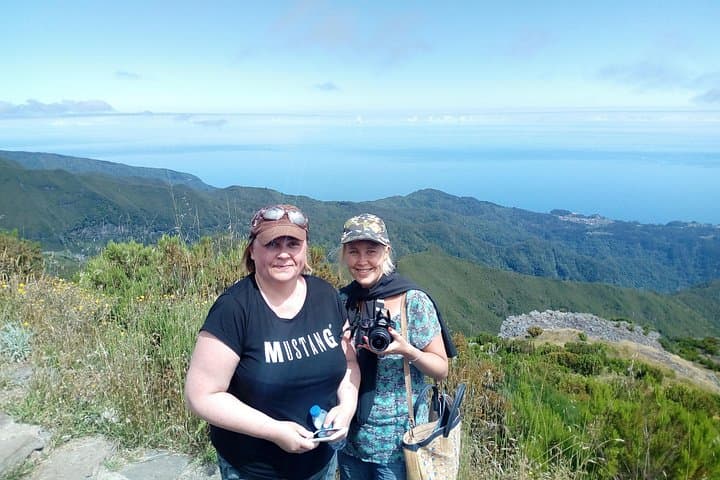
Expect roughly 13 km round-trip and about 5–6 hours on narrow, rocky track with repeated ascents and descents—the technical challenge is exposure and steady footing more than vertical gain. Trails alternate packed earth, stone steps and short metal ladders; mist can reduce visibility. The views reward effort: northern cliffs plunging to the Atlantic and the forested interior folding away beneath you.
Practical notes: start early for stable weather and fewer clouds, carry at least 2–3 liters of water, layered windproof clothing, and headlamp if you’ll be out near dawn. Use sturdy boots with good traction and consider poles for balance. The route is serviced by private-transfer operators and local guides who know microclimates and timing; small-group guided hikes are helpful for route management and brief geological and cultural commentary.
This ridge walk is best undertaken with respect for fragile high-altitude vegetation—stay on marked trail, pack out waste, and be prepared for sudden weather shifts.