THE ADVENTURE COLLECTIVE® · Independent discovery and booking for outdoor travel

A windswept 8 km coastal walk at Madeira’s easternmost point, PR8 delivers raw volcanic scenery, sharp sea cliffs, and open exposure. This practical guide outlines what to expect, local context, and how to prepare for the trail.
A windswept 8 km coastal walk at Madeira’s easternmost point, PR8 delivers raw volcanic scenery, sharp sea cliffs, and open exposure. This practical guide outlines what to expect, local context, and how to prepare for the trail.
The trail opens like a theater of wind and stone: low scrub clings to ochre rock, the Atlantic presses against serrated cliffs, and a lighthouse stands watch at the island’s farthest point. Hikers move along a narrow spine of land where waves dare the shore and the wind pushes you toward the horizon.
Verified experiences and guided adventures in the surrounding area.
Operated by My Guide Madeira · Caniçal, Madeira
The trail opens like a theater of wind and stone: low scrub clings to ochre rock, the Atlantic presses against serrated cliffs, and a lighthouse stands watch at the island’s farthest point. Hikers move along a narrow spine of land where waves dare the shore and the wind pushes you toward the horizon.
Ponta de São Lourenço sits on Madeira’s volcanic eastern edge, formed by ancient submarine eruptions and later sculpted by relentless seas and north winds. Unlike the island’s laurel forests, this peninsula wears a semi-arid coat—low, salt-tolerant vegetation and exposed rock tell the story of exposure more than soil. Culturally, the area has long served fishermen and navigators; modern conservation recognizes it as a distinctive natural heritage zone.
Expect an 8 km out-and-back that typically takes around four hours on foot when you allow time for photos and short rests. The trail is mostly dirt and rock with sweeping cliffside views, short scrambles over stony sections, and almost no shade—wind and sun are constant companions. Transfers from Funchal or nearby hotels are common and often included in packages, making logistics simple.
Practical guidance: start early to avoid midday glare, carry ample water and windproof layers, and wear sturdy footwear with good traction for loose volcanic debris. Binoculars will reward birdwatchers; sunscreen and a brimmed hat are essential. The route is exposed but straightforward—plan for changing winds and keep to marked paths to protect fragile vegetation and cliff edges.
The walking section is about 8 km round-trip and typically takes around four hours; transfers often extend the total outing to 5–6 hours.
The path is not highly technical but is exposed with uneven rocky sections; children and older walkers should be comfortable with steady walking and have supervision—bring sun and wind protection.
Many operators include hotel pickup and drop-off, making logistics straightforward; confirm pickup location and timing when you book.
Wind is a constant; mornings are usually calmer. Summer is warm and sunny, but spring and fall offer cooler temperatures—check forecasts for wind advisories before heading out.
My Guide Madeira operates guided outdoor trips and adventures with an emphasis on safety, stewardship, and memorable experiences.
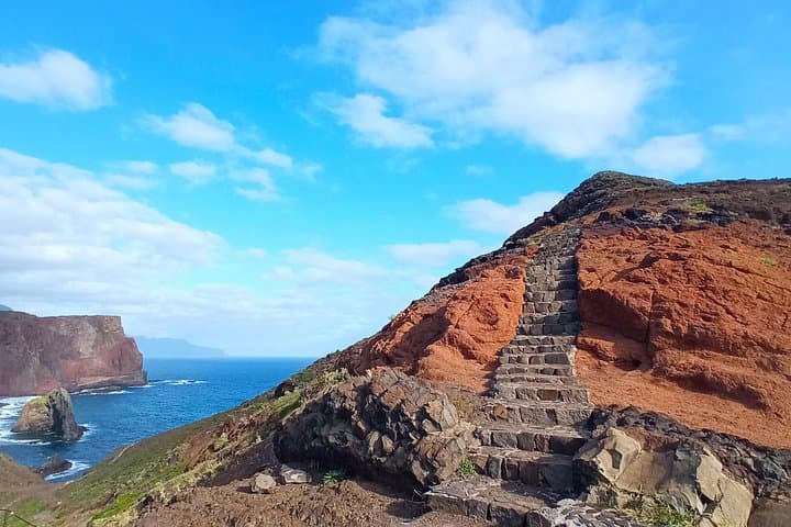
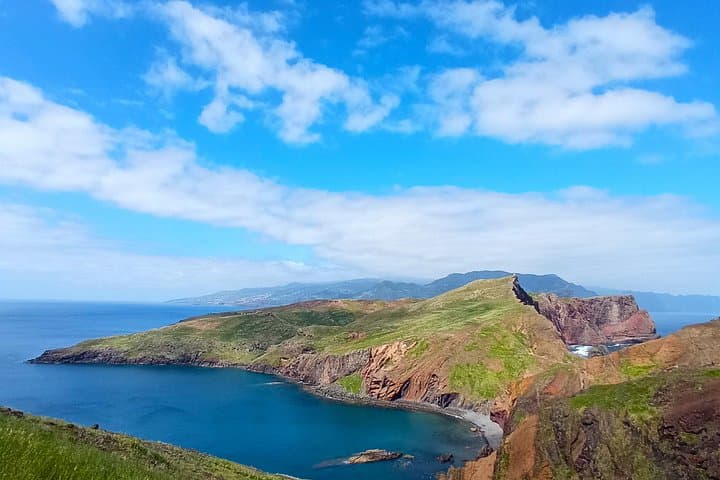
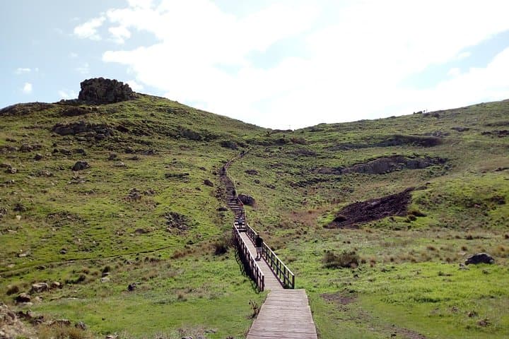
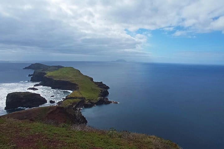
The trail opens like a theater of wind and stone: low scrub clings to ochre rock, the Atlantic presses against serrated cliffs, and a lighthouse stands watch at the island’s farthest point. Hikers move along a narrow spine of land where waves dare the shore and the wind pushes you toward the horizon.
The trail opens like a theater of wind and stone: low scrub clings to ochre rock, the Atlantic presses against serrated cliffs, and a lighthouse stands watch at the island’s farthest point. Hikers move along a narrow spine of land where waves dare the shore and the wind pushes you toward the horizon.
Ponta de São Lourenço sits on Madeira’s volcanic eastern edge, formed by ancient submarine eruptions and later sculpted by relentless seas and north winds. Unlike the island’s laurel forests, this peninsula wears a semi-arid coat—low, salt-tolerant vegetation and exposed rock tell the story of exposure more than soil. Culturally, the area has long served fishermen and navigators; modern conservation recognizes it as a distinctive natural heritage zone.
Expect an 8 km out-and-back that typically takes around four hours on foot when you allow time for photos and short rests. The trail is mostly dirt and rock with sweeping cliffside views, short scrambles over stony sections, and almost no shade—wind and sun are constant companions. Transfers from Funchal or nearby hotels are common and often included in packages, making logistics simple.
Practical guidance: start early to avoid midday glare, carry ample water and windproof layers, and wear sturdy footwear with good traction for loose volcanic debris. Binoculars will reward birdwatchers; sunscreen and a brimmed hat are essential. The route is exposed but straightforward—plan for changing winds and keep to marked paths to protect fragile vegetation and cliff edges.