THE ADVENTURE COLLECTIVE® · Independent discovery and booking for outdoor travel

Drive under the fjord, climb a weathered granite path, and stand 604 meters above Lysefjorden on the iconic Pulpit Rock. This guided day trip from Stavanger pairs local knowledge with safe logistics for a full-day adventure.
Drive under the fjord, climb a weathered granite path, and stand 604 meters above Lysefjorden on the iconic Pulpit Rock. This guided day trip from Stavanger pairs local knowledge with safe logistics for a full-day adventure.
The car hums through the tunnel and the world tilts: 14 kilometers of engineered darkness that slip beneath the fjord, and then daylight opens onto scrubby hills and the glint of water. Your guide pulls the white Opel Vivaro to the trailhead and, within minutes, the chatter of the parking lot softens as the path narrows and the landscape takes the lead.
Verified experiences and guided adventures in the surrounding area.
Operated by Get Guided Norway · Stavanger, Rogaland
The car hums through the tunnel and the world tilts: 14 kilometers of engineered darkness that slip beneath the fjord, and then daylight opens onto scrubby hills and the glint of water. Your guide pulls the white Opel Vivaro to the trailhead and, within minutes, the chatter of the parking lot softens as the path narrows and the landscape takes the lead.
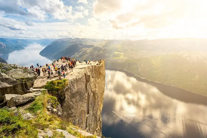
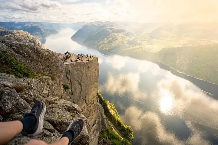
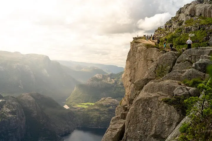
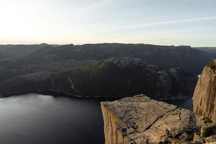
The trail to Preikestolen, or Pulpit Rock, climbs steadily across weathered granite, past boggy patches and wooden steps placed where erosion bites deepest. After roughly 2–2.5 hours you arrive at a 25 by 25 meter rock shelf poised 604 meters above Lysefjorden. The cliff does not shout; it sits with a kind of quiet insistence, a slab of ancient bedrock daring you to step to the edge and look back at the arc of fjord below.
This plateau is a product of the Ice Age; glaciers gouged the valley and left steep walls that the sea later filled. Local names map human reactions: Preikestolen literally means the pulpit, and for generations Norwegians have read sermons in the raw geometry of the cliffs and the fjord. The modern approach includes another marvel of local engineering — the Ryfylke undersea tunnel — a reminder that this landscape combines high drama with practical improvisation.
Culturally, the hike is part modern tourism and part neighborhood ritual. Guides who grew up in Jørpeland and Stavanger share stories about salmon runs, the old ferry routes, and the stubborn weather. On a clear day you can see other attractions across the water; on a moody day the clouds sculpt the fjord into a different story entirely.
Practicalities are simple but decisive. The round-trip is about 7.6 kilometers with roughly 350 meters of elevation gain; expect wet patches, uneven rock, and short stone staircases. Plan on 7–8 hours total with transfers — the operator includes pickup, snacks, and return transport. Wear sturdy hiking boots, layer for wind and rain, and bring at least 1.5–2 liters of water and a warm snack. The guide evaluates conditions and carries knowledge worth trusting: if the day feels iffy, they’ll reroute or advise waiting — better to trade a dramatic photo for a safe one.
For photographers, the plateau at sunrise or late afternoon offers the richest light; for swimmers, small mountain lakes below the trail can be a rewarding dip on a warm afternoon. Respect the rock edge, pack out what you pack in, and leave space on the ledge for the next person to have their moment. The hike is equal parts geology lesson, cardio, and theater — and the payoff is a view that makes you feel, briefly and honestly, very small and perfectly awake.
The round-trip is about 7.6 km with ~350 m elevation gain; expect 2–2.5 hours up and similar down — classified as moderate.
Yes — the drive includes passage through the Ryfylke undersea tunnel, an impressive engineering feature between Stavanger and the trailhead.
The tour includes a typical Norwegian hiking snack; guides can store extra belongings in the vehicle and may provide basic gear on request—ask ahead.
Restrooms are available at the main visitor parking and trailhead; beyond that facilities are natural only—plan accordingly.
Many families complete the hike but it depends on fitness and comfort with heights; consult the operator and consider pace, rest stops, and weather.
Swimming directly below the cliff is not practical; however, small mountain lakes along the route or calmer fjord beaches offer better spots for a dip on warm days.
Get Guided Norway operates guided outdoor trips and adventures with an emphasis on safety, stewardship, and memorable experiences.
The car hums through the tunnel and the world tilts: 14 kilometers of engineered darkness that slip beneath the fjord, and then daylight opens onto scrubby hills and the glint of water. Your guide pulls the white Opel Vivaro to the trailhead and, within minutes, the chatter of the parking lot softens as the path narrows and the landscape takes the lead.
The car hums through the tunnel and the world tilts: 14 kilometers of engineered darkness that slip beneath the fjord, and then daylight opens onto scrubby hills and the glint of water. Your guide pulls the white Opel Vivaro to the trailhead and, within minutes, the chatter of the parking lot softens as the path narrows and the landscape takes the lead.
The trail to Preikestolen, or Pulpit Rock, climbs steadily across weathered granite, past boggy patches and wooden steps placed where erosion bites deepest. After roughly 2–2.5 hours you arrive at a 25 by 25 meter rock shelf poised 604 meters above Lysefjorden. The cliff does not shout; it sits with a kind of quiet insistence, a slab of ancient bedrock daring you to step to the edge and look back at the arc of fjord below.
This plateau is a product of the Ice Age; glaciers gouged the valley and left steep walls that the sea later filled. Local names map human reactions: Preikestolen literally means the pulpit, and for generations Norwegians have read sermons in the raw geometry of the cliffs and the fjord. The modern approach includes another marvel of local engineering — the Ryfylke undersea tunnel — a reminder that this landscape combines high drama with practical improvisation.
Culturally, the hike is part modern tourism and part neighborhood ritual. Guides who grew up in Jørpeland and Stavanger share stories about salmon runs, the old ferry routes, and the stubborn weather. On a clear day you can see other attractions across the water; on a moody day the clouds sculpt the fjord into a different story entirely.
Practicalities are simple but decisive. The round-trip is about 7.6 kilometers with roughly 350 meters of elevation gain; expect wet patches, uneven rock, and short stone staircases. Plan on 7–8 hours total with transfers — the operator includes pickup, snacks, and return transport. Wear sturdy hiking boots, layer for wind and rain, and bring at least 1.5–2 liters of water and a warm snack. The guide evaluates conditions and carries knowledge worth trusting: if the day feels iffy, they’ll reroute or advise waiting — better to trade a dramatic photo for a safe one.
For photographers, the plateau at sunrise or late afternoon offers the richest light; for swimmers, small mountain lakes below the trail can be a rewarding dip on a warm afternoon. Respect the rock edge, pack out what you pack in, and leave space on the ledge for the next person to have their moment. The hike is equal parts geology lesson, cardio, and theater — and the payoff is a view that makes you feel, briefly and honestly, very small and perfectly awake.