THE ADVENTURE COLLECTIVE® · Independent discovery and booking for outdoor travel

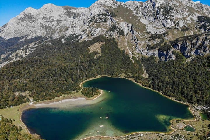
A full-day private hike from Sarajevo to Trnovačko Lake takes you across Sutjeska’s ridges to a heart-shaped, glacial mountain lake beneath Maglić. Expect a 5 km hike to a perfect picnic and swim spot, with dramatic geology and WWII history along the way.
A full-day private hike from Sarajevo to Trnovačko Lake takes you across Sutjeska’s ridges to a heart-shaped, glacial mountain lake beneath Maglić. Expect a 5 km hike to a perfect picnic and swim spot, with dramatic geology and WWII history along the way.
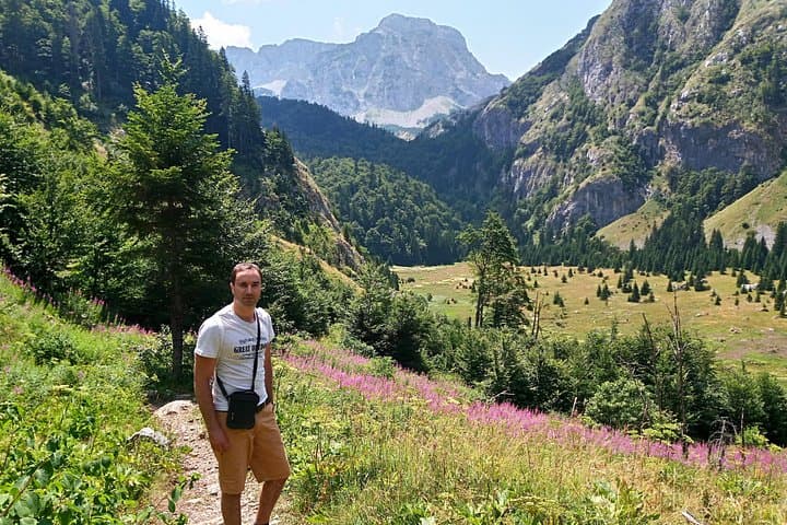
You leave Sarajevo before dawn and the city thins into river valleys and folded beech forests. The road climbs, and by the time you cross into the high karst ridges the air has sharpened; mountains push forward, Maglić’s dark bulk watching from the border. After about 2½ hours of driving the trailhead drops you into a narrow valley—the hike to Trnovačko (Trnovacko) Lake begins along rough switchbacks and rocky shelves.
Verified experiences and guided adventures in the surrounding area.
Operated by Torus Tours · Foča, Republika Srpska
You leave Sarajevo before dawn and the city thins into river valleys and folded beech forests. The road climbs, and by the time you cross into the high karst ridges the air has sharpened; mountains push forward, Maglić’s dark bulk watching from the border. After about 2½ hours of driving the trailhead drops you into a narrow valley—the hike to Trnovačko (Trnovacko) Lake begins along rough switchbacks and rocky shelves.
Geology and history are visible at once: steep glacial cirques, perched moraines and limestone cliffs that funnel rain into the lake’s cobalt basin. Trnovacko’s near-perfect heart shape is carved by ice and time and framed by jagged peaks; half the route sits in Bosnia’s Sutjeska National Park, the other half touches Montenegro’s Piva region. The area has wartime memory too—the wider Sutjeska valley was a key WWII battleground—and now protection efforts emphasize conservation and low-impact access.
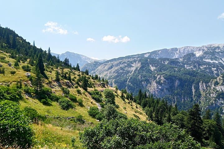
Expect roughly 5 km each way with intermittent scree and forested stretches; a steady climb of a few hundred meters rewards you with alpine views and a picnic spot at the shore. On hot days the lake tempts a brisk swim; the water is cold and clear. Practical guide: carry layered clothing for sudden mountain wind, 1.5–2 L of water, sturdy boots and a packed lunch (included on many tours). Border formalities can be brief but bring ID. Plan for a full-day outing—this is a long drive plus hiking—but the payoff is one of the clearest, most photographic alpine lakes in the Western Balkans.
The organized walk is about 5 km one-way from the trailhead described—expect client itineraries to list roughly 10 km round trip, with a few hundred metres of ascent.
Yes—on warm days swimming is common, but the water is cold and entry points can be rocky; assess conditions and your comfort with cold water.
Entrance and conservation fees vary; many private tours include fees and taxes, but confirm with your operator ahead of time.
Families with older children who are comfortable on uneven terrain can do the hike, but those with limited fitness should consider the long driving time and steady climbs.
Torus Tours operates guided outdoor trips and adventures with an emphasis on safety, stewardship, and memorable experiences.

You leave Sarajevo before dawn and the city thins into river valleys and folded beech forests. The road climbs, and by the time you cross into the high karst ridges the air has sharpened; mountains push forward, Maglić’s dark bulk watching from the border. After about 2½ hours of driving the trailhead drops you into a narrow valley—the hike to Trnovačko (Trnovacko) Lake begins along rough switchbacks and rocky shelves.
You leave Sarajevo before dawn and the city thins into river valleys and folded beech forests. The road climbs, and by the time you cross into the high karst ridges the air has sharpened; mountains push forward, Maglić’s dark bulk watching from the border. After about 2½ hours of driving the trailhead drops you into a narrow valley—the hike to Trnovačko (Trnovacko) Lake begins along rough switchbacks and rocky shelves.
Geology and history are visible at once: steep glacial cirques, perched moraines and limestone cliffs that funnel rain into the lake’s cobalt basin. Trnovacko’s near-perfect heart shape is carved by ice and time and framed by jagged peaks; half the route sits in Bosnia’s Sutjeska National Park, the other half touches Montenegro’s Piva region. The area has wartime memory too—the wider Sutjeska valley was a key WWII battleground—and now protection efforts emphasize conservation and low-impact access.
Expect roughly 5 km each way with intermittent scree and forested stretches; a steady climb of a few hundred meters rewards you with alpine views and a picnic spot at the shore. On hot days the lake tempts a brisk swim; the water is cold and clear. Practical guide: carry layered clothing for sudden mountain wind, 1.5–2 L of water, sturdy boots and a packed lunch (included on many tours). Border formalities can be brief but bring ID. Plan for a full-day outing—this is a long drive plus hiking—but the payoff is one of the clearest, most photographic alpine lakes in the Western Balkans.