THE ADVENTURE COLLECTIVE® · Independent discovery and booking for outdoor travel

Stand atop Qizilqaya as the peak blushes red with sunrise. This two-day Khinalug-based summit blends alpine meadows, shepherd routes and panoramic Caucasus views — plan for a long day, high altitude, and variable weather.
Stand atop Qizilqaya as the peak blushes red with sunrise. This two-day Khinalug-based summit blends alpine meadows, shepherd routes and panoramic Caucasus views — plan for a long day, high altitude, and variable weather.
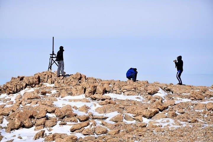
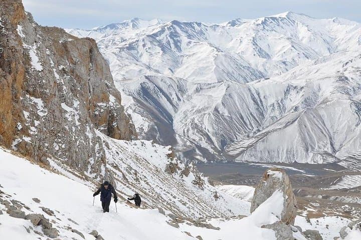
Dawn breaks cold and copper on the ridgeline as you climb toward Qizilqaya, the peak that catches the sun and briefly turns red. The path threads through high pastures, shepherd huts, and lichen-scabbed rocks, with long views opening to Shahdag and the jagged border ridges when clouds lift.
Verified experiences and guided adventures in the surrounding area.
Operated by Qartal Professional Guide Services · Khinalug, Guba District
Dawn breaks cold and copper on the ridgeline as you climb toward Qizilqaya, the peak that catches the sun and briefly turns red. The path threads through high pastures, shepherd huts, and lichen-scabbed rocks, with long views opening to Shahdag and the jagged border ridges when clouds lift.
The mountain sits in the northeast Greater Caucasus above the ancient village of Khinalug, a settlement with its own language and centuries of highland pastoral culture. Geologically the massif is folded limestone and volcanic intrusions; the summit’s coloration at sunset gave the peak its name — “Golden” or “Red Rock.” Locals call it Baltagaya (Axe Rock), a nod to the bold profile that drops into deep valleys.
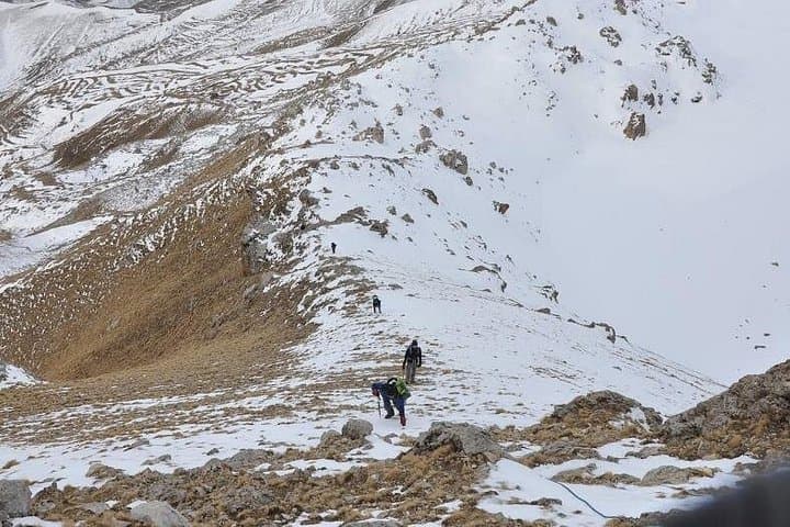
Practically, the typical itinerary uses Khinalug as base: a pre-dawn start, roughly 7 km to the summit from the trailhead, and a full-day push with substantial elevation gain (expect ~1,200–1,500 m). Terrain alternates grassy alpine meadows, loose scree, and exposed rocky sections where footing matters. Weather shifts quickly at altitude — plan for wind, sun, and sudden chill.
Bring waterproof layers, sturdy boots with ankle support, and poles for loose sections. Hydrate well and pace for altitude; even fit hikers feel the thin air above 3,000 m. Guides handle logistics and local navigation; permits are not typical but respect grazing land and private village routes. Summit windows are best on clear, calm mornings — aim for a night in Khinalug and a daylight summit for the safest, most rewarding experience.
From the usual start near Khinalug the uphill leg is about 7 km to the summit; plan roughly 5–7 hours up depending on pace and conditions.
No technical climbing gear is needed in normal summer conditions; the route is a strenuous hike with some loose rock and exposed sections.
Local guiding is strongly recommended for navigation, cultural access and safety at altitude; tour operators typically provide guides and transport.
Summer and late spring offer the most reliable access; early season may have persistent snow and winter routes require mountaineering experience.
Qartal Professional Guide Services operates guided outdoor trips and adventures with an emphasis on safety, stewardship, and memorable experiences.
Dawn breaks cold and copper on the ridgeline as you climb toward Qizilqaya, the peak that catches the sun and briefly turns red. The path threads through high pastures, shepherd huts, and lichen-scabbed rocks, with long views opening to Shahdag and the jagged border ridges when clouds lift.
Dawn breaks cold and copper on the ridgeline as you climb toward Qizilqaya, the peak that catches the sun and briefly turns red. The path threads through high pastures, shepherd huts, and lichen-scabbed rocks, with long views opening to Shahdag and the jagged border ridges when clouds lift.
The mountain sits in the northeast Greater Caucasus above the ancient village of Khinalug, a settlement with its own language and centuries of highland pastoral culture. Geologically the massif is folded limestone and volcanic intrusions; the summit’s coloration at sunset gave the peak its name — “Golden” or “Red Rock.” Locals call it Baltagaya (Axe Rock), a nod to the bold profile that drops into deep valleys.
Practically, the typical itinerary uses Khinalug as base: a pre-dawn start, roughly 7 km to the summit from the trailhead, and a full-day push with substantial elevation gain (expect ~1,200–1,500 m). Terrain alternates grassy alpine meadows, loose scree, and exposed rocky sections where footing matters. Weather shifts quickly at altitude — plan for wind, sun, and sudden chill.
Bring waterproof layers, sturdy boots with ankle support, and poles for loose sections. Hydrate well and pace for altitude; even fit hikers feel the thin air above 3,000 m. Guides handle logistics and local navigation; permits are not typical but respect grazing land and private village routes. Summit windows are best on clear, calm mornings — aim for a night in Khinalug and a daylight summit for the safest, most rewarding experience.