THE ADVENTURE COLLECTIVE® · Independent discovery and booking for outdoor travel

A full-day, high-altitude hike from Cusco to Vinicunca (Rainbow Mountain) that combines dramatic mineral-striped slopes, Andean culture, and 4 km of trail climbing. Ideal for acclimatized hikers who want vivid panoramas and a compact but demanding day in the high puna.
A full-day, high-altitude hike from Cusco to Vinicunca (Rainbow Mountain) that combines dramatic mineral-striped slopes, Andean culture, and 4 km of trail climbing. Ideal for acclimatized hikers who want vivid panoramas and a compact but demanding day in the high puna.
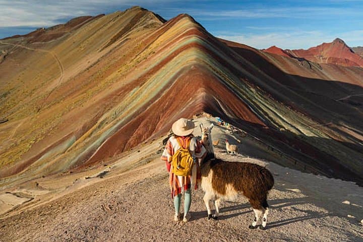
Before dawn the van slides out of Cusco and the Andes open up: low light on terraced hills, the air thin and flavored with wood smoke. By the time you step onto the puna at Fullawasipata, alpacas graze against a skyline that will soon reveal bands of ochre, rose, and teal — Rainbow Mountain daring you up a steep, high-altitude ridge.
Verified experiences and guided adventures in the surrounding area.
Operated by Geo Adventures Peru · Cusco, Cusco
Before dawn the van slides out of Cusco and the Andes open up: low light on terraced hills, the air thin and flavored with wood smoke. By the time you step onto the puna at Fullawasipata, alpacas graze against a skyline that will soon reveal bands of ochre, rose, and teal — Rainbow Mountain daring you up a steep, high-altitude ridge.
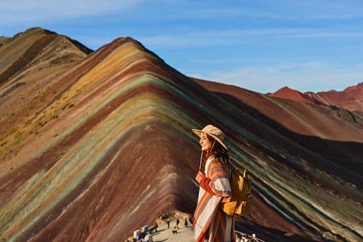
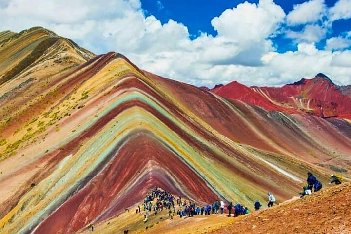
Geology here is blunt and instructive: layers of sediment, oxidized iron and copper minerals, and ancient glacial scouring expose the striped pigments that give Vinicunca its name. The route follows old Andean tracks once used by local communities and, at the summit, guides commonly explain the mountain’s cultural role as an Apu — a sacred peak in Quechua tradition.
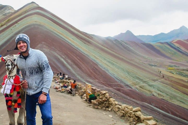
Expect a roughly 4 km uphill trail from 4,626 m to about 5,200 m, with an elevation gain near 500–600 m; the surface alternates between compacted dirt, loose scree, and grassy tussocks. Weather swings quickly — fierce sun and biting wind can arrive in the same hour — so layers matter.
Practically: plan for a 10–12 hour day including transport, take at least 2 liters of water, move slowly to manage altitude, and use trekking poles on the final pitches. Photography windows are best late morning when colors pop, but mid-day cloud can add drama. Respect local communities: stay on trails, carry out waste, and consider hiring a local guide to support the villages that steward this landscape.
The walking section is about 4 km with roughly 500–600 m of elevation gain; gradients include sustained uphill pitches and some loose footing near the summit.
Yes—Vinicunca tops around 5,200 m. Acclimatize in Cusco for 24–48 hours, stay hydrated, and descend if you feel severe symptoms.
Local communities sometimes offer horse or mule rentals for part of the ascent, but availability varies; confirm with your operator and prioritize safety if unsteady at altitude.
The dry season (May–September) has the most stable weather and clearer skies for colors, while the wet season (November–March) sees more clouds and muddy trails.
Geo Adventures Peru operates guided outdoor trips and adventures with an emphasis on safety, stewardship, and memorable experiences.
Before dawn the van slides out of Cusco and the Andes open up: low light on terraced hills, the air thin and flavored with wood smoke. By the time you step onto the puna at Fullawasipata, alpacas graze against a skyline that will soon reveal bands of ochre, rose, and teal — Rainbow Mountain daring you up a steep, high-altitude ridge.
Before dawn the van slides out of Cusco and the Andes open up: low light on terraced hills, the air thin and flavored with wood smoke. By the time you step onto the puna at Fullawasipata, alpacas graze against a skyline that will soon reveal bands of ochre, rose, and teal — Rainbow Mountain daring you up a steep, high-altitude ridge.
Geology here is blunt and instructive: layers of sediment, oxidized iron and copper minerals, and ancient glacial scouring expose the striped pigments that give Vinicunca its name. The route follows old Andean tracks once used by local communities and, at the summit, guides commonly explain the mountain’s cultural role as an Apu — a sacred peak in Quechua tradition.
Expect a roughly 4 km uphill trail from 4,626 m to about 5,200 m, with an elevation gain near 500–600 m; the surface alternates between compacted dirt, loose scree, and grassy tussocks. Weather swings quickly — fierce sun and biting wind can arrive in the same hour — so layers matter.
Practically: plan for a 10–12 hour day including transport, take at least 2 liters of water, move slowly to manage altitude, and use trekking poles on the final pitches. Photography windows are best late morning when colors pop, but mid-day cloud can add drama. Respect local communities: stay on trails, carry out waste, and consider hiring a local guide to support the villages that steward this landscape.