THE ADVENTURE COLLECTIVE® · Independent discovery and booking for outdoor travel

Explore Spina Verde’s ridge trails where smugglers’ tracks and Great War fortifications meet lake views. This guided 5–6 hour hike combines history, geology and open panoramas above Como.
Explore Spina Verde’s ridge trails where smugglers’ tracks and Great War fortifications meet lake views. This guided 5–6 hour hike combines history, geology and open panoramas above Como.
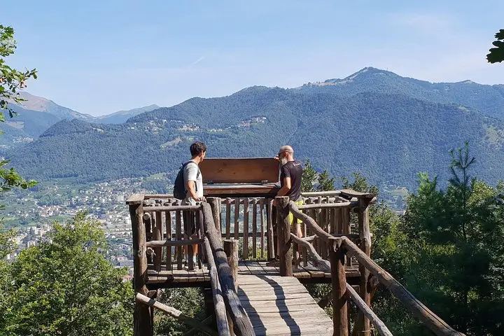
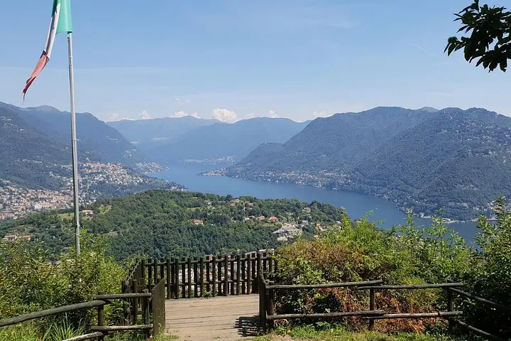
You start on a ridge above Como, the lake a bright slash of blue below, while chestnut and holm oak crowd the trail and the breeze pushes you toward rocky viewpoints. The forest seems to dare you to follow old smuggling paths and wartime tracks that still cut the hillside.
Verified experiences and guided adventures in the surrounding area.
Operated by Slow Lake Como · Como, Lombardy
You start on a ridge above Como, the lake a bright slash of blue below, while chestnut and holm oak crowd the trail and the breeze pushes you toward rocky viewpoints. The forest seems to dare you to follow old smuggling paths and wartime tracks that still cut the hillside.
Spina Verde is a limestone escarpment that split the routes between Italy and Switzerland for centuries. Stone foxholes, scarred barracks and exposed trenches from the Great War sit alongside collapsed dry-stone walls where brigands once moved goods and people under cover of trees. Geologically, the ridge is karstic—hard limestone, short steep climbs and occasional slabs—so views open suddenly: Como city, the lakeshore and distant Alpine ridgelines.
Culturally the park reads like a frontier: border patrol history, peasant routes, and local oral tales of clandestine crossings. Guides will point out engraved dates on rocks and tell stories where fact blurs into folklore. The landscape rewards curiosity—small caves, ruined fortifications, and quiet terraces that are easy to miss if you rush.
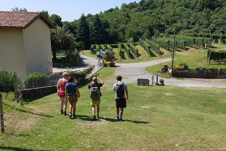
Practical guidance: expect a 5–6 hour outing, roughly 10–12 km with 400–600 m total ascent over uneven stone and forest paths. Wear sturdy boots, bring 1–2 liters of water, sun protection and a light jacket for wind on exposed ridges. Start early in summer to avoid heat; in spring and fall trails are at their most interesting and wildlife is active. Stay on marked routes to protect archaeological sites and fragile karst ground.
The tour lasts about 5–6 hours and covers roughly 10–12 km with 400–600 m of ascent—rated moderate due to uneven terrain and sustained climbs.
Children can participate but must be accompanied by an adult; organizers advise moderate fitness and caution near old trenches and drop-offs.
Yes—Como is well connected by train and bus; the meeting point is a short transfer from Como city center and guides will provide exact directions.
You may view and walk near fortifications and foxholes, but climbing on fragile structures is discouraged to protect archaeological features.
Slow Lake Como operates guided outdoor trips and adventures with an emphasis on safety, stewardship, and memorable experiences.
You start on a ridge above Como, the lake a bright slash of blue below, while chestnut and holm oak crowd the trail and the breeze pushes you toward rocky viewpoints. The forest seems to dare you to follow old smuggling paths and wartime tracks that still cut the hillside.
You start on a ridge above Como, the lake a bright slash of blue below, while chestnut and holm oak crowd the trail and the breeze pushes you toward rocky viewpoints. The forest seems to dare you to follow old smuggling paths and wartime tracks that still cut the hillside.
Spina Verde is a limestone escarpment that split the routes between Italy and Switzerland for centuries. Stone foxholes, scarred barracks and exposed trenches from the Great War sit alongside collapsed dry-stone walls where brigands once moved goods and people under cover of trees. Geologically, the ridge is karstic—hard limestone, short steep climbs and occasional slabs—so views open suddenly: Como city, the lakeshore and distant Alpine ridgelines.
Culturally the park reads like a frontier: border patrol history, peasant routes, and local oral tales of clandestine crossings. Guides will point out engraved dates on rocks and tell stories where fact blurs into folklore. The landscape rewards curiosity—small caves, ruined fortifications, and quiet terraces that are easy to miss if you rush.
Practical guidance: expect a 5–6 hour outing, roughly 10–12 km with 400–600 m total ascent over uneven stone and forest paths. Wear sturdy boots, bring 1–2 liters of water, sun protection and a light jacket for wind on exposed ridges. Start early in summer to avoid heat; in spring and fall trails are at their most interesting and wildlife is active. Stay on marked routes to protect archaeological sites and fragile karst ground.