THE ADVENTURE COLLECTIVE® · Independent discovery and booking for outdoor travel

This 14-day itinerary traces the classic Lukla–Everest Base Camp route with built-in acclimatization and teahouse stays. Expect daily 7–13 km hikes, high alpine terrain, and a pre-dawn push to Kala Patthar for summit-level views of Everest.
This 14-day itinerary traces the classic Lukla–Everest Base Camp route with built-in acclimatization and teahouse stays. Expect daily 7–13 km hikes, high alpine terrain, and a pre-dawn push to Kala Patthar for summit-level views of Everest.
A cold dawn in Lukla frames the first step of a route that pushes up from river valleys into a thin, crystalline air. Trekkers leave the buzz of Kathmandu behind after an iconic, weather-steeped flight to Lukla, then follow switchbacks and suspension bridges where the Dudh Koshi dares you downstream and the rhododendron forests hold their breath.
Verified experiences and guided adventures in the surrounding area.
Operated by Nepal Mountain Club Pvt Ltd · Kathmandu, Bagmati Province
A cold dawn in Lukla frames the first step of a route that pushes up from river valleys into a thin, crystalline air. Trekkers leave the buzz of Kathmandu behind after an iconic, weather-steeped flight to Lukla, then follow switchbacks and suspension bridges where the Dudh Koshi dares you downstream and the rhododendron forests hold their breath.
This itinerary moves through Sherpa heartland — Phakding to Namche Bazaar, Tengboche’s monastery ridge, dingy stone villages at Dingboche and Lobuche — before the moraine and scree of Gorak Shep and the final approach to Everest Base Camp. Kala Patthar’s 5,545 m summit offers the clearest, closest panorama of Everest and Lhotse.
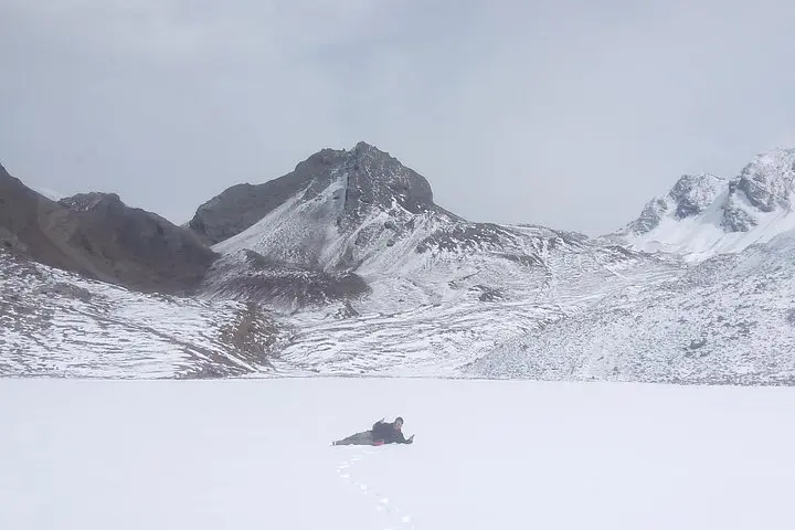
Geologically the trail traces glacial valleys carved by the Khumbu Glacier; moraine, talus, and high alpine scree dominate above 4,000 m. Culturally the trek runs through Sagarmatha National Park, a Sherpa region long tied to Himalayan mountaineering and conservation since the park’s 1976 designation.
Practically: allow time for acclimatization (scheduled rest days at Namche and Dingboche), expect daily hikes of 7–13 km with 3–7 hours on steep, rocky terrain, and plan for altitude-related slow ascents. Lukla flights are weather-dependent; carry layered insulation, crampon-capable boots for early-season ice, and permits (Sagarmatha NP entry/TIMS) are required. Hydration, a conservative pace, and a trusted guide are the best defenses against altitude sickness.
For travelers the journey is equal parts scenery and systems — mountain weather, basic teahouse lodging, and high-altitude logistics — making this a demanding but hugely accessible Himalayan classic.
Yes — Sagarmatha National Park entry and TIMS permit are required; your operator usually arranges these and includes fees.
The route is non-technical but challenging due to sustained elevation; planned acclimatization days reduce risk but altitude sickness can still occur.
They are essential but weather dependent; flights get delayed or canceled in poor visibility—operators often build contingency time into itineraries.
Basic teahouses and guesthouses with shared bathrooms above Namche; simple Nepalese and Western meals (dal bhat, noodles), and hot drinks to aid hydration.
Nepal Mountain Club Pvt Ltd operates guided outdoor trips and adventures with an emphasis on safety, stewardship, and memorable experiences.
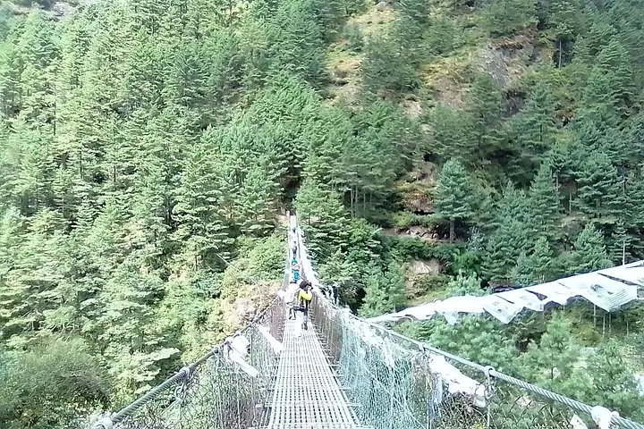
A cold dawn in Lukla frames the first step of a route that pushes up from river valleys into a thin, crystalline air. Trekkers leave the buzz of Kathmandu behind after an iconic, weather-steeped flight to Lukla, then follow switchbacks and suspension bridges where the Dudh Koshi dares you downstream and the rhododendron forests hold their breath.
A cold dawn in Lukla frames the first step of a route that pushes up from river valleys into a thin, crystalline air. Trekkers leave the buzz of Kathmandu behind after an iconic, weather-steeped flight to Lukla, then follow switchbacks and suspension bridges where the Dudh Koshi dares you downstream and the rhododendron forests hold their breath.
This itinerary moves through Sherpa heartland — Phakding to Namche Bazaar, Tengboche’s monastery ridge, dingy stone villages at Dingboche and Lobuche — before the moraine and scree of Gorak Shep and the final approach to Everest Base Camp. Kala Patthar’s 5,545 m summit offers the clearest, closest panorama of Everest and Lhotse.
Geologically the trail traces glacial valleys carved by the Khumbu Glacier; moraine, talus, and high alpine scree dominate above 4,000 m. Culturally the trek runs through Sagarmatha National Park, a Sherpa region long tied to Himalayan mountaineering and conservation since the park’s 1976 designation.
Practically: allow time for acclimatization (scheduled rest days at Namche and Dingboche), expect daily hikes of 7–13 km with 3–7 hours on steep, rocky terrain, and plan for altitude-related slow ascents. Lukla flights are weather-dependent; carry layered insulation, crampon-capable boots for early-season ice, and permits (Sagarmatha NP entry/TIMS) are required. Hydration, a conservative pace, and a trusted guide are the best defenses against altitude sickness.
For travelers the journey is equal parts scenery and systems — mountain weather, basic teahouse lodging, and high-altitude logistics — making this a demanding but hugely accessible Himalayan classic.