THE ADVENTURE COLLECTIVE® · Independent discovery and booking for outdoor travel

Descend from the Omalos plateau through Europe’s longest gorge: a dramatic 16–18 km trail that drops to the Libyan Sea. This practical guide lays out what to expect—terrain, timing, and the gear you’ll need to complete the classic Samaria trek.
Descend from the Omalos plateau through Europe’s longest gorge: a dramatic 16–18 km trail that drops to the Libyan Sea. This practical guide lays out what to expect—terrain, timing, and the gear you’ll need to complete the classic Samaria trek.
You step off the shuttle onto the Omalos plateau at Xyloskalo, 1,227 meters above sea level, and the world narrows into stone and sky. The trail ahead drops through pine-shaded slopes, then into a riverbed where the stream seems to dare you onward. For the next 16–18 kilometres the gorge presses you between vertical limestone walls; sunlit terraces one minute give way to the cool shadow of the Iron Gates the next.
Verified experiences and guided adventures in the surrounding area.
Operated by ANY DESTINATION · Chania, Crete
You step off the shuttle onto the Omalos plateau at Xyloskalo, 1,227 meters above sea level, and the world narrows into stone and sky. The trail ahead drops through pine-shaded slopes, then into a riverbed where the stream seems to dare you onward. For the next 16–18 kilometres the gorge presses you between vertical limestone walls; sunlit terraces one minute give way to the cool shadow of the Iron Gates the next.
Geology here speaks in layers—tough limestone folded and worn by water and time—while the White Mountains (Lefka Ori) form the spine that channels weather and runoff toward the Libyan Sea. The Samaria National Park was added to UNESCO’s Man and Biosphere network in 1981 to protect these habitats and the endemic kri-kri (Cretan wild goat). Local villages along the south coast, like Agia Roumeli, still mark the end of the trail with taverna smoke and the smell of grilled fish.
Practically: plan a full day. The trail is marked and popular from May to October, but loose rock, steep descents, and narrow passages demand steady shoes and steady legs. Expect 6–8 hours on the trail for fit hikers; allow extra time for transfers and the post-hike ferry north. Carry water, sun protection, and layered clothing—the plateau can be cool in the morning and the coast warm by afternoon. Leave no trace: stick to the path, pack out trash, and respect park rules—this is a walk through living geological history, and its survival depends on careful visitors.
The trail through the gorge is roughly 16–18 km from Xyloskalo to Agia Roumeli; most hikers take 6–8 hours depending on pace and stops.
The trail is typically open from May through October; exact dates can vary with weather and park management so check local updates.
While the trail is well marked and not technically difficult, it involves long descents and uneven terrain—consider fitness, joint health, and experience before deciding.
No permit is required and the trail is well marked; guided options are available and helpful for logistics and interpretation, especially for first-time visitors.
ANY DESTINATION operates guided outdoor trips and adventures with an emphasis on safety, stewardship, and memorable experiences.
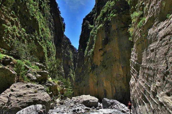
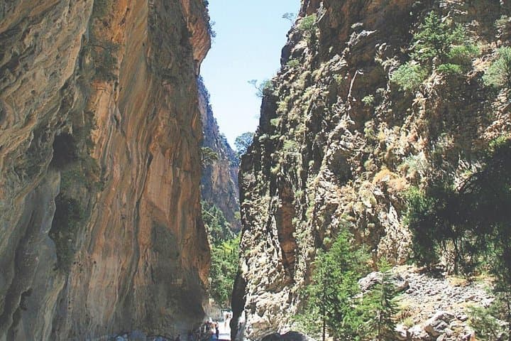
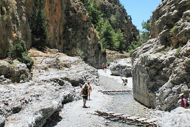
You step off the shuttle onto the Omalos plateau at Xyloskalo, 1,227 meters above sea level, and the world narrows into stone and sky. The trail ahead drops through pine-shaded slopes, then into a riverbed where the stream seems to dare you onward. For the next 16–18 kilometres the gorge presses you between vertical limestone walls; sunlit terraces one minute give way to the cool shadow of the Iron Gates the next.
You step off the shuttle onto the Omalos plateau at Xyloskalo, 1,227 meters above sea level, and the world narrows into stone and sky. The trail ahead drops through pine-shaded slopes, then into a riverbed where the stream seems to dare you onward. For the next 16–18 kilometres the gorge presses you between vertical limestone walls; sunlit terraces one minute give way to the cool shadow of the Iron Gates the next.
Geology here speaks in layers—tough limestone folded and worn by water and time—while the White Mountains (Lefka Ori) form the spine that channels weather and runoff toward the Libyan Sea. The Samaria National Park was added to UNESCO’s Man and Biosphere network in 1981 to protect these habitats and the endemic kri-kri (Cretan wild goat). Local villages along the south coast, like Agia Roumeli, still mark the end of the trail with taverna smoke and the smell of grilled fish.
Practically: plan a full day. The trail is marked and popular from May to October, but loose rock, steep descents, and narrow passages demand steady shoes and steady legs. Expect 6–8 hours on the trail for fit hikers; allow extra time for transfers and the post-hike ferry north. Carry water, sun protection, and layered clothing—the plateau can be cool in the morning and the coast warm by afternoon. Leave no trace: stick to the path, pack out trash, and respect park rules—this is a walk through living geological history, and its survival depends on careful visitors.