THE ADVENTURE COLLECTIVE® · Independent discovery and booking for outdoor travel

Spend two days walking Muong Hoa Valley: terraced rice fields, hill-tribe villages and a rocky river crossed by a small suspension bridge. This private itinerary combines cultural encounters with moderate trekking across some of northern Vietnam’s most photographed landscapes.
Spend two days walking Muong Hoa Valley: terraced rice fields, hill-tribe villages and a rocky river crossed by a small suspension bridge. This private itinerary combines cultural encounters with moderate trekking across some of northern Vietnam’s most photographed landscapes.
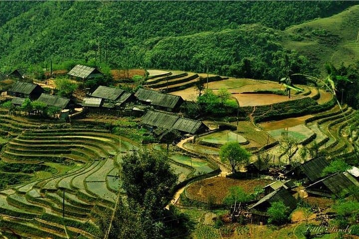
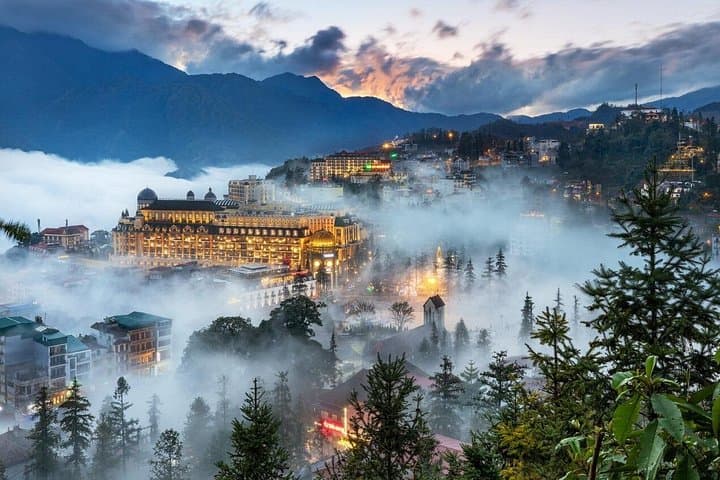
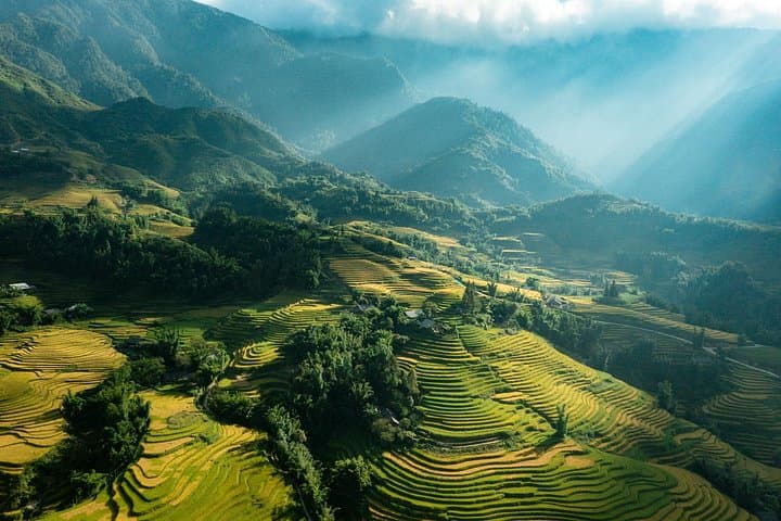
A low cloud lifts as the road from Lao Cai drops into Muong Hoa Valley, revealing stair-stepped green that clings to steep slopes. On this private 2-day trek travelers move through small back roads, cross a suspension bridge rattling over the rocky river below, and follow paths that run past Black Hmong and Day village houses. The sound of water running through channels and the occasional call of a water buffalo fill the air.
Verified experiences and guided adventures in the surrounding area.
Operated by Custom Asia Travel · Sapa, Lao Cai
A low cloud lifts as the road from Lao Cai drops into Muong Hoa Valley, revealing stair-stepped green that clings to steep slopes. On this private 2-day trek travelers move through small back roads, cross a suspension bridge rattling over the rocky river below, and follow paths that run past Black Hmong and Day village houses. The sound of water running through channels and the occasional call of a water buffalo fill the air.
The valley’s terraces are the result of centuries of incremental engineering by local hill tribes; each banded bench holds a season’s rice and a cultural practice. Geologically the valley is carved into metamorphic foothills of the Hoang Lien range, with fast-draining soils, narrow ridgelines and a river that still shifts the valley floor. Cultural exchanges happen at village doorsteps—textiles from Black Hmong embroideries and the quiet etiquette of homestay life.
Expect uneven trails, short steep pitches and panoramic vantage points into the greater Hoang Lien massif. The route includes about 7 km (roughly 2–2.5 hours) of walking each day between Sa Xéng, Y Linh Ho and Lao Chai villages; footing can be slippery after rain. Practical planning: bring layered, water-resistant clothing, a daypack with water and snacks, and allow extra time for photography and village visits. Guides handle logistics — transfers, bottled water and twin-share hotel lodging — but travelers should be prepared for basic accommodations and simple meals in town. Aim for early starts to catch valley light and avoid the heaviest afternoon showers; be respectful in villages, ask before photographing residents, and tip guides or homestays directly to support the local economy.
Yes—routes are moderate with short daily distances; guides set pace and the terrain is manageable for those with basic fitness.
Sapa sits around 1,500 m—most travelers acclimate quickly, but stay hydrated and avoid strenuous exertion on arrival if you feel unwell.
Accommodation is twin-share hotel lodging in Sapa town (standard boutique hotels) with one night included; homestays can be requested depending on operator availability.
Breakfast, two lunches and one dinner are included per the itinerary; bottled water is provided in the vehicle but carry extra water on hikes.
Custom Asia Travel operates guided outdoor trips and adventures with an emphasis on safety, stewardship, and memorable experiences.

A low cloud lifts as the road from Lao Cai drops into Muong Hoa Valley, revealing stair-stepped green that clings to steep slopes. On this private 2-day trek travelers move through small back roads, cross a suspension bridge rattling over the rocky river below, and follow paths that run past Black Hmong and Day village houses. The sound of water running through channels and the occasional call of a water buffalo fill the air.
A low cloud lifts as the road from Lao Cai drops into Muong Hoa Valley, revealing stair-stepped green that clings to steep slopes. On this private 2-day trek travelers move through small back roads, cross a suspension bridge rattling over the rocky river below, and follow paths that run past Black Hmong and Day village houses. The sound of water running through channels and the occasional call of a water buffalo fill the air.
The valley’s terraces are the result of centuries of incremental engineering by local hill tribes; each banded bench holds a season’s rice and a cultural practice. Geologically the valley is carved into metamorphic foothills of the Hoang Lien range, with fast-draining soils, narrow ridgelines and a river that still shifts the valley floor. Cultural exchanges happen at village doorsteps—textiles from Black Hmong embroideries and the quiet etiquette of homestay life.
Expect uneven trails, short steep pitches and panoramic vantage points into the greater Hoang Lien massif. The route includes about 7 km (roughly 2–2.5 hours) of walking each day between Sa Xéng, Y Linh Ho and Lao Chai villages; footing can be slippery after rain. Practical planning: bring layered, water-resistant clothing, a daypack with water and snacks, and allow extra time for photography and village visits. Guides handle logistics — transfers, bottled water and twin-share hotel lodging — but travelers should be prepared for basic accommodations and simple meals in town. Aim for early starts to catch valley light and avoid the heaviest afternoon showers; be respectful in villages, ask before photographing residents, and tip guides or homestays directly to support the local economy.