THE ADVENTURE COLLECTIVE® · Independent discovery and booking for outdoor travel

A two-day trek from Sapa that leads deep into quiet villages, an ancient banyan tree and bamboo-lined trails. Ideal for travelers seeking cultural contact, homestay nights and highland views away from the main tourist loops.
A two-day trek from Sapa that leads deep into quiet villages, an ancient banyan tree and bamboo-lined trails. Ideal for travelers seeking cultural contact, homestay nights and highland views away from the main tourist loops.
Cold air cuts through the valley as trekkers step off the paved road and into a landscape shaped by elevation and human hands: rice terraces stacked on slopes, bamboo stands that hush your steps, and an ancient banyan whose roots sprawl like a village map. Daylight moves across wooden houses; children scatter from under the tree to watch strangers pass.
Verified experiences and guided adventures in the surrounding area.
Operated by SaPa Local Tour Guides · Sapa, Lao Cai Province
Cold air cuts through the valley as trekkers step off the paved road and into a landscape shaped by elevation and human hands: rice terraces stacked on slopes, bamboo stands that hush your steps, and an ancient banyan whose roots sprawl like a village map. Daylight moves across wooden houses; children scatter from under the tree to watch strangers pass.
This route threads through the Hoang Lien Son foothills above Muong Hoa Valley, an area carved by centuries of river and glacial action. The terrain mixes steep terrace walls, forested gullies, and narrow village tracks. Local culture is front and center: Hmong, Dao and Tay households tend vegetables and orchids, and the Banyan at Bridge 32 functions as a living meeting place and informal schoolyard. The Gau Tao festival in Ban Hau Thao — held each Lunar New Year — reveals the region’s ritual calendar.
Expect roughly 8–12 km of walking per day with several steep sections and up to 500–700 m of total elevation change across stages. Trails range from packed dirt to loose stones and bamboo-cleared paths; rainfall can make sections slippery.
Practical notes: travel light, bring a rain shell and warm layer for nights at Pang homestay, and carry cash for small purchases. Respect homestay customs—remove shoes, ask before photographing people—and follow your guide’s lead on route choices. Hydrate early, pace uphill sections, and leave no trace: these villages rely on low-impact tourism to keep their landscape and traditions intact.
The trek is rated challenging: expect steep, uneven trails with several sustained climbs; participants should have a high fitness level and be comfortable walking 8–12 km across varied terrain.
You’ll sleep on traditional mattresses in a family homestay (Pang homestay); facilities are basic—bring a lightweight sleeping liner if you prefer extra hygiene comfort.
Sapa sits around 1,500–1,600 m; most travelers acclimate quickly, but take it easy on arrival, stay hydrated, and alert your guide if you feel unwell.
Most travelers take an overnight train or a 5–6 hour shuttle/bus to Lao Cai followed by a short transfer to Sapa town; arrange transport in advance during peak season.
SaPa Local Tour Guides operates guided outdoor trips and adventures with an emphasis on safety, stewardship, and memorable experiences.
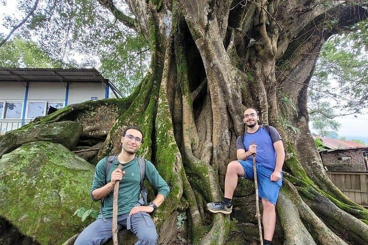

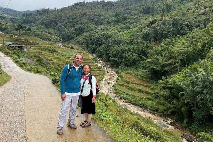
Cold air cuts through the valley as trekkers step off the paved road and into a landscape shaped by elevation and human hands: rice terraces stacked on slopes, bamboo stands that hush your steps, and an ancient banyan whose roots sprawl like a village map. Daylight moves across wooden houses; children scatter from under the tree to watch strangers pass.
Cold air cuts through the valley as trekkers step off the paved road and into a landscape shaped by elevation and human hands: rice terraces stacked on slopes, bamboo stands that hush your steps, and an ancient banyan whose roots sprawl like a village map. Daylight moves across wooden houses; children scatter from under the tree to watch strangers pass.
This route threads through the Hoang Lien Son foothills above Muong Hoa Valley, an area carved by centuries of river and glacial action. The terrain mixes steep terrace walls, forested gullies, and narrow village tracks. Local culture is front and center: Hmong, Dao and Tay households tend vegetables and orchids, and the Banyan at Bridge 32 functions as a living meeting place and informal schoolyard. The Gau Tao festival in Ban Hau Thao — held each Lunar New Year — reveals the region’s ritual calendar.
Expect roughly 8–12 km of walking per day with several steep sections and up to 500–700 m of total elevation change across stages. Trails range from packed dirt to loose stones and bamboo-cleared paths; rainfall can make sections slippery.
Practical notes: travel light, bring a rain shell and warm layer for nights at Pang homestay, and carry cash for small purchases. Respect homestay customs—remove shoes, ask before photographing people—and follow your guide’s lead on route choices. Hydrate early, pace uphill sections, and leave no trace: these villages rely on low-impact tourism to keep their landscape and traditions intact.