THE ADVENTURE COLLECTIVE® · Independent discovery and booking for outdoor travel

A brisk climb from Pokhara’s lakeside leads to a ridge-top that frames Phewa Lake and the Annapurna massif. This guided Sarangkot hike offers sunrise panoramas, local tea-house stops and manageable terrain for most hikers.
A brisk climb from Pokhara’s lakeside leads to a ridge-top that frames Phewa Lake and the Annapurna massif. This guided Sarangkot hike offers sunrise panoramas, local tea-house stops and manageable terrain for most hikers.
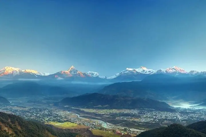
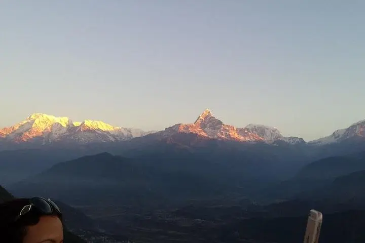
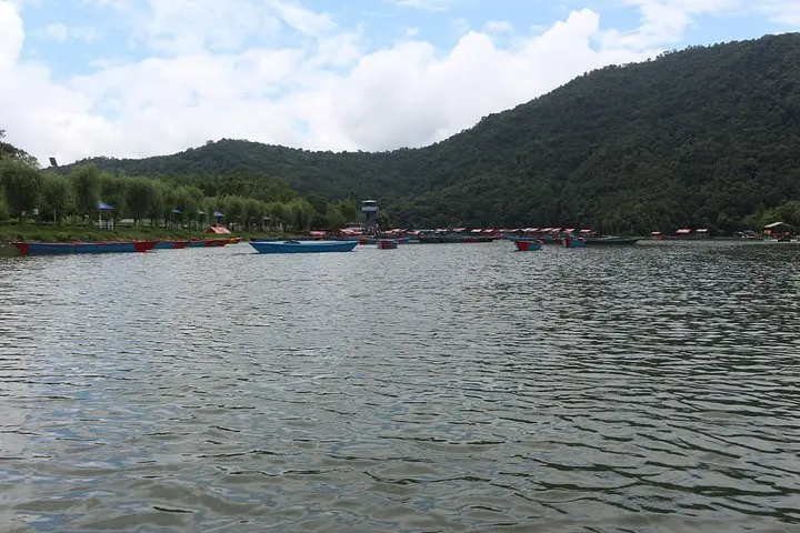
Dawn arrives over Sarangkot in the hush between lake and summit: pale light spills across Phewa Lake and the Annapurna range sharpens into ridges. The path from Pokhara’s lakeside climbs through terraces and scattered villages, each switchback offering a new angle on the mountains until the ridge opens and the world drops away.
Verified experiences and guided adventures in the surrounding area.
Operated by Green Leaf Treks and Expedition Private Limited · Pokhara, Gandaki Province
Dawn arrives over Sarangkot in the hush between lake and summit: pale light spills across Phewa Lake and the Annapurna range sharpens into ridges. The path from Pokhara’s lakeside climbs through terraces and scattered villages, each switchback offering a new angle on the mountains until the ridge opens and the world drops away.
Geology here is the work of the Himalaya’s uplift — broken limestone and sandstone folded and pushed high by colliding plates — while centuries of local settlement mean stone walls and small shrines punctuate the climb. Culturally, the route threads Gurung and Brahmin villages where tea houses welcome trekkers, and the hill has long been a lookout for trade routes into the high valleys.
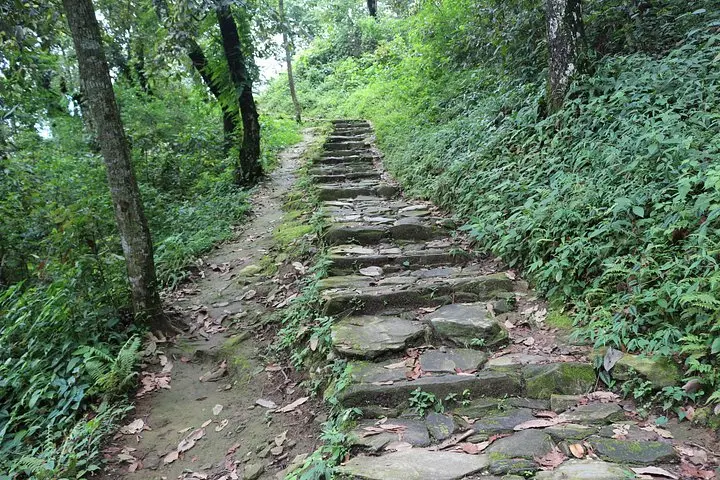
Expect roughly 600–800 m of elevation gain depending on start point and about 4–6 hours for a guided ascent, stop for sunrise, lunch and return. Terrain is mixed: compact dirt, stone steps and short loose-rock pitches; waterproof footing and steady legs matter. Guides manage pacing, local logistics and lunch; they also know which viewpoints are least crowded for photos.
Plan an early start to catch sunrise and avoid midday heat, carry at least 1–1.5 L of water, wear grippy shoes and a wind layer — temperatures swing quickly on the ridge. The trail is accessible to most hikers with regular fitness but steady, not rushed, steps make it more enjoyable.
The trail is moderate: sustained uphill with some steep pitches but no technical climbing. Beginners with reasonable fitness can complete it with frequent breaks and a guide.
A guide is helpful for route-finding, pacing and local insight; this tour includes a guide and lunch, which simplifies logistics.
Typical itineraries leave early and return mid-to-late morning or early afternoon; total time is about 4–6 hours depending on stops.
Basic tea houses and pit toilets appear lower on the trail; the tour provides lunch at a local spot near the summit or on the return.
Green Leaf Treks and Expedition Private Limited operates guided outdoor trips and adventures with an emphasis on safety, stewardship, and memorable experiences.
Dawn arrives over Sarangkot in the hush between lake and summit: pale light spills across Phewa Lake and the Annapurna range sharpens into ridges. The path from Pokhara’s lakeside climbs through terraces and scattered villages, each switchback offering a new angle on the mountains until the ridge opens and the world drops away.
Dawn arrives over Sarangkot in the hush between lake and summit: pale light spills across Phewa Lake and the Annapurna range sharpens into ridges. The path from Pokhara’s lakeside climbs through terraces and scattered villages, each switchback offering a new angle on the mountains until the ridge opens and the world drops away.
Geology here is the work of the Himalaya’s uplift — broken limestone and sandstone folded and pushed high by colliding plates — while centuries of local settlement mean stone walls and small shrines punctuate the climb. Culturally, the route threads Gurung and Brahmin villages where tea houses welcome trekkers, and the hill has long been a lookout for trade routes into the high valleys.
Expect roughly 600–800 m of elevation gain depending on start point and about 4–6 hours for a guided ascent, stop for sunrise, lunch and return. Terrain is mixed: compact dirt, stone steps and short loose-rock pitches; waterproof footing and steady legs matter. Guides manage pacing, local logistics and lunch; they also know which viewpoints are least crowded for photos.
Plan an early start to catch sunrise and avoid midday heat, carry at least 1–1.5 L of water, wear grippy shoes and a wind layer — temperatures swing quickly on the ridge. The trail is accessible to most hikers with regular fitness but steady, not rushed, steps make it more enjoyable.