THE ADVENTURE COLLECTIVE® · Independent discovery and booking for outdoor travel

Walk Boston’s Freedom Trail at your own pace with a downloadable audio guide that connects all 16 historic sites. Start at Boston Common, download the VoiceMap tour, and expect 2–3 hours of focused exploration with flexible stopping points.
Walk Boston’s Freedom Trail at your own pace with a downloadable audio guide that connects all 16 historic sites. Start at Boston Common, download the VoiceMap tour, and expect 2–3 hours of focused exploration with flexible stopping points.
The red-brick line underfoot threads through a city that still argues with its past: cobblestone alleys, a harbor that dares you to remember commerce and rebellion, and weathered stone markers that point to decisive moments in American history.
Verified experiences and guided adventures in the surrounding area.
Operated by VoiceMap Audio Tours · Boston, Massachusetts
The red-brick line underfoot threads through a city that still argues with its past: cobblestone alleys, a harbor that dares you to remember commerce and rebellion, and weathered stone markers that point to decisive moments in American history.
Begin at Boston Common and move deliberately eastward. The route links 16 sites — from meeting houses and burial grounds to the State House’s gilded dome — each stop offering a tight portrait of colonial politics, urban growth, and immigrant labor. The route you’ll follow was formalized as the Freedom Trail in the mid-20th century to connect existing monuments; the older fabric beneath your feet is 18th-century brick, 19th-century granite, and layers of municipal change. Geology here matters mostly as foundations — glacially scoured bedrock underlies the narrow streets — while culture is lived in the markets, Irish and Italian neighborhoods, and the North End’s persistent bakeries.
This is a walking itinerary as much as an audio narrative. Practicalities shape the day: download the VoiceMap audio and offline assets before you leave, carry a charged phone and wired or plugged headphones, and expect 2–3 hours if you move steadily or longer if you linger in museums and markets.
Timing makes the difference: mornings reduce crowds at the Massacre site and Faneuil Hall; late afternoon brings warmer light on the State House dome. Wear supportive footwear, keep water accessible, and leave extra battery for mapping. The trail is public, accessible, and entirely walkable at your own pace — a compact urban adventure that puts Boston’s past in clear, navigable form.
Install the VoiceMap app, create an account, go to Tour Codes › Enter Codes, input the eight-character code from your confirmation, and download the tour for offline use.
Much of the Freedom Trail is on paved streets and is accessible, but expect some brick and cobbled sections and occasional curb cuts; check specific site accessibility before visiting.
Yes — the self-guided audio can be paused and restarted at any point; it’s designed to work offline once downloaded and triggers content when you reach designated locations.
Some sites (museums) may require separate admission or timed entry; the VoiceMap tour provides historical context but does not include museum admission.
VoiceMap Audio Tours operates guided outdoor trips and adventures with an emphasis on safety, stewardship, and memorable experiences.

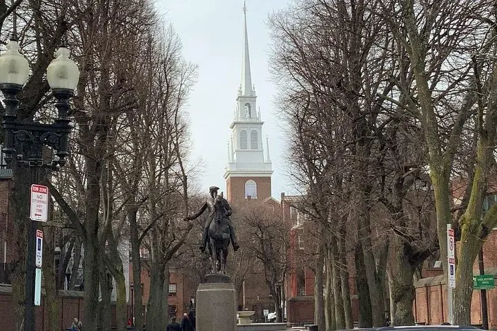
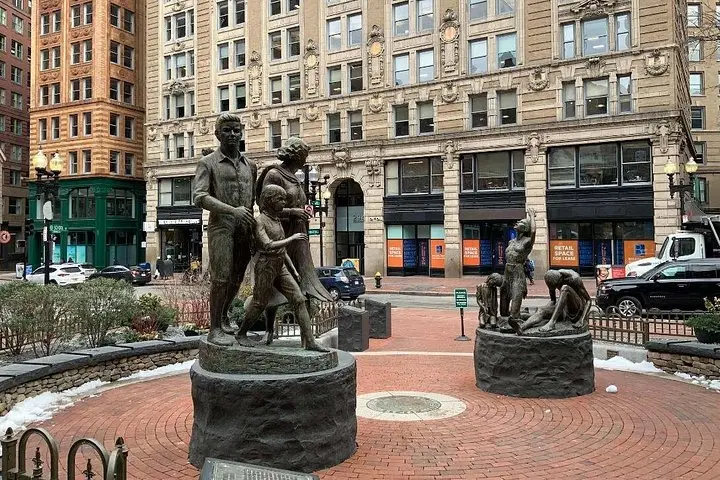

The red-brick line underfoot threads through a city that still argues with its past: cobblestone alleys, a harbor that dares you to remember commerce and rebellion, and weathered stone markers that point to decisive moments in American history.
The red-brick line underfoot threads through a city that still argues with its past: cobblestone alleys, a harbor that dares you to remember commerce and rebellion, and weathered stone markers that point to decisive moments in American history.
Begin at Boston Common and move deliberately eastward. The route links 16 sites — from meeting houses and burial grounds to the State House’s gilded dome — each stop offering a tight portrait of colonial politics, urban growth, and immigrant labor. The route you’ll follow was formalized as the Freedom Trail in the mid-20th century to connect existing monuments; the older fabric beneath your feet is 18th-century brick, 19th-century granite, and layers of municipal change. Geology here matters mostly as foundations — glacially scoured bedrock underlies the narrow streets — while culture is lived in the markets, Irish and Italian neighborhoods, and the North End’s persistent bakeries.
This is a walking itinerary as much as an audio narrative. Practicalities shape the day: download the VoiceMap audio and offline assets before you leave, carry a charged phone and wired or plugged headphones, and expect 2–3 hours if you move steadily or longer if you linger in museums and markets.
Timing makes the difference: mornings reduce crowds at the Massacre site and Faneuil Hall; late afternoon brings warmer light on the State House dome. Wear supportive footwear, keep water accessible, and leave extra battery for mapping. The trail is public, accessible, and entirely walkable at your own pace — a compact urban adventure that puts Boston’s past in clear, navigable form.