THE ADVENTURE COLLECTIVE® · Independent discovery and booking for outdoor travel

Drive up Pikes Peak at your own pace with a location‑aware audio guide. Learn geology, local history, and best viewpoints as you climb to 14,115 feet — no cell service required once downloaded.
Drive up Pikes Peak at your own pace with a location‑aware audio guide. Learn geology, local history, and best viewpoints as you climb to 14,115 feet — no cell service required once downloaded.
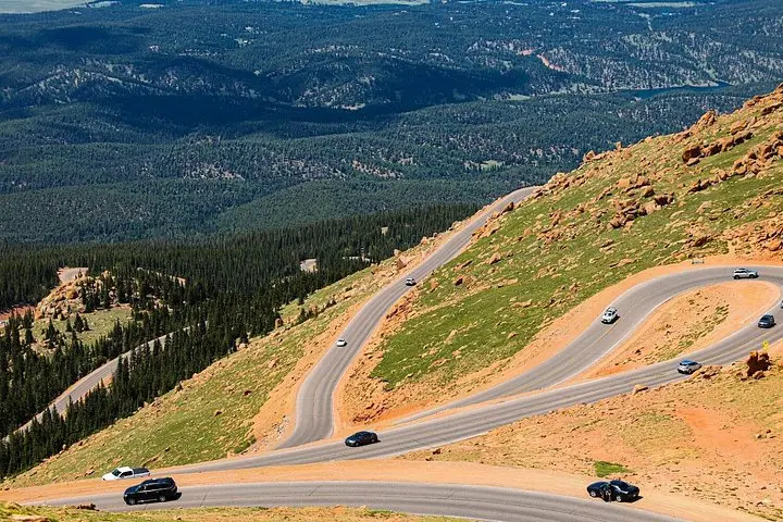
You start low in the pines and, within minutes, the road begins to climb. Switchbacks tighten, spruce and fir thin, and the air takes on a thinner quality that tugs at your breath. The Pikes Peak Highway climbs relentlessly toward the summit — a raw, high-mountain theater where clouds push back and the wind dares you to stop and watch.
Verified experiences and guided adventures in the surrounding area.
Operated by Gypsy Guide GPS LLC · Cascade, Colorado
You start low in the pines and, within minutes, the road begins to climb. Switchbacks tighten, spruce and fir thin, and the air takes on a thinner quality that tugs at your breath. The Pikes Peak Highway climbs relentlessly toward the summit — a raw, high-mountain theater where clouds push back and the wind dares you to stop and watch.
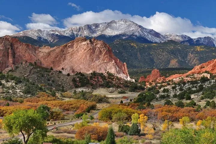
The route traces a history of exploration and engineering: named for explorer Zebulon Pike and threaded with stories of the Cog Railway and early auto races. Geologically the drive crosses the Pikes Peak batholith — hard pink granite that breeds steep slopes and scree — and transitions from montane forest to alpine tundra as elevation rises. Local culture is visible in Manitou Springs below, a historic gateway with mineral springs and Route 66 lore.
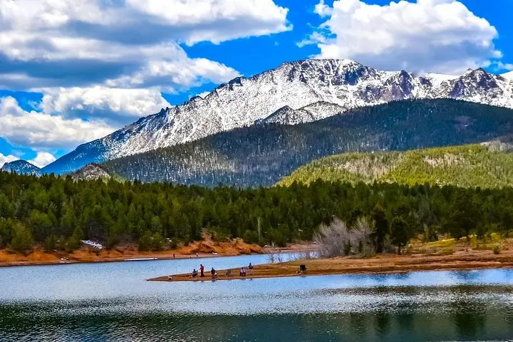
Practically, this audio tour does the guiding for you: location-triggered narration cues points of interest like Crystal Creek Reservoir, the Cascade Observation Site, and Barr Trail trailhead. Download the GuideAlong app and the tour over Wi‑Fi before you lose signal; the commentary works offline using your phone’s GPS.
Timing matters — start early to avoid afternoon thunderstorms in summer, and expect slower traffic on holiday weekends. Park at designated pullouts, give hikers and cyclists space, and respect closure signs in winter. Bring layers, a car charger, water, and altitude awareness: even a short drive to 14,115 feet can leave you winded.
The highway offers a concentrated mountain experience: dramatic views with low exertion, but clear logistical needs — prep your device, watch weather, and let the road and narration do the rest.
No — you must download the GuideAlong app and the audio tour over Wi‑Fi or cellular before leaving; the tour plays offline using your phone’s GPS.
The self‑guided audio itineraries suggest 1–2 hours for a straightforward summit loop, but you can spend a half or full day stopping at overlooks, trails, and picnic spots.
The Pikes Peak Highway charges a toll for private vehicles and commercial operations; check the official Pikes Peak Highway website for current rates and seasonal closures.
Yes — it’s suitable for families, but monitor children at overlooks and be mindful of altitude-related symptoms in young or sensitive travelers.
Gypsy Guide GPS LLC operates guided outdoor trips and adventures with an emphasis on safety, stewardship, and memorable experiences.

You start low in the pines and, within minutes, the road begins to climb. Switchbacks tighten, spruce and fir thin, and the air takes on a thinner quality that tugs at your breath. The Pikes Peak Highway climbs relentlessly toward the summit — a raw, high-mountain theater where clouds push back and the wind dares you to stop and watch.
You start low in the pines and, within minutes, the road begins to climb. Switchbacks tighten, spruce and fir thin, and the air takes on a thinner quality that tugs at your breath. The Pikes Peak Highway climbs relentlessly toward the summit — a raw, high-mountain theater where clouds push back and the wind dares you to stop and watch.
The route traces a history of exploration and engineering: named for explorer Zebulon Pike and threaded with stories of the Cog Railway and early auto races. Geologically the drive crosses the Pikes Peak batholith — hard pink granite that breeds steep slopes and scree — and transitions from montane forest to alpine tundra as elevation rises. Local culture is visible in Manitou Springs below, a historic gateway with mineral springs and Route 66 lore.
Practically, this audio tour does the guiding for you: location-triggered narration cues points of interest like Crystal Creek Reservoir, the Cascade Observation Site, and Barr Trail trailhead. Download the GuideAlong app and the tour over Wi‑Fi before you lose signal; the commentary works offline using your phone’s GPS.
Timing matters — start early to avoid afternoon thunderstorms in summer, and expect slower traffic on holiday weekends. Park at designated pullouts, give hikers and cyclists space, and respect closure signs in winter. Bring layers, a car charger, water, and altitude awareness: even a short drive to 14,115 feet can leave you winded.
The highway offers a concentrated mountain experience: dramatic views with low exertion, but clear logistical needs — prep your device, watch weather, and let the road and narration do the rest.