THE ADVENTURE COLLECTIVE® · Independent discovery and booking for outdoor travel

Climb to 3,082 m for a commanding view of the Machu Picchu citadel and surrounding Andes. This full-day hike combines steep Inca steps, cloud-forest microclimates and essential permit logistics.
Climb to 3,082 m for a commanding view of the Machu Picchu citadel and surrounding Andes. This full-day hike combines steep Inca steps, cloud-forest microclimates and essential permit logistics.
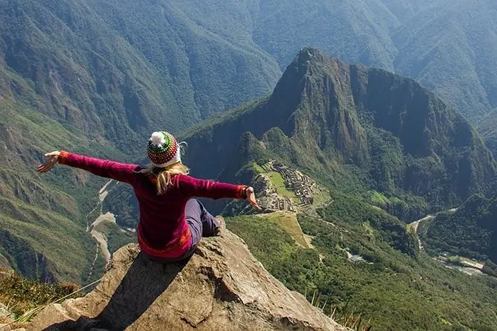
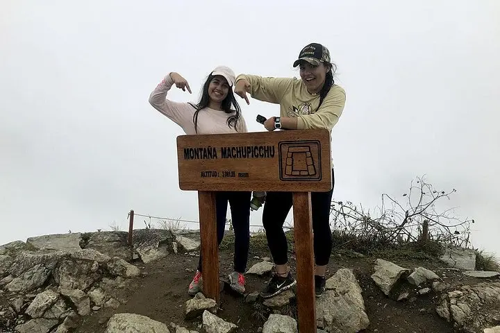
You climb out of the mist and the stone steps begin to pitch steeply; the citadel below untucks itself like a map. Machupicchu Mountain (Montaña) rises to about 3,082 m.a.s.l., and the trail to its summit pushes you through carved Inca stairways, patches of cloud forest and sudden windows of panorama that force you to stop and take stock.
Verified experiences and guided adventures in the surrounding area.
Operated by CrossoverPeru Tours · Aguas Calientes, Cusco
You climb out of the mist and the stone steps begin to pitch steeply; the citadel below untucks itself like a map. Machupicchu Mountain (Montaña) rises to about 3,082 m.a.s.l., and the trail to its summit pushes you through carved Inca stairways, patches of cloud forest and sudden windows of panorama that force you to stop and take stock.
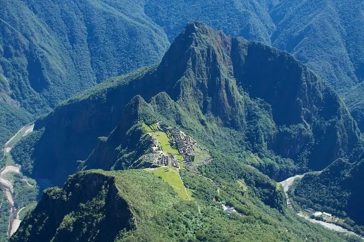
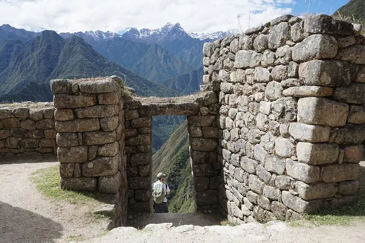
Geology here is compacted volcanic and metamorphic rock sculpted by glaciers and the Urubamba River over millennia. The Inca chose the ridge for ceremonial and strategic sightlines; today the same ridge grants wide-angle views of the Machu Picchu citadel, the valley and the serranía beyond. Local culture still threads through the journey—guides often point out terraces, quarry marks and faint footpaths used for centuries.
Expect a full day beginning with a transfer from Cusco, a train to Aguas Calientes, then the climb after entry to the citadel. The route is steep and uses stone steps and narrow switchbacks; altitude and sustained ascent matter more than technical difficulty. Weather turns quickly—cloud forest can be humid and rainy or sunlit and exposed within hours—so plan layered clothing, a steady pacing strategy, and extra water.
Practical: acquire the specific Machu Picchu + Montaña permit in advance, carry a valid passport, and schedule downhill time in Aguas Calientes for food and a train back to Ollantaytambo. The summit rewards patience: the citadel below, the river cutting through the valley and a sense of standing on the spine of the Andes.
Yes—tickets are time-slot specific and separate from general Machu Picchu entry; book the Montaña permit ahead of your visit.
The steep stone stairways make the route physically demanding; allow 1.5–3 hours ascent and similar descent depending on pace and stops.
The summit is near 3,082 m; symptoms are possible—acclimatize in Cusco, hydrate, avoid alcohol and consider medication if prone to AMS.
The path is well-defined but narrow in places with many steps—no technical climbing gear required, but caution is needed in wet conditions.
CrossoverPeru Tours operates guided outdoor trips and adventures with an emphasis on safety, stewardship, and memorable experiences.
You climb out of the mist and the stone steps begin to pitch steeply; the citadel below untucks itself like a map. Machupicchu Mountain (Montaña) rises to about 3,082 m.a.s.l., and the trail to its summit pushes you through carved Inca stairways, patches of cloud forest and sudden windows of panorama that force you to stop and take stock.
You climb out of the mist and the stone steps begin to pitch steeply; the citadel below untucks itself like a map. Machupicchu Mountain (Montaña) rises to about 3,082 m.a.s.l., and the trail to its summit pushes you through carved Inca stairways, patches of cloud forest and sudden windows of panorama that force you to stop and take stock.
Geology here is compacted volcanic and metamorphic rock sculpted by glaciers and the Urubamba River over millennia. The Inca chose the ridge for ceremonial and strategic sightlines; today the same ridge grants wide-angle views of the Machu Picchu citadel, the valley and the serranía beyond. Local culture still threads through the journey—guides often point out terraces, quarry marks and faint footpaths used for centuries.
Expect a full day beginning with a transfer from Cusco, a train to Aguas Calientes, then the climb after entry to the citadel. The route is steep and uses stone steps and narrow switchbacks; altitude and sustained ascent matter more than technical difficulty. Weather turns quickly—cloud forest can be humid and rainy or sunlit and exposed within hours—so plan layered clothing, a steady pacing strategy, and extra water.
Practical: acquire the specific Machu Picchu + Montaña permit in advance, carry a valid passport, and schedule downhill time in Aguas Calientes for food and a train back to Ollantaytambo. The summit rewards patience: the citadel below, the river cutting through the valley and a sense of standing on the spine of the Andes.