THE ADVENTURE COLLECTIVE® · Independent discovery and booking for outdoor travel

Begin at Sundarijal’s rushing springs and climb through forested steps, terraced farmsteads and meadow ridges on a full-day circuit to Mulkharka and Bhajyang. This 10–12 hour trek offers waterfalls, rooftop views of the high Himalaya on clear days, and authentic village stops along the way.
Begin at Sundarijal’s rushing springs and climb through forested steps, terraced farmsteads and meadow ridges on a full-day circuit to Mulkharka and Bhajyang. This 10–12 hour trek offers waterfalls, rooftop views of the high Himalaya on clear days, and authentic village stops along the way.
The morning air at Sundarijal tastes like river and pine. You step off the narrow road where a steady stream tumbles through a cleft in the rocks, and the water immediately begins to set the tempo—gurgling, chattering, daring you uphill. Local children run past carrying schoolbooks; a temple bell rings across the valley. As the trail pushes into forest, the city slips behind you and the ridges open like pages of an old map. By midday the path climbs out of trees to grassy slopes, and on clear days the snowline of the Annapurna range pins the horizon.
Verified experiences and guided adventures in the surrounding area.
Operated by Osho world Adventure · Kathmandu, Bagmati Province
The morning air at Sundarijal tastes like river and pine. You step off the narrow road where a steady stream tumbles through a cleft in the rocks, and the water immediately begins to set the tempo—gurgling, chattering, daring you uphill. Local children run past carrying schoolbooks; a temple bell rings across the valley. As the trail pushes into forest, the city slips behind you and the ridges open like pages of an old map. By midday the path climbs out of trees to grassy slopes, and on clear days the snowline of the Annapurna range pins the horizon.
Sundarijal’s springs have fed Kathmandu for centuries; the name honours the local deity Sundarimai and the area has long been a gateway for treks north toward Chisapani and the Langtang foothills. Geologically the corridor is young Himalayan foothill—steep drainage cut into soft sediments, with exposed boulders at waterfalls and loamier soils on the ridge tops. Cultural signposts—small shrines, stacked mani stones, single-room tea houses—mark the transition from valley life to hill agriculture. You’ll pass terraced plots and hamlets where women tend mustard fields and offer a cup of salted tea.
On the Mulkharka–Bhajyang circuit the trail is a mix: packed earth and stone steps through rhododendron and oak, occasional switchbacks, and open meadows that carry wind like a conversation. Expect 16–20 km total distance, roughly 800–1,000 m of cumulative ascent depending on your route variations, and a long but steady day of hiking—this is a 10–12 hour outing when done as a loop with breaks. The route is well-trod but can be steep in sections; after monsoon the stream crossings and muddy patches demand attention.
Practicalities: departures are typically from central Kathmandu (Dom Himalaya Hotel as a common meeting point) with private transport to the trailhead. Carry at least 2–3 liters of water, high-energy snacks provided by local operators are helpful, and footwear with good traction matters—expect loose stone and wet roots. Start early to avoid afternoon heat and to secure the best light on the ridges; afternoon storms form quickly in summer. Guides are available and useful for navigation and cultural context, but the route is straightforward for fit hikers.
Wildlife here is subtle: grey langurs, Himalayan squirrels and a chorus of birds. Leave no trace—pack out wrappers, avoid disturbing water sources, and support local tea houses when you can. By dusk, back in Kathmandu, the city lights feel like another kind of trailhead: busier, louder, but threaded to the hills you’ve just left.
Most groups cover about 16–20 km with roughly 800–1,000 m of cumulative ascent; expect a full 10–12 hour day including stops.
No special permit is required for this day circuit; guides are recommended for groups unfamiliar with Nepal’s trails or who want cultural context.
Autumn (October–November) and spring (March–May) offer the clearest mountain views and stable weather; avoid peak monsoon for muddy trails.
Small tea houses and village taps along the way can refill water and offer snacks or tea, but bring your own supplies for the full day.
The route is steep in places and long; older adults and children in good shape can do it with rest breaks, but it’s not ideal for very young kids.
Sturdy trail shoes with good grip and ankle support are best; sandals or flat sneakers aren’t advisable on rocky sections.
Osho world Adventure operates guided outdoor trips and adventures with an emphasis on safety, stewardship, and memorable experiences.
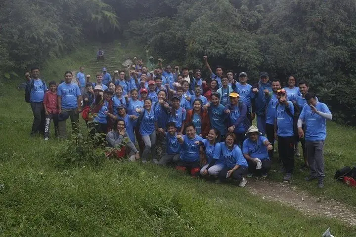
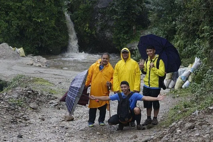
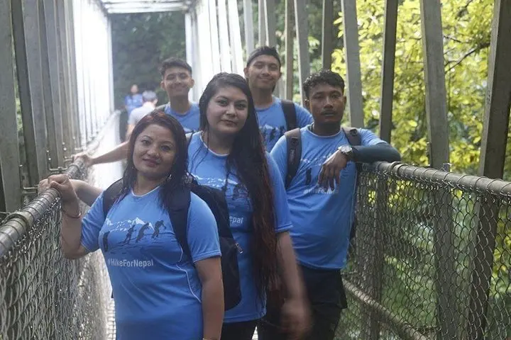
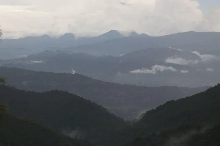
The morning air at Sundarijal tastes like river and pine. You step off the narrow road where a steady stream tumbles through a cleft in the rocks, and the water immediately begins to set the tempo—gurgling, chattering, daring you uphill. Local children run past carrying schoolbooks; a temple bell rings across the valley. As the trail pushes into forest, the city slips behind you and the ridges open like pages of an old map. By midday the path climbs out of trees to grassy slopes, and on clear days the snowline of the Annapurna range pins the horizon.
The morning air at Sundarijal tastes like river and pine. You step off the narrow road where a steady stream tumbles through a cleft in the rocks, and the water immediately begins to set the tempo—gurgling, chattering, daring you uphill. Local children run past carrying schoolbooks; a temple bell rings across the valley. As the trail pushes into forest, the city slips behind you and the ridges open like pages of an old map. By midday the path climbs out of trees to grassy slopes, and on clear days the snowline of the Annapurna range pins the horizon.
Sundarijal’s springs have fed Kathmandu for centuries; the name honours the local deity Sundarimai and the area has long been a gateway for treks north toward Chisapani and the Langtang foothills. Geologically the corridor is young Himalayan foothill—steep drainage cut into soft sediments, with exposed boulders at waterfalls and loamier soils on the ridge tops. Cultural signposts—small shrines, stacked mani stones, single-room tea houses—mark the transition from valley life to hill agriculture. You’ll pass terraced plots and hamlets where women tend mustard fields and offer a cup of salted tea.
On the Mulkharka–Bhajyang circuit the trail is a mix: packed earth and stone steps through rhododendron and oak, occasional switchbacks, and open meadows that carry wind like a conversation. Expect 16–20 km total distance, roughly 800–1,000 m of cumulative ascent depending on your route variations, and a long but steady day of hiking—this is a 10–12 hour outing when done as a loop with breaks. The route is well-trod but can be steep in sections; after monsoon the stream crossings and muddy patches demand attention.
Practicalities: departures are typically from central Kathmandu (Dom Himalaya Hotel as a common meeting point) with private transport to the trailhead. Carry at least 2–3 liters of water, high-energy snacks provided by local operators are helpful, and footwear with good traction matters—expect loose stone and wet roots. Start early to avoid afternoon heat and to secure the best light on the ridges; afternoon storms form quickly in summer. Guides are available and useful for navigation and cultural context, but the route is straightforward for fit hikers.
Wildlife here is subtle: grey langurs, Himalayan squirrels and a chorus of birds. Leave no trace—pack out wrappers, avoid disturbing water sources, and support local tea houses when you can. By dusk, back in Kathmandu, the city lights feel like another kind of trailhead: busier, louder, but threaded to the hills you’ve just left.