THE ADVENTURE COLLECTIVE® · Independent discovery and booking for outdoor travel

A two-day traverse from Da Lat across the Dragon’s Backbone to the Yaly stream—this demanding ridge trek combines long ascents, open grass saddles and an overnight under the stars. Expect steep, muddy sections, simple campsites and strong cultural and ecological variety.
A two-day traverse from Da Lat across the Dragon’s Backbone to the Yaly stream—this demanding ridge trek combines long ascents, open grass saddles and an overnight under the stars. Expect steep, muddy sections, simple campsites and strong cultural and ecological variety.
Morning light cuts across the ridgeline as hikers leave Da Lat and stand at the Three Provinces marker where Lam Dong, Binh Thuan and Ninh Thuan meet. The first day pushes uphill for roughly 10 km through mixed pine and evergreen forest, then follows the narrow crest known locally as the “Dragon’s Backbone” to a windswept campsite. Tents go up, a BBQ is shared, and the night sky, suddenly vast, answers with stars.
Verified experiences and guided adventures in the surrounding area.
Operated by Viet Challenge Tours · Da Lat, Lam Dong
Morning light cuts across the ridgeline as hikers leave Da Lat and stand at the Three Provinces marker where Lam Dong, Binh Thuan and Ninh Thuan meet. The first day pushes uphill for roughly 10 km through mixed pine and evergreen forest, then follows the narrow crest known locally as the “Dragon’s Backbone” to a windswept campsite. Tents go up, a BBQ is shared, and the night sky, suddenly vast, answers with stars.
The route traverses the southern Central Highlands—an uplifted volcanic plateau of basalt soils, steep valleys and long ridges carved by seasonal monsoon rains. K'Ho villages and small coffee clearings appear on the lower slopes, offering cultural glimpses; ecologically the trail moves from secondary pine stands into humid gullies fed by clear tributaries such as the Yaly stream. The second day begins in mist, drops to the Yaly for a refreshing soak, then follows rolling slopes 5–8 km to the trek endpoint.
Practical guidance: this is a physically demanding multi-day traverse—train on loaded hikes and runs beforehand. Expect uneven, root- and rock-strewn trails, muddy sections after rain, and strong sun on exposed ridgelines. Carry 3–4 liters or a reliable filter, use sturdy, broken-in boots, pack a lightweight warm layer for cold nights and a dependable rain shell. Start early each day to avoid afternoon storms, move light, respect local trails and minimize camp impact. The Ta Nang–Phan Dung trek rewards persistence with sweeping ridge views and a clear mountain stream that seems to dare you to jump in.
You should have a high level of fitness—able to complete sustained uphill hiking and 4–6 hour continuous walking; training with loaded hikes and short runs is recommended.
Yes—tents and sleeping bags are listed as provided in the itinerary, though bringing a lightweight liner can add comfort and hygiene.
Clear streams like the Yaly are available but should be treated with a filter or purification tablets before drinking.
The tour picks up participants at a designated meeting point in Da Lat and provides transportation to the trailhead as part of the itinerary.
Viet Challenge Tours operates guided outdoor trips and adventures with an emphasis on safety, stewardship, and memorable experiences.
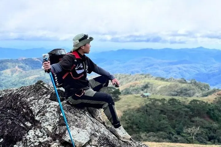
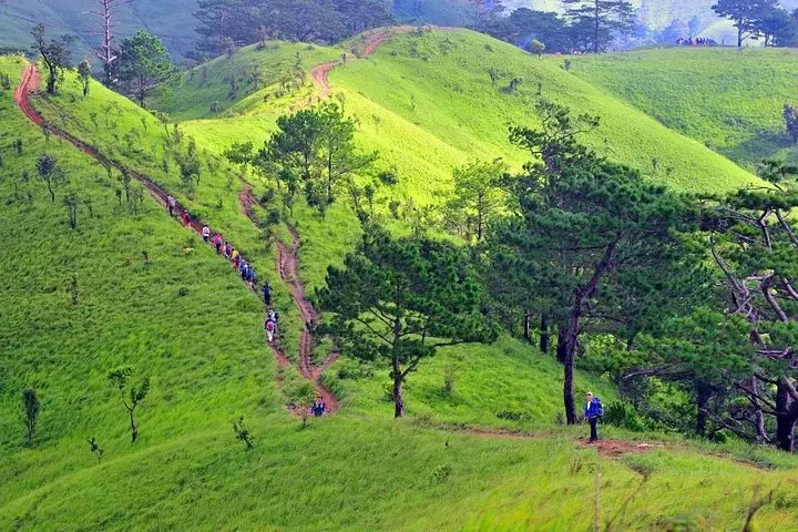
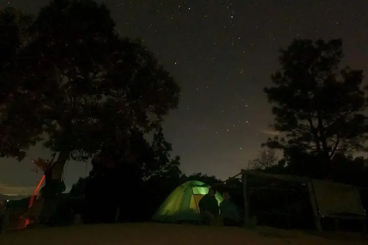
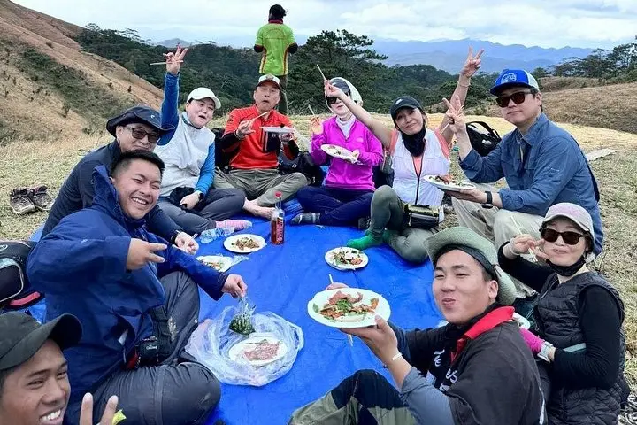
Morning light cuts across the ridgeline as hikers leave Da Lat and stand at the Three Provinces marker where Lam Dong, Binh Thuan and Ninh Thuan meet. The first day pushes uphill for roughly 10 km through mixed pine and evergreen forest, then follows the narrow crest known locally as the “Dragon’s Backbone” to a windswept campsite. Tents go up, a BBQ is shared, and the night sky, suddenly vast, answers with stars.
Morning light cuts across the ridgeline as hikers leave Da Lat and stand at the Three Provinces marker where Lam Dong, Binh Thuan and Ninh Thuan meet. The first day pushes uphill for roughly 10 km through mixed pine and evergreen forest, then follows the narrow crest known locally as the “Dragon’s Backbone” to a windswept campsite. Tents go up, a BBQ is shared, and the night sky, suddenly vast, answers with stars.
The route traverses the southern Central Highlands—an uplifted volcanic plateau of basalt soils, steep valleys and long ridges carved by seasonal monsoon rains. K'Ho villages and small coffee clearings appear on the lower slopes, offering cultural glimpses; ecologically the trail moves from secondary pine stands into humid gullies fed by clear tributaries such as the Yaly stream. The second day begins in mist, drops to the Yaly for a refreshing soak, then follows rolling slopes 5–8 km to the trek endpoint.
Practical guidance: this is a physically demanding multi-day traverse—train on loaded hikes and runs beforehand. Expect uneven, root- and rock-strewn trails, muddy sections after rain, and strong sun on exposed ridgelines. Carry 3–4 liters or a reliable filter, use sturdy, broken-in boots, pack a lightweight warm layer for cold nights and a dependable rain shell. Start early each day to avoid afternoon storms, move light, respect local trails and minimize camp impact. The Ta Nang–Phan Dung trek rewards persistence with sweeping ridge views and a clear mountain stream that seems to dare you to jump in.