THE ADVENTURE COLLECTIVE® · Independent discovery and booking for outdoor travel

Spend a full day on the Thin Pha Trail from Luang Prabang—12 km of rice paddies, limestone ridgelines and village visits topped by a traditional Hmong lunch and a boat trip to Tad Sae Waterfall. This private tour blends cultural insight with a moderate trek and a refreshing swim when the river is high.
Spend a full day on the Thin Pha Trail from Luang Prabang—12 km of rice paddies, limestone ridgelines and village visits topped by a traditional Hmong lunch and a boat trip to Tad Sae Waterfall. This private tour blends cultural insight with a moderate trek and a refreshing swim when the river is high.
You step off the boat onto a narrow dirt track and the rhythm of the countryside slips into your boots—water buffalo graze in flooded paddies, and the trail climbs through mid-canopy forest that smells faintly of earth and wet limestone. The Thin Pha Trail threads between Khmu and Hmong villages, opening onto ridgelines where the Nam Khan shimmers below and distant karst outcrops tilt like folded pages.
Verified experiences and guided adventures in the surrounding area.
Operated by Discova - Asia · Luang Prabang, Luang Prabang Province
You step off the boat onto a narrow dirt track and the rhythm of the countryside slips into your boots—water buffalo graze in flooded paddies, and the trail climbs through mid-canopy forest that smells faintly of earth and wet limestone. The Thin Pha Trail threads between Khmu and Hmong villages, opening onto ridgelines where the Nam Khan shimmers below and distant karst outcrops tilt like folded pages.
The area sits on karst geology common to northern Laos: limestone grottos, sharp ridges and occasional caves carved by seasonal streams. Luang Prabang itself is a cultural crossroads—centuries of Tai-Lao influence with strong Khmu and Hmong presences—so village visits are less staged performances and more living, working communities where weaving, rice farming, and animist customs persist.
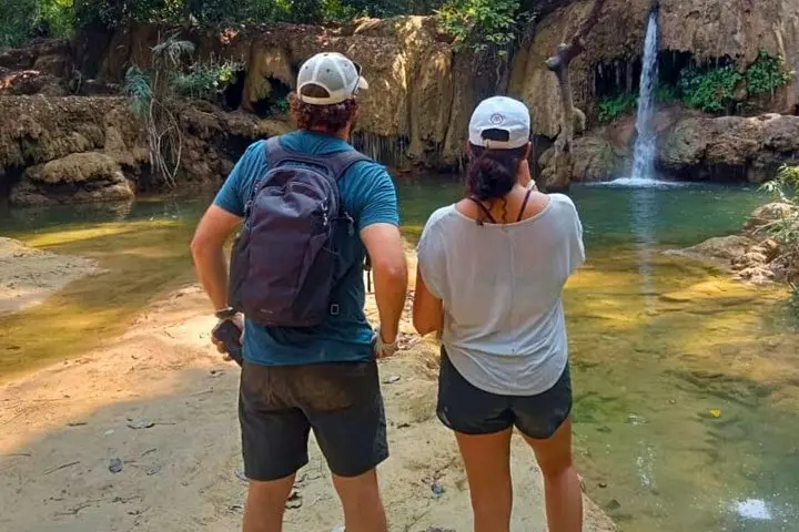
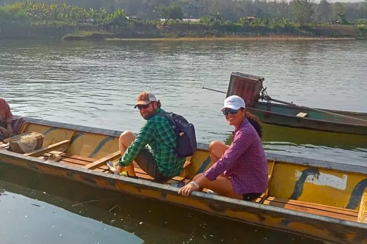
Expect a full day: roughly 12 km of walking across rice paddies, rocky slopes and forest paths, a home-cooked lunch in Ban Tinpha, and a restorative boat ride on the Nam Khan to Tad Sae Waterfall where a swim is possible in high water.
Practical edge: bring sturdy footwear for uneven rock and sticky clay, a light rain shell for sudden monsoon bursts, and cash for small village purchases. Water levels vary—Tad Sae is most impressive August–January; February–July can be low. Guides handle logistics and local introductions; be respectful on private land and ask before photographing people. This is a culturally rich, moderate trek that pairs scenery with genuine village interaction—ideal for travelers who want both nature and context in one day.
The full-day outing is moderate: about 12 km of mixed terrain with 4–5 hours of hiking; most sections are non-technical but uneven underfoot.
No—Tad Sae is best in the high-water season (roughly August–January); during the dry months it can be low or dry and may be omitted.
Yes—guides facilitate introductions. Always ask before photographing people and avoid entering private homes without invitation.
This tour is not recommended for children under 6; the itinerary involves boat transfers and multi-hour walking that may be unsuitable for very young kids.
Discova - Asia operates guided outdoor trips and adventures with an emphasis on safety, stewardship, and memorable experiences.

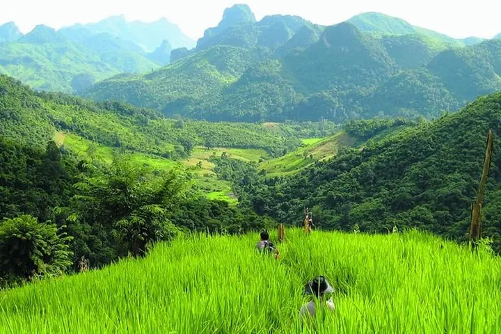
You step off the boat onto a narrow dirt track and the rhythm of the countryside slips into your boots—water buffalo graze in flooded paddies, and the trail climbs through mid-canopy forest that smells faintly of earth and wet limestone. The Thin Pha Trail threads between Khmu and Hmong villages, opening onto ridgelines where the Nam Khan shimmers below and distant karst outcrops tilt like folded pages.
You step off the boat onto a narrow dirt track and the rhythm of the countryside slips into your boots—water buffalo graze in flooded paddies, and the trail climbs through mid-canopy forest that smells faintly of earth and wet limestone. The Thin Pha Trail threads between Khmu and Hmong villages, opening onto ridgelines where the Nam Khan shimmers below and distant karst outcrops tilt like folded pages.
The area sits on karst geology common to northern Laos: limestone grottos, sharp ridges and occasional caves carved by seasonal streams. Luang Prabang itself is a cultural crossroads—centuries of Tai-Lao influence with strong Khmu and Hmong presences—so village visits are less staged performances and more living, working communities where weaving, rice farming, and animist customs persist.
Expect a full day: roughly 12 km of walking across rice paddies, rocky slopes and forest paths, a home-cooked lunch in Ban Tinpha, and a restorative boat ride on the Nam Khan to Tad Sae Waterfall where a swim is possible in high water.
Practical edge: bring sturdy footwear for uneven rock and sticky clay, a light rain shell for sudden monsoon bursts, and cash for small village purchases. Water levels vary—Tad Sae is most impressive August–January; February–July can be low. Guides handle logistics and local introductions; be respectful on private land and ask before photographing people. This is a culturally rich, moderate trek that pairs scenery with genuine village interaction—ideal for travelers who want both nature and context in one day.