THE ADVENTURE COLLECTIVE® · Independent discovery and booking for outdoor travel

A swift cable-car ascent from Innsbruck to the Hafelekar summit delivers 360° alpine panoramas without the climb. Learn what to expect—timing, terrain, wildlife, and essential tips for a comfortable visit.
A swift cable-car ascent from Innsbruck to the Hafelekar summit delivers 360° alpine panoramas without the climb. Learn what to expect—timing, terrain, wildlife, and essential tips for a comfortable visit.
Stand at the Altstadt station and feel the city tilt away as the cable car sweeps upward, the Inn River shrinking into a silver thread and Innsbruck’s roofs spreading like a map beneath you. In minutes the air cools, pines sharpen into silhouette, and the Hafelekar ridge—the Top of Innsbruck at roughly 2,300 m—comes into view. A short 10–15 minute walk from the Hafelekar station completes the ascent: no long climb, only thin air and a summit panorama that frames the alpine capital against the raw ridgelines of the Karwendel.
Verified experiences and guided adventures in the surrounding area.
Operated by Wanderung · Innsbruck, Tyrol
Stand at the Altstadt station and feel the city tilt away as the cable car sweeps upward, the Inn River shrinking into a silver thread and Innsbruck’s roofs spreading like a map beneath you. In minutes the air cools, pines sharpen into silhouette, and the Hafelekar ridge—the Top of Innsbruck at roughly 2,300 m—comes into view. A short 10–15 minute walk from the Hafelekar station completes the ascent: no long climb, only thin air and a summit panorama that frames the alpine capital against the raw ridgelines of the Karwendel.
The Nordkette route links urban and alpine history—funicular and cable systems built in the 20th century to open mountain access to city dwellers and visitors. Geology here is limestone and dolomite, cliffs carved by glaciers and weather; the exposed rock and scree give way to alpine meadows on gentler slopes. Culturally, the route is part of Innsbruck’s identity: a daily commute for some and a gateway for hikers, climbers, and ski-tourers. Wildlife is shy but present—chamois and alpine birds patrol the heights.
Practical guidance: tickets cover the Hungerburg funicular, Seegruben, and Hafelekar cable cars; rides run every 15 minutes with seasonal hour changes. Expect sudden wind, bright sun at altitude, and quick temperature swings—bring layers and sun protection. Peak times mid-morning to late afternoon; arrive early for clearer air and fewer crowds. The short summit walk is rocky; wear sturdy shoes. Facilities at stations are limited: plan water and snacks. For photos, the best light is early morning or late afternoon when shadows sculpt the ridges.
Allow 2–4 hours for the round trip including station transfers, time on Seegruben, and a summit walk; the cable cars run every 15 minutes.
Hungerburg funicular and the cable cars accommodate strollers and have accessible boarding areas, but check specific accessibility needs in advance.
Yes—several marked alpine and high-route trails start near the summit; some are short and rocky while others descend into the Karwendel and require proper hiking gear.
Dogs are generally permitted but may require a ticket; keep pets leashed and check current operator rules before travel.
Wanderung operates guided outdoor trips and adventures with an emphasis on safety, stewardship, and memorable experiences.
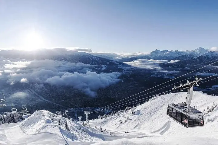
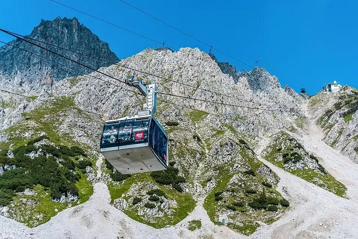
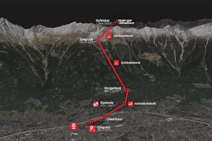
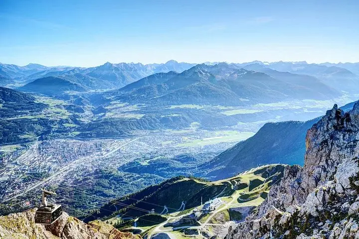
Stand at the Altstadt station and feel the city tilt away as the cable car sweeps upward, the Inn River shrinking into a silver thread and Innsbruck’s roofs spreading like a map beneath you. In minutes the air cools, pines sharpen into silhouette, and the Hafelekar ridge—the Top of Innsbruck at roughly 2,300 m—comes into view. A short 10–15 minute walk from the Hafelekar station completes the ascent: no long climb, only thin air and a summit panorama that frames the alpine capital against the raw ridgelines of the Karwendel.
Stand at the Altstadt station and feel the city tilt away as the cable car sweeps upward, the Inn River shrinking into a silver thread and Innsbruck’s roofs spreading like a map beneath you. In minutes the air cools, pines sharpen into silhouette, and the Hafelekar ridge—the Top of Innsbruck at roughly 2,300 m—comes into view. A short 10–15 minute walk from the Hafelekar station completes the ascent: no long climb, only thin air and a summit panorama that frames the alpine capital against the raw ridgelines of the Karwendel.
The Nordkette route links urban and alpine history—funicular and cable systems built in the 20th century to open mountain access to city dwellers and visitors. Geology here is limestone and dolomite, cliffs carved by glaciers and weather; the exposed rock and scree give way to alpine meadows on gentler slopes. Culturally, the route is part of Innsbruck’s identity: a daily commute for some and a gateway for hikers, climbers, and ski-tourers. Wildlife is shy but present—chamois and alpine birds patrol the heights.
Practical guidance: tickets cover the Hungerburg funicular, Seegruben, and Hafelekar cable cars; rides run every 15 minutes with seasonal hour changes. Expect sudden wind, bright sun at altitude, and quick temperature swings—bring layers and sun protection. Peak times mid-morning to late afternoon; arrive early for clearer air and fewer crowds. The short summit walk is rocky; wear sturdy shoes. Facilities at stations are limited: plan water and snacks. For photos, the best light is early morning or late afternoon when shadows sculpt the ridges.