THE ADVENTURE COLLECTIVE® · Independent discovery and booking for outdoor travel

Follow war-era supply trails to Pu To Co Peak for sweeping views over the Muong Thanh Valley and visits to Muong Phang historical bunkers. This full-day trek blends battlefield history with mountain scenery and local village stops.
Follow war-era supply trails to Pu To Co Peak for sweeping views over the Muong Thanh Valley and visits to Muong Phang historical bunkers. This full-day trek blends battlefield history with mountain scenery and local village stops.
You start before dawn on a narrow concrete road as mist lifts from the Muong Thanh Valley; trees lean toward the trail as if listening for boots. A local guide leads the group through a mix of farm tracks and forest switchbacks that once served as wartime supply routes—today they carry the careful footsteps of trekkers and the quiet of mountain birds.
Verified experiences and guided adventures in the surrounding area.
Operated by Local Tours ASIA · Dien Bien Phu, Dien Bien
You start before dawn on a narrow concrete road as mist lifts from the Muong Thanh Valley; trees lean toward the trail as if listening for boots. A local guide leads the group through a mix of farm tracks and forest switchbacks that once served as wartime supply routes—today they carry the careful footsteps of trekkers and the quiet of mountain birds.
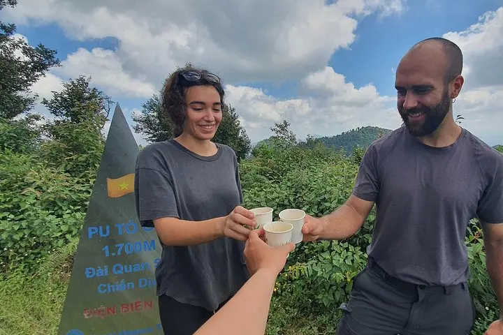
The route follows traces of the 1954 Dien Bien Phu Campaign. At Muong Phang, visitors can inspect command bunkers carved into limestone hills and imagine the logistical chess played on these slopes. Geologically, the area is a fold of Red River ophiolitic and alluvial terraces giving way to steep ridgelines; the summit of Pu To Co sits near 1,700 m and commands a full panorama of the former battlefield below.
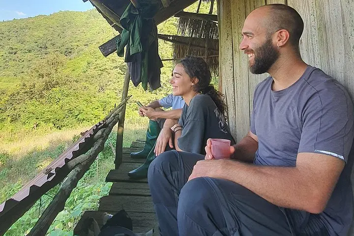
Culturally, the trail passes through Hmong and Thai farming clearings and Ban Kha homestay clusters where sticky rice and mountain herbs are staples; local guides often weave oral histories into the hike.
Plan for a long day: the ascent is roughly a 3-hour climb with mixed packed-earth and rocky sections, then a 5.5 km descent. Bring layered clothing for wind at the summit, at least 1.5–2 liters of water, and sturdy treaded shoes; trekking poles make the descent easier on knees. Start early to avoid afternoon showers, carry cash for homestay snacks, and respect memorial sites—stay on marked paths to protect both artifacts and fragile alpine vegetation.
The full excursion is about 10 hours with pickup around 6:30 AM and includes driving, the ascent (~3 hours), summit time, descent (~5.5 km) and return transfer.
Yes — guides report the tour is suitable for most fitness levels, but participants should be comfortable with multi-hour uphill walking and rough terrain.
Breakfast, lunch and bottled water are included; carry extra snacks if you prefer more frequent fueling during the hike.
Yes — the itinerary visits Muong Phang historical positions and the summit observation area used during the 1954 campaign, with guide commentary on-site.
Local Tours ASIA operates guided outdoor trips and adventures with an emphasis on safety, stewardship, and memorable experiences.
You start before dawn on a narrow concrete road as mist lifts from the Muong Thanh Valley; trees lean toward the trail as if listening for boots. A local guide leads the group through a mix of farm tracks and forest switchbacks that once served as wartime supply routes—today they carry the careful footsteps of trekkers and the quiet of mountain birds.
You start before dawn on a narrow concrete road as mist lifts from the Muong Thanh Valley; trees lean toward the trail as if listening for boots. A local guide leads the group through a mix of farm tracks and forest switchbacks that once served as wartime supply routes—today they carry the careful footsteps of trekkers and the quiet of mountain birds.
The route follows traces of the 1954 Dien Bien Phu Campaign. At Muong Phang, visitors can inspect command bunkers carved into limestone hills and imagine the logistical chess played on these slopes. Geologically, the area is a fold of Red River ophiolitic and alluvial terraces giving way to steep ridgelines; the summit of Pu To Co sits near 1,700 m and commands a full panorama of the former battlefield below.
Culturally, the trail passes through Hmong and Thai farming clearings and Ban Kha homestay clusters where sticky rice and mountain herbs are staples; local guides often weave oral histories into the hike.
Plan for a long day: the ascent is roughly a 3-hour climb with mixed packed-earth and rocky sections, then a 5.5 km descent. Bring layered clothing for wind at the summit, at least 1.5–2 liters of water, and sturdy treaded shoes; trekking poles make the descent easier on knees. Start early to avoid afternoon showers, carry cash for homestay snacks, and respect memorial sites—stay on marked paths to protect both artifacts and fragile alpine vegetation.