THE ADVENTURE COLLECTIVE® · Independent discovery and booking for outdoor travel

A classic day hike from McLeod Ganj, the Triund trek delivers sweeping Dhauladhar views, forested switchbacks and an alpine ridge experience in one accessible outing. Read on for what to expect and how to prepare.
A classic day hike from McLeod Ganj, the Triund trek delivers sweeping Dhauladhar views, forested switchbacks and an alpine ridge experience in one accessible outing. Read on for what to expect and how to prepare.
A cool mountain wind meets you before the ridge does — carrying pine resin and the soft murmur of tea shops below McLeod Ganj. Step by step the town falls away and a mixed forest of oak, rhododendron and deodar takes over, the trail pitching upward until Triund opens like a high green balcony. From that grassy crest the Dhauladhar range rises, snow-edged and abrupt, while the Kangra Valley spreads down into orchards and villages.
Verified experiences and guided adventures in the surrounding area.
Operated by Himachal Bylocals · McLeod Ganj, Himachal Pradesh
A cool mountain wind meets you before the ridge does — carrying pine resin and the soft murmur of tea shops below McLeod Ganj. Step by step the town falls away and a mixed forest of oak, rhododendron and deodar takes over, the trail pitching upward until Triund opens like a high green balcony. From that grassy crest the Dhauladhar range rises, snow-edged and abrupt, while the Kangra Valley spreads down into orchards and villages.
Triund sits on a flat alpine ridge at roughly 2,800–2,900 m; the route from McLeod Ganj is a classic day-hike used by locals and visitors for decades. Geologically, the Dhauladhars are a steep, folded spur of the Himalaya — sharp escarpments carved by glaciation and seasonal streams — which makes the views dramatic and the weather changeable. Culturally the trail threads through shepherd routes and tea stalls where guides share local stories about Tibetan settlements in nearby Dharamshala and the Bhagsu Nag temple below.
Plan for a steady uphill of roughly 450–1,100 m elevation gain and about 9 km round-trip depending on the start point; the ascent takes 3–4 hours at a moderate pace. Bring layered clothing, plenty of water, good hiking shoes and sun protection. Start early to avoid afternoon cloud and to catch the best light on the snowline. Respect local grazing areas, carry out waste, and stick to the marked path — the ridge is fragile and popular. With basic fitness and the right gear, this is a day that rewards simple effort with Himalayan scale and clarity.
Expect roughly 6–8 hours round-trip depending on pace and breaks; ascent commonly takes 3–4 hours.
No — the trail is well marked, but a local guide adds safety, local stories and easier navigation if weather changes.
Triund is around 2,800–2,900 m above sea level; acclimatize if you’re coming from low elevations.
Small tea shops and stalls operate on the trail offering snacks and hot drinks, but availability varies by season.
Himachal Bylocals operates guided outdoor trips and adventures with an emphasis on safety, stewardship, and memorable experiences.
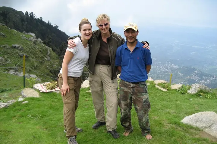
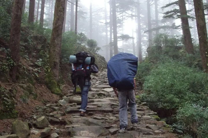
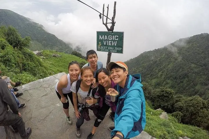
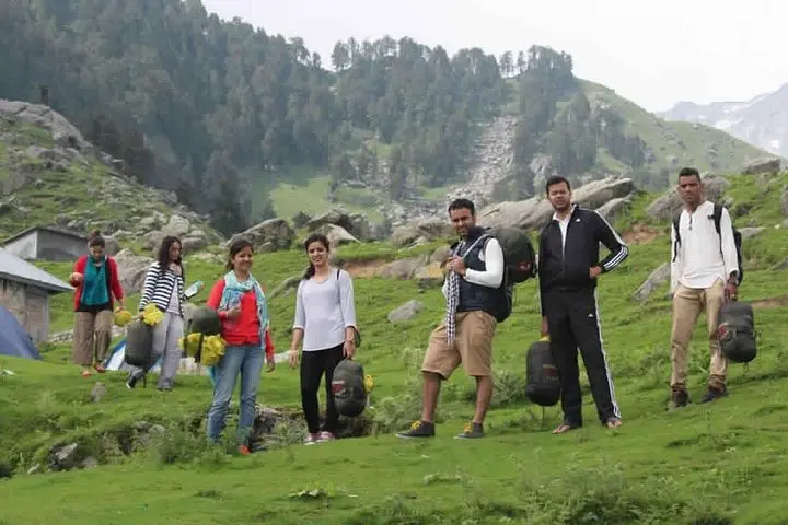
A cool mountain wind meets you before the ridge does — carrying pine resin and the soft murmur of tea shops below McLeod Ganj. Step by step the town falls away and a mixed forest of oak, rhododendron and deodar takes over, the trail pitching upward until Triund opens like a high green balcony. From that grassy crest the Dhauladhar range rises, snow-edged and abrupt, while the Kangra Valley spreads down into orchards and villages.
A cool mountain wind meets you before the ridge does — carrying pine resin and the soft murmur of tea shops below McLeod Ganj. Step by step the town falls away and a mixed forest of oak, rhododendron and deodar takes over, the trail pitching upward until Triund opens like a high green balcony. From that grassy crest the Dhauladhar range rises, snow-edged and abrupt, while the Kangra Valley spreads down into orchards and villages.
Triund sits on a flat alpine ridge at roughly 2,800–2,900 m; the route from McLeod Ganj is a classic day-hike used by locals and visitors for decades. Geologically, the Dhauladhars are a steep, folded spur of the Himalaya — sharp escarpments carved by glaciation and seasonal streams — which makes the views dramatic and the weather changeable. Culturally the trail threads through shepherd routes and tea stalls where guides share local stories about Tibetan settlements in nearby Dharamshala and the Bhagsu Nag temple below.
Plan for a steady uphill of roughly 450–1,100 m elevation gain and about 9 km round-trip depending on the start point; the ascent takes 3–4 hours at a moderate pace. Bring layered clothing, plenty of water, good hiking shoes and sun protection. Start early to avoid afternoon cloud and to catch the best light on the snowline. Respect local grazing areas, carry out waste, and stick to the marked path — the ridge is fragile and popular. With basic fitness and the right gear, this is a day that rewards simple effort with Himalayan scale and clarity.