THE ADVENTURE COLLECTIVE® · Independent discovery and booking for outdoor travel

Follow a GPS-guided smartphone tour up Tunnel Mountain, a compact 4.3 km round-trip hike that pairs sweeping Bow River views with stories of First Nations, Bill Peyto, and the park’s geology. Download the audio in advance, lace up your boots, and bring bear-aware common sense for a concise summit with big perspectives.
Follow a GPS-guided smartphone tour up Tunnel Mountain, a compact 4.3 km round-trip hike that pairs sweeping Bow River views with stories of First Nations, Bill Peyto, and the park’s geology. Download the audio in advance, lace up your boots, and bring bear-aware common sense for a concise summit with big perspectives.
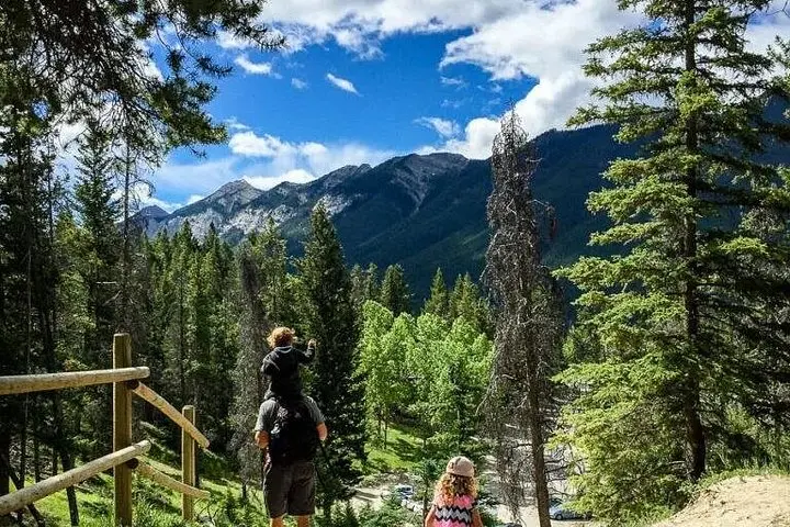
You step out of the parking lot on Tunnel Mountain Drive and the town’s bustle softens behind you. The path climbs steadily through lodgepole pines, switchbacks easing the ascent while the Bow River waits below, its current daring you to look away. Around each bend the valley opens: Sulphur Mountain’s ridgeline to the south, Mount Rundle’s layered cliffs to the east, and the compact roofs of Banff folded into the river’s curve.
Verified experiences and guided adventures in the surrounding area.
Operated by Tripvia Tours · Banff, Alberta
You step out of the parking lot on Tunnel Mountain Drive and the town’s bustle softens behind you. The path climbs steadily through lodgepole pines, switchbacks easing the ascent while the Bow River waits below, its current daring you to look away. Around each bend the valley opens: Sulphur Mountain’s ridgeline to the south, Mount Rundle’s layered cliffs to the east, and the compact roofs of Banff folded into the river’s curve.
This short, well-worn trail has a layered story. Indigenous Stoney Nakoda people called the ridge “Sleeping Buffalo”; later settlers and guides like Bill Peyto became part of Banff’s frontier narrative. Geologically the route skirts Paleozoic limestone folded by tectonic pressure—the cliffs show the mineral bands that color Mount Rundle. Culturally, the summit has long been a local viewpoint, a place for railway passengers and park visitors to orient themselves within the Rockies.
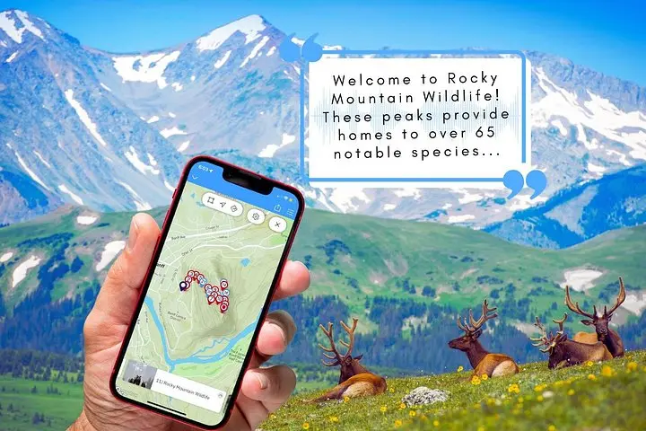
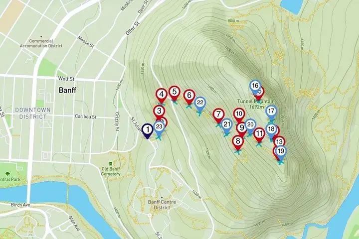
The Tripvia audio tour adds context at each marker, automatically cueing stories about wildlife, wildflowers and the human history that shaped the park. Practically, the hike is a short 4.3 km round-trip with moderate elevation gain on mixed dirt and rock—expect 1.5–3 hours depending on stops. Download the app on Wi‑Fi, carry a charged phone and offline map, and keep to the trail to reduce erosion. Wear supportive footwear, bring water, and carry bear-aware safety measures.
On a clear day the summit’s 360-degree outlook rewards a compact effort: peaks, river, and the town below—simple, immediate, and informative.
The full route on this tour is about 4.3 km round-trip; most visitors take 1.5–3 hours depending on stops and pace.
No, the trail can be hiked without the app, but the audio tour provides location-triggered commentary, history and trivia that enrich the experience.
The path is family-friendly but has steady climbs and some rocky sections; assess mobility and take more time if needed.
Pets are restricted in national parks except for service animals—check Banff National Park rules and keep animals off formal trails unless permitted.
Tripvia Tours operates guided outdoor trips and adventures with an emphasis on safety, stewardship, and memorable experiences.

You step out of the parking lot on Tunnel Mountain Drive and the town’s bustle softens behind you. The path climbs steadily through lodgepole pines, switchbacks easing the ascent while the Bow River waits below, its current daring you to look away. Around each bend the valley opens: Sulphur Mountain’s ridgeline to the south, Mount Rundle’s layered cliffs to the east, and the compact roofs of Banff folded into the river’s curve.
You step out of the parking lot on Tunnel Mountain Drive and the town’s bustle softens behind you. The path climbs steadily through lodgepole pines, switchbacks easing the ascent while the Bow River waits below, its current daring you to look away. Around each bend the valley opens: Sulphur Mountain’s ridgeline to the south, Mount Rundle’s layered cliffs to the east, and the compact roofs of Banff folded into the river’s curve.
This short, well-worn trail has a layered story. Indigenous Stoney Nakoda people called the ridge “Sleeping Buffalo”; later settlers and guides like Bill Peyto became part of Banff’s frontier narrative. Geologically the route skirts Paleozoic limestone folded by tectonic pressure—the cliffs show the mineral bands that color Mount Rundle. Culturally, the summit has long been a local viewpoint, a place for railway passengers and park visitors to orient themselves within the Rockies.
The Tripvia audio tour adds context at each marker, automatically cueing stories about wildlife, wildflowers and the human history that shaped the park. Practically, the hike is a short 4.3 km round-trip with moderate elevation gain on mixed dirt and rock—expect 1.5–3 hours depending on stops. Download the app on Wi‑Fi, carry a charged phone and offline map, and keep to the trail to reduce erosion. Wear supportive footwear, bring water, and carry bear-aware safety measures.
On a clear day the summit’s 360-degree outlook rewards a compact effort: peaks, river, and the town below—simple, immediate, and informative.