THE ADVENTURE COLLECTIVE® · Independent discovery and booking for outdoor travel

Scale North Africa’s highest peak on a concentrated two-day route from Imlil. This climb blends Berber valley culture, steep high-altitude hiking and a night at the Neltner refuge before a summit push to 4,167 m.
Scale North Africa’s highest peak on a concentrated two-day route from Imlil. This climb blends Berber valley culture, steep high-altitude hiking and a night at the Neltner refuge before a summit push to 4,167 m.
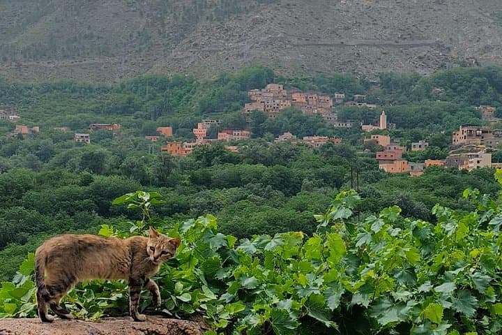
You step out of the minibus into the thin, cool air of Imlil and the High Atlas immediately takes shape — stony terraces, a stream that seems to dare you to follow it uphill, and a network of mule tracks climbing toward a skyline of serrated ridges.
Verified experiences and guided adventures in the surrounding area.
Operated by TOUBKAL TREK AZDOUR · Imlil, Marrakech-Safi
You step out of the minibus into the thin, cool air of Imlil and the High Atlas immediately takes shape — stony terraces, a stream that seems to dare you to follow it uphill, and a network of mule tracks climbing toward a skyline of serrated ridges.
The route follows the valley used for centuries by Berber shepherds and traders. Geologically, Toubkal is part of the Atlantic Atlas chain: ancient rock folded and uplifted by tectonic forces, with glacial scouring still readable in steep cirques near the summit. Cultural touchpoints appear as you climb — stone guesthouses, the pilgrims’ halt at Sidi Chamharouch, and mule caravans that have long supported local livelihoods.
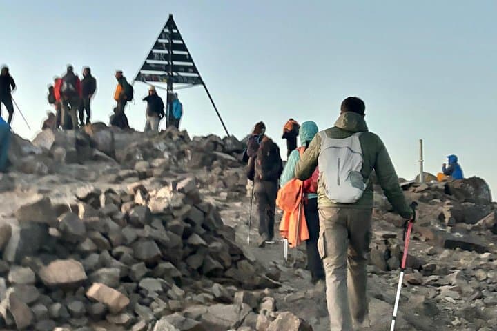
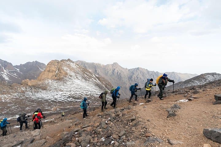
Expect a straightforward but sustained alpine hike: day one gains to the Neltner refuge at roughly 3,200 m over mixed dirt track and rocky trail, day two pushes to the summit at 4,167 m and returns to Imlil. Weather can change fast; wind and afternoon cloud build are common in shoulder seasons. The summit view opens across ridgelines to the Sahara on a clear day, while the descent tests legs tired from the ascent.
Practical guidance: pace conservatively and drink often; start early on summit day to avoid afternoon snow or storms. Wear stiff-soled boots and layer for temperature swings between valley warmth and summit cold. Guides and mules reduce pack weight and help route-finding above the refuge. Two days covers the objective if you have solid fitness and basic high-altitude hiking experience.
It’s a challenging high-altitude hike that requires good fitness and experience with long, steep days; the route is non-technical but sustained.
Local guides and mule support are typically provided by operators; guides handle route-finding and mules carry communal gear—confirm specifics when booking.
No technical climbing gear is needed in summer and shoulder seasons, though crampons and an ice axe may be required in winter—check conditions.
Late spring to early autumn (May–October) offers the most stable conditions; winter ascents are possible but expect snow and higher objective risks.
TOUBKAL TREK AZDOUR operates guided outdoor trips and adventures with an emphasis on safety, stewardship, and memorable experiences.

You step out of the minibus into the thin, cool air of Imlil and the High Atlas immediately takes shape — stony terraces, a stream that seems to dare you to follow it uphill, and a network of mule tracks climbing toward a skyline of serrated ridges.
You step out of the minibus into the thin, cool air of Imlil and the High Atlas immediately takes shape — stony terraces, a stream that seems to dare you to follow it uphill, and a network of mule tracks climbing toward a skyline of serrated ridges.
The route follows the valley used for centuries by Berber shepherds and traders. Geologically, Toubkal is part of the Atlantic Atlas chain: ancient rock folded and uplifted by tectonic forces, with glacial scouring still readable in steep cirques near the summit. Cultural touchpoints appear as you climb — stone guesthouses, the pilgrims’ halt at Sidi Chamharouch, and mule caravans that have long supported local livelihoods.
Expect a straightforward but sustained alpine hike: day one gains to the Neltner refuge at roughly 3,200 m over mixed dirt track and rocky trail, day two pushes to the summit at 4,167 m and returns to Imlil. Weather can change fast; wind and afternoon cloud build are common in shoulder seasons. The summit view opens across ridgelines to the Sahara on a clear day, while the descent tests legs tired from the ascent.
Practical guidance: pace conservatively and drink often; start early on summit day to avoid afternoon snow or storms. Wear stiff-soled boots and layer for temperature swings between valley warmth and summit cold. Guides and mules reduce pack weight and help route-finding above the refuge. Two days covers the objective if you have solid fitness and basic high-altitude hiking experience.