THE ADVENTURE COLLECTIVE® · Independent discovery and booking for outdoor travel

A full-day hike from Morogoro through village trails and ancient forest to the spray of Choma Waterfalls — ideal for travelers who want cultural contact, steady climbs, and a taste of the Eastern Arc’s biodiversity. Read practical advice on timing, gear, and what to expect.
A full-day hike from Morogoro through village trails and ancient forest to the spray of Choma Waterfalls — ideal for travelers who want cultural contact, steady climbs, and a taste of the Eastern Arc’s biodiversity. Read practical advice on timing, gear, and what to expect.
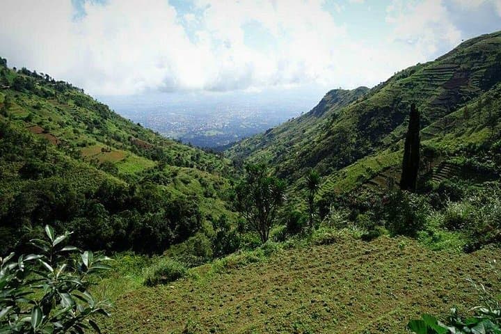
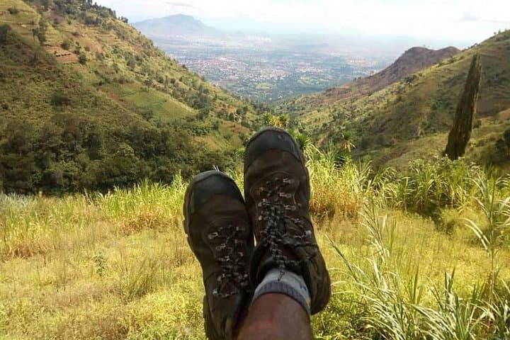
The trail climbs out of Morogoro’s heat and into a green, breathing shoulder of the Uluguru Mountains. Early morning light slips through tall trees as villagers edge past with bundles of produce; streams appear without fanfare and the path angles upward, promising the sharp hiss of the Choma waterfall ahead.
Verified experiences and guided adventures in the surrounding area.
Operated by Safaris Partners · Morogoro, Morogoro Region
The trail climbs out of Morogoro’s heat and into a green, breathing shoulder of the Uluguru Mountains. Early morning light slips through tall trees as villagers edge past with bundles of produce; streams appear without fanfare and the path angles upward, promising the sharp hiss of the Choma waterfall ahead.
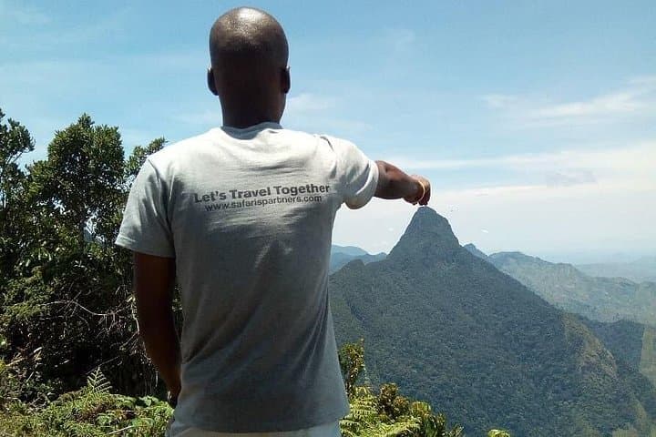
These mountains are part of the Eastern Arc, a geologically ancient chain whose crystalline soils and persistent moisture created some of Africa’s oldest forests. The Luguru (or Uluguru) people have farmed the lower slopes for generations; remnants of colonial-era structures such as the Morningside German mountain hut mark routes once used for timber and administration. Lupanga Peak, the range’s 2,150 m high point, sits above the valleys and frames the weather here.
Culturally this is a working landscape — terraced fields, smallholdings, and village trails that double as highways for local life. On the hike you move through coffee plots and indigenous forest, with birds and monkeys announcing your progress while waterfall spray dares you closer to the pool.
Practical guidance: the common starting point is near the Regional Administration buildings about 3 km south of Morogoro town centre. Expect steep dirt trails and village paths rather than technical rock scrambling. Carry at least 2–3 liters of water, sturdy footwear, sun and rain protection, and a small first-aid kit. Guides are recommended for navigation, cultural context, and to support local communities. Aim for dry-season windows (June–September or January–February) for firmer trails and clearer views; the long rains (March–May) make paths slippery. Plan a full day for Choma Waterfalls or an ambitious route to Lupanga Peak, and leave no trace — these forests are fragile and vital.
Most hikes start near the Regional Administration buildings about 3 km south of the town centre at the end of Boma Rd; taxis or arranged pickup from your lodging are common.
A guide is not strictly required for the Choma Waterfalls walk but is recommended for safety, navigation, local insight, and community benefit.
Choma Waterfalls is a steep but non-technical route suited to moderately fit walkers; Lupanga Peak adds significant elevation and time, making it a long, strenuous day for many hikers.
Small environmental or park fees may apply (often collected locally); if booking through a tour operator, fees are typically included—confirm before you go.
Safaris Partners operates guided outdoor trips and adventures with an emphasis on safety, stewardship, and memorable experiences.

The trail climbs out of Morogoro’s heat and into a green, breathing shoulder of the Uluguru Mountains. Early morning light slips through tall trees as villagers edge past with bundles of produce; streams appear without fanfare and the path angles upward, promising the sharp hiss of the Choma waterfall ahead.
The trail climbs out of Morogoro’s heat and into a green, breathing shoulder of the Uluguru Mountains. Early morning light slips through tall trees as villagers edge past with bundles of produce; streams appear without fanfare and the path angles upward, promising the sharp hiss of the Choma waterfall ahead.
These mountains are part of the Eastern Arc, a geologically ancient chain whose crystalline soils and persistent moisture created some of Africa’s oldest forests. The Luguru (or Uluguru) people have farmed the lower slopes for generations; remnants of colonial-era structures such as the Morningside German mountain hut mark routes once used for timber and administration. Lupanga Peak, the range’s 2,150 m high point, sits above the valleys and frames the weather here.
Culturally this is a working landscape — terraced fields, smallholdings, and village trails that double as highways for local life. On the hike you move through coffee plots and indigenous forest, with birds and monkeys announcing your progress while waterfall spray dares you closer to the pool.
Practical guidance: the common starting point is near the Regional Administration buildings about 3 km south of Morogoro town centre. Expect steep dirt trails and village paths rather than technical rock scrambling. Carry at least 2–3 liters of water, sturdy footwear, sun and rain protection, and a small first-aid kit. Guides are recommended for navigation, cultural context, and to support local communities. Aim for dry-season windows (June–September or January–February) for firmer trails and clearer views; the long rains (March–May) make paths slippery. Plan a full day for Choma Waterfalls or an ambitious route to Lupanga Peak, and leave no trace — these forests are fragile and vital.