THE ADVENTURE COLLECTIVE® · Independent discovery and booking for outdoor travel

Follow a high, arid trail from Jomsom to the walled capital of Lo Manthang, crossing the rain-shadow plateaus of Upper Mustang. This 15–16 day trek demands acclimatization, permits for the restricted area, and readiness for long, exposed walking days at 3,000–3,800 m.
Follow a high, arid trail from Jomsom to the walled capital of Lo Manthang, crossing the rain-shadow plateaus of Upper Mustang. This 15–16 day trek demands acclimatization, permits for the restricted area, and readiness for long, exposed walking days at 3,000–3,800 m.
At dawn the plateau above the Kali Gandaki opens like a page - thin air sharpening each step as prayer flags snap along low walls. The Upper Mustang Trek pushes across wind-scoured valleys and ochre cliffs, moving from Jomsom's dusty airstrip up through Kagbeni and the fortified lanes of Lo Manthang.
Verified experiences and guided adventures in the surrounding area.
Operated by Alpine Luxury Treks Pvt Ltd · Lo Manthang, Gandaki Province
At dawn the plateau above the Kali Gandaki opens like a page - thin air sharpening each step as prayer flags snap along low walls. The Upper Mustang Trek pushes across wind-scoured valleys and ochre cliffs, moving from Jomsom's dusty airstrip up through Kagbeni and the fortified lanes of Lo Manthang.
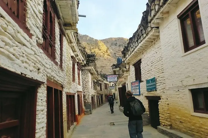
The route follows a human history that reads Tibetan: walled towns, gompas with whitewashed facades, prayer wheels and murals tied to centuries of trade between central Nepal and the Tibetan plateau. Geologically, this is rain-shadow country - strata of red sandstone and conglomerate cut by the world’s deepest gorge and sculpted by monsoon-skeptical winds that polish cliffs into ribs and ledges.
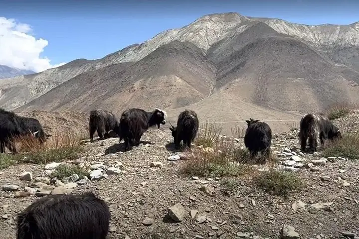
Culturally the region remains conservative and Buddhist; local festivals and small household shrines are common. Visitors pass through villages where barley dries on roofs and yak caravans still move goods between high pastures.
Practical guide: the standard itinerary runs about 15-16 days with teahouse nights, an acclimatization day in Lo Manthang, and long 5-8 hour walking days at 3,000-3,800 m. Trails are rocky and often scree-covered; expect arid, exposed stretches with steep stair-like ascents between villages. Permits for the restricted area and TIMS are mandatory; organized groups provide these.
Plan for altitude: add an extra acclimatization day if you have limited high-altitude exposure. Bring sturdy boots, warm layers for cold nights, and water treatment - sources are sparse. Flights to Jomsom are weather-dependent; build buffer days into your schedule. Expect stark beauty, quiet villages, and travel logistics that reward patience and preparation.
Yes. Upper Mustang is a restricted area; you must obtain a permit in addition to TIMS. Most operators arrange permits before departure.
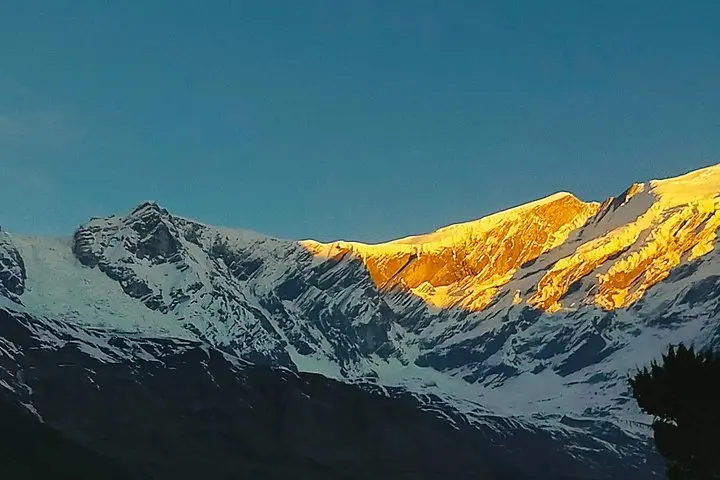
Autumn (late Sept–Nov) and spring (April–May) offer the most stable weather and clear mountain views; monsoon months are dusty in Upper Mustang but flights to Jomsom can be disrupted.
Trek accommodation is typically teahouses or basic guesthouses with shared bathrooms; expect modest facilities and simple meals in remote villages.
Altitude is the main risk—follow a conservative ascent profile, hydrate, and use the scheduled acclimatization day; descend immediately if symptoms worsen.
Alpine Luxury Treks Pvt Ltd operates guided outdoor trips and adventures with an emphasis on safety, stewardship, and memorable experiences.
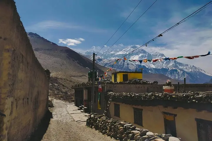
At dawn the plateau above the Kali Gandaki opens like a page - thin air sharpening each step as prayer flags snap along low walls. The Upper Mustang Trek pushes across wind-scoured valleys and ochre cliffs, moving from Jomsom's dusty airstrip up through Kagbeni and the fortified lanes of Lo Manthang.
At dawn the plateau above the Kali Gandaki opens like a page - thin air sharpening each step as prayer flags snap along low walls. The Upper Mustang Trek pushes across wind-scoured valleys and ochre cliffs, moving from Jomsom's dusty airstrip up through Kagbeni and the fortified lanes of Lo Manthang.
The route follows a human history that reads Tibetan: walled towns, gompas with whitewashed facades, prayer wheels and murals tied to centuries of trade between central Nepal and the Tibetan plateau. Geologically, this is rain-shadow country - strata of red sandstone and conglomerate cut by the world’s deepest gorge and sculpted by monsoon-skeptical winds that polish cliffs into ribs and ledges.
Culturally the region remains conservative and Buddhist; local festivals and small household shrines are common. Visitors pass through villages where barley dries on roofs and yak caravans still move goods between high pastures.
Practical guide: the standard itinerary runs about 15-16 days with teahouse nights, an acclimatization day in Lo Manthang, and long 5-8 hour walking days at 3,000-3,800 m. Trails are rocky and often scree-covered; expect arid, exposed stretches with steep stair-like ascents between villages. Permits for the restricted area and TIMS are mandatory; organized groups provide these.
Plan for altitude: add an extra acclimatization day if you have limited high-altitude exposure. Bring sturdy boots, warm layers for cold nights, and water treatment - sources are sparse. Flights to Jomsom are weather-dependent; build buffer days into your schedule. Expect stark beauty, quiet villages, and travel logistics that reward patience and preparation.