THE ADVENTURE COLLECTIVE® · Independent discovery and booking for outdoor travel

Soar from Pitt Meadows over Stanley Park, Lions Gate Bridge and the North Shore Mountains on a 30-minute curated helicopter circuit. This quick aerial tour compresses Vancouver’s sea-to-sky scenery into a vivid, photo-ready flight—weather and a two-passenger minimum apply.
Soar from Pitt Meadows over Stanley Park, Lions Gate Bridge and the North Shore Mountains on a 30-minute curated helicopter circuit. This quick aerial tour compresses Vancouver’s sea-to-sky scenery into a vivid, photo-ready flight—weather and a two-passenger minimum apply.
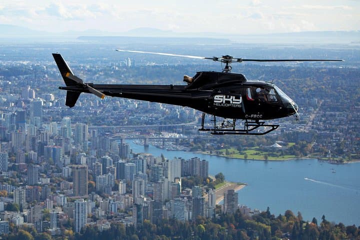
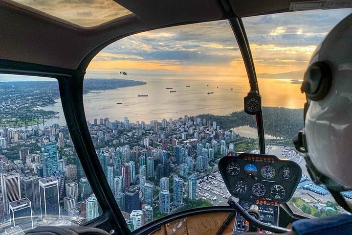
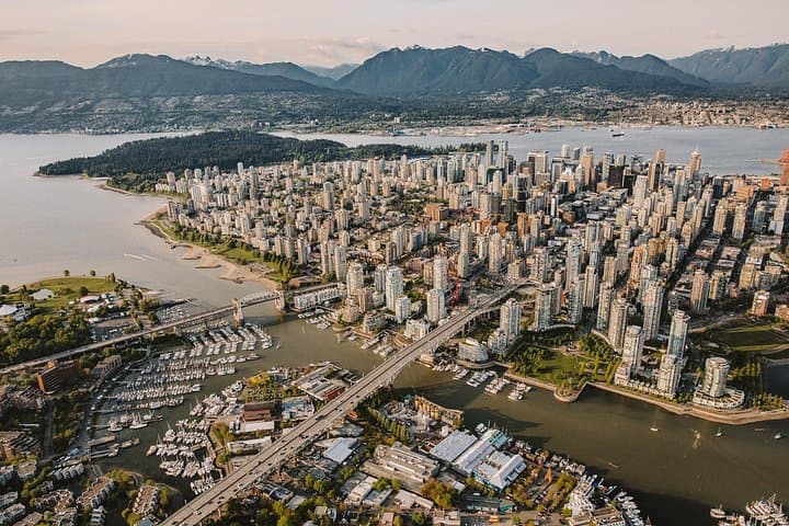
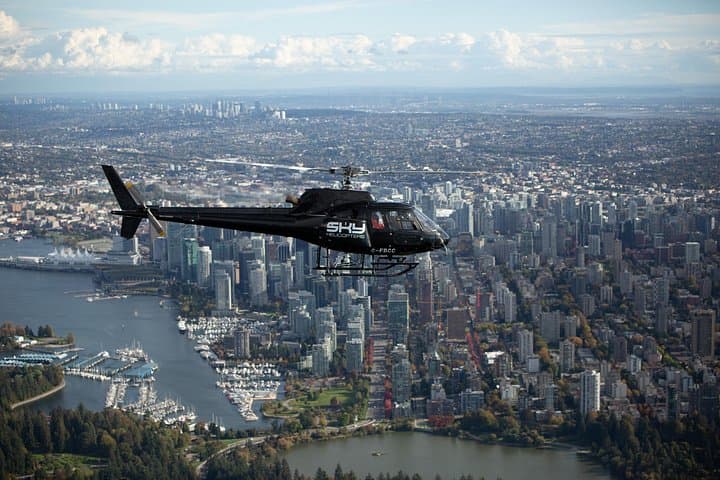
You lift off from the low-slung hangar at Pitt Meadows and the Fraser Valley opens beneath you like a moving map: the patchwork of farmlands gives way to the bright grid of downtown, Stanley Park’s dark green mass, and the serrated line of the North Shore Mountains. The helicopter hums, panoramic windows framing Lions Gate Bridge as it narrows into a ribbon, and the waters of Burrard Inlet push and pull like a living thing.
Verified experiences and guided adventures in the surrounding area.
Operated by SKY Helicopters Inc · Vancouver, British Columbia
You lift off from the low-slung hangar at Pitt Meadows and the Fraser Valley opens beneath you like a moving map: the patchwork of farmlands gives way to the bright grid of downtown, Stanley Park’s dark green mass, and the serrated line of the North Shore Mountains. The helicopter hums, panoramic windows framing Lions Gate Bridge as it narrows into a ribbon, and the waters of Burrard Inlet push and pull like a living thing.
Vancouver’s modern skyline sits at the junction of sea and mountain—its growth tied to timber, shipping and the railways that stitched the Pacific Coast to the continent. Geologically, the Coast Mountains are young and rugged, carved by glaciers that also shaped the inlets and tidal flats you’ll pass. From the air you’ll see human stories—Granville Island’s market, the cruise terminal, and the engineered edges of False Creek—alongside tidal channels that still host migrating birds and seals.
The flight is sightseeing with a precise edge: 30 minutes of curated aerial views that compress Vancouver’s geography into a single circuit. Bring a camera and a jacket; winds and light change fast over coastal waters. Note operational realities—minimum two purchased seats, weather-dependent cancellations, and a check-in at Pitt Meadows Regional Airport about 45 minutes east of downtown.
Practical tips: confirm your flight a day ahead, allow extra time for parking and weight checks, and expect clear instructions on safety and seating. For travelers who want a quick, high-impact orientation to Vancouver’s converging landscapes, this helicopter tour is an efficient, visceral way to read the city from above.
The operator requires a minimum of two purchased seats and may pair solo passengers; if pairing isn’t possible they reserve the right to cancel and issue a refund.
Flights are weather-dependent; heavy rain, low ceilings or strong winds can cause delays or cancellations—confirm with the operator the day before.
Pitt Meadows Regional Airport is about 45 minutes east of downtown Vancouver by car; there’s free parking for cars, RVs and large vehicles—public transport options are nearby but check schedules.
Operators collect passenger weights and require full names and ages during booking for seating and weight-balance planning—contact guest services for specifics on limits and young child policies.
SKY Helicopters Inc operates guided outdoor trips and adventures with an emphasis on safety, stewardship, and memorable experiences.
You lift off from the low-slung hangar at Pitt Meadows and the Fraser Valley opens beneath you like a moving map: the patchwork of farmlands gives way to the bright grid of downtown, Stanley Park’s dark green mass, and the serrated line of the North Shore Mountains. The helicopter hums, panoramic windows framing Lions Gate Bridge as it narrows into a ribbon, and the waters of Burrard Inlet push and pull like a living thing.
You lift off from the low-slung hangar at Pitt Meadows and the Fraser Valley opens beneath you like a moving map: the patchwork of farmlands gives way to the bright grid of downtown, Stanley Park’s dark green mass, and the serrated line of the North Shore Mountains. The helicopter hums, panoramic windows framing Lions Gate Bridge as it narrows into a ribbon, and the waters of Burrard Inlet push and pull like a living thing.
Vancouver’s modern skyline sits at the junction of sea and mountain—its growth tied to timber, shipping and the railways that stitched the Pacific Coast to the continent. Geologically, the Coast Mountains are young and rugged, carved by glaciers that also shaped the inlets and tidal flats you’ll pass. From the air you’ll see human stories—Granville Island’s market, the cruise terminal, and the engineered edges of False Creek—alongside tidal channels that still host migrating birds and seals.
The flight is sightseeing with a precise edge: 30 minutes of curated aerial views that compress Vancouver’s geography into a single circuit. Bring a camera and a jacket; winds and light change fast over coastal waters. Note operational realities—minimum two purchased seats, weather-dependent cancellations, and a check-in at Pitt Meadows Regional Airport about 45 minutes east of downtown.
Practical tips: confirm your flight a day ahead, allow extra time for parking and weight checks, and expect clear instructions on safety and seating. For travelers who want a quick, high-impact orientation to Vancouver’s converging landscapes, this helicopter tour is an efficient, visceral way to read the city from above.