THE ADVENTURE COLLECTIVE® · Independent discovery and booking for outdoor travel

Drive the Reykjanes Peninsula to see youngest lava fields, steaming geothermal areas, and the coastal town of Grindavík. This seven‑hour loop blends dramatic geology with short, accessible walks and adaptable routes near active volcanic zones.
Drive the Reykjanes Peninsula to see youngest lava fields, steaming geothermal areas, and the coastal town of Grindavík. This seven‑hour loop blends dramatic geology with short, accessible walks and adaptable routes near active volcanic zones.
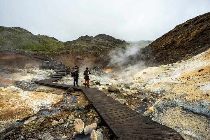
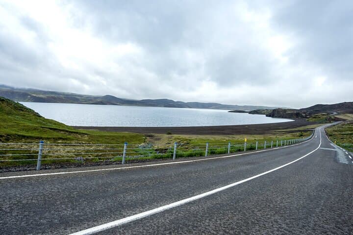
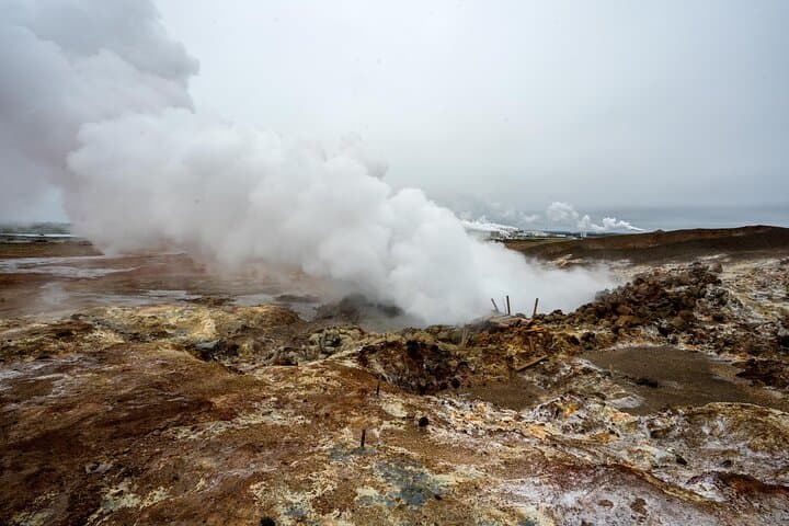
A wind-swept road bends along Kleifarvatn, the lake’s surface breaking sunlight into a fine silver. Steam rises in pockets from the ground ahead; the peninsula smells faintly of sulfur and salt. On this seven‑hour loop you move through recent earth—black lava ridges softened by bright green moss, geothermal fields that hiss and bubble, and a small fishing town whose streets still show scars from earthquakes.
Verified experiences and guided adventures in the surrounding area.
Operated by Glaciers and Waterfalls · Grindavík, Reykjanes
A wind-swept road bends along Kleifarvatn, the lake’s surface breaking sunlight into a fine silver. Steam rises in pockets from the ground ahead; the peninsula smells faintly of sulfur and salt. On this seven‑hour loop you move through recent earth—black lava ridges softened by bright green moss, geothermal fields that hiss and bubble, and a small fishing town whose streets still show scars from earthquakes.
Geology shapes every mile. Reykjanes sits on the Mid‑Atlantic Ridge where the North American and Eurasian plates pry apart, creating fissures, hot springs and the youngest volcanic ground in Iceland — including flows from Fagradalsfjall. Grindavík’s fishing history and periodic evacuations tell a human story of living beside a volatile landscape.
Expect colorful mineral pans at Seltún, the quiet sweep of Kleifarvatn’s shoreline, and the low bridge that visually splits two continents. Guides typically point out lava formations, fumaroles and safe viewing distances; if an eruption is active, the tour adapts to prioritize the best available viewpoints.
Practical advice: layer up for wind and sudden weather shifts, wear grippy boots for uneven lava and mud, and keep at least a few meters from steaming vents. Photography thrives in low, angled light—bring a windproof camera cover. Respect marked trails: moss and crust are fragile and hazardous. The itinerary moves by van between stops with short walks at most viewpoints, so it’s accessible to most travelers but still rewards attention and steady footing.
This is a day that trains your eyes to read geology: cracks, breath, and the slow work of new land forming beneath your feet.
The tour lasts about seven hours with several short walks at viewpoints (typically 10–60 minutes per stop); most transit is by van so it’s accessible to most travelers.
You may see recent lava fields and, if an eruption is active and safe viewing is possible, guides will adapt the route to take you to the best approved viewpoint—visibility depends on current volcanic activity and closures.
There are limited facilities at village stops like Grindavík and at some attractions; bring snacks and water for flexibility and check in with the guide about scheduled breaks.
Yes—many segments are family‑friendly with short, easy walks—but keep young children close around geothermal features and uneven lava; follow guide instructions at all times.
Glaciers and Waterfalls operates guided outdoor trips and adventures with an emphasis on safety, stewardship, and memorable experiences.

A wind-swept road bends along Kleifarvatn, the lake’s surface breaking sunlight into a fine silver. Steam rises in pockets from the ground ahead; the peninsula smells faintly of sulfur and salt. On this seven‑hour loop you move through recent earth—black lava ridges softened by bright green moss, geothermal fields that hiss and bubble, and a small fishing town whose streets still show scars from earthquakes.
A wind-swept road bends along Kleifarvatn, the lake’s surface breaking sunlight into a fine silver. Steam rises in pockets from the ground ahead; the peninsula smells faintly of sulfur and salt. On this seven‑hour loop you move through recent earth—black lava ridges softened by bright green moss, geothermal fields that hiss and bubble, and a small fishing town whose streets still show scars from earthquakes.
Geology shapes every mile. Reykjanes sits on the Mid‑Atlantic Ridge where the North American and Eurasian plates pry apart, creating fissures, hot springs and the youngest volcanic ground in Iceland — including flows from Fagradalsfjall. Grindavík’s fishing history and periodic evacuations tell a human story of living beside a volatile landscape.
Expect colorful mineral pans at Seltún, the quiet sweep of Kleifarvatn’s shoreline, and the low bridge that visually splits two continents. Guides typically point out lava formations, fumaroles and safe viewing distances; if an eruption is active, the tour adapts to prioritize the best available viewpoints.
Practical advice: layer up for wind and sudden weather shifts, wear grippy boots for uneven lava and mud, and keep at least a few meters from steaming vents. Photography thrives in low, angled light—bring a windproof camera cover. Respect marked trails: moss and crust are fragile and hazardous. The itinerary moves by van between stops with short walks at most viewpoints, so it’s accessible to most travelers but still rewards attention and steady footing.
This is a day that trains your eyes to read geology: cracks, breath, and the slow work of new land forming beneath your feet.