THE ADVENTURE COLLECTIVE® · Independent discovery and booking for outdoor travel

Climb the historic Franz Joseph switchbacks above Kotor for sweeping views of the Bay of Kotor. This private, 7‑hour hike blends history, limestone ridgelines, and panoramic overlooks—best for hikers with moderate fitness.
Climb the historic Franz Joseph switchbacks above Kotor for sweeping views of the Bay of Kotor. This private, 7‑hour hike blends history, limestone ridgelines, and panoramic overlooks—best for hikers with moderate fitness.
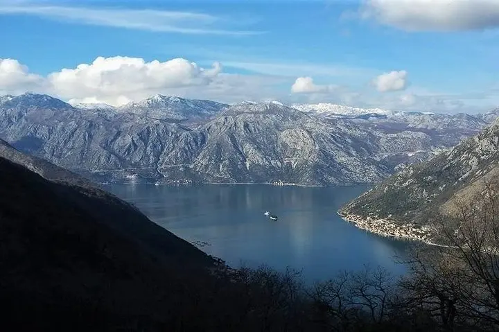
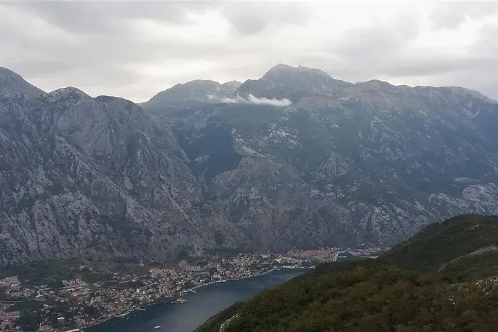
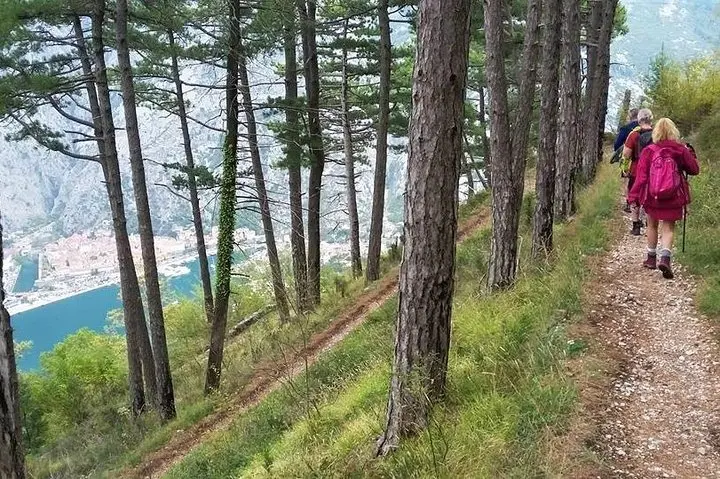
You leave the stone teeth of Kotor’s old harbor behind and climb into cooled shade, the bay opening beneath you like a slow-moving ocean that refuses to sit still. Early switchbacks rise quickly—an Austro‑Hungarian engineering line cut into the slope—taking you 550 meters up from the port on an old military road. The air tightens, the pine and oak canopies alter light into green filters, and every turn rewards another postcard view of the Old Town, the fjord‑like inlet, and the needle of Herceg Novi across the water.
Verified experiences and guided adventures in the surrounding area.
Operated by Montenegro Travel Club · Kotor, Kotor Municipality
You leave the stone teeth of Kotor’s old harbor behind and climb into cooled shade, the bay opening beneath you like a slow-moving ocean that refuses to sit still. Early switchbacks rise quickly—an Austro‑Hungarian engineering line cut into the slope—taking you 550 meters up from the port on an old military road. The air tightens, the pine and oak canopies alter light into green filters, and every turn rewards another postcard view of the Old Town, the fjord‑like inlet, and the needle of Herceg Novi across the water.
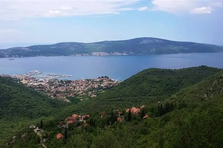
The track follows a historic route named after Emperor Franz Joseph, a remnant of 19th‑century strategic works that linked Kotor to Vrmac’s forts. Geologically the ridge is limestone folded into steep cliffs and shallow karst soils; expect rocky gravel underfoot and stretches of compacted dirt on the forested service road. Cultural touches appear in scattered shepherd paths and terraces on lower slopes, while modern contrasts—Porto Montenegro’s marina and Tivat’s waterfront—sit like polished islands below.
Practical guidance: the full itinerary runs about seven hours with moderate ascent and some sustained climbs; a one‑hour optional summit pushes you to 750 m for the broadest panorama. Wear sturdy hiking shoes with good traction, carry at least 2 liters of water, layered clothing for wind on exposed sections, and sun protection. The trail is suitable for hikers with moderate fitness and steady balance; steep switchbacks reward patience with uninterrupted views. Start early to avoid midday heat and allow time for photo stops and a relaxed descent back toward Tivat or Kotor.
The route gains about 550 m on the main trail with steep switchbacks; it’s rated moderate—good for hikers with basic fitness.
The walk begins a 10‑minute walk from Kotor Old Town’s port; the route descends toward Tivat with transport included back to your pickup point.
Yes—the tour includes a licensed guide and transportation in a standard sedan, minivan, or minibus as listed in the inclusions.
Infants must sit on laps; the tour is not recommended for people with back, heart, or pregnancy concerns and suits those with moderate fitness.
Montenegro Travel Club operates guided outdoor trips and adventures with an emphasis on safety, stewardship, and memorable experiences.
You leave the stone teeth of Kotor’s old harbor behind and climb into cooled shade, the bay opening beneath you like a slow-moving ocean that refuses to sit still. Early switchbacks rise quickly—an Austro‑Hungarian engineering line cut into the slope—taking you 550 meters up from the port on an old military road. The air tightens, the pine and oak canopies alter light into green filters, and every turn rewards another postcard view of the Old Town, the fjord‑like inlet, and the needle of Herceg Novi across the water.
You leave the stone teeth of Kotor’s old harbor behind and climb into cooled shade, the bay opening beneath you like a slow-moving ocean that refuses to sit still. Early switchbacks rise quickly—an Austro‑Hungarian engineering line cut into the slope—taking you 550 meters up from the port on an old military road. The air tightens, the pine and oak canopies alter light into green filters, and every turn rewards another postcard view of the Old Town, the fjord‑like inlet, and the needle of Herceg Novi across the water.
The track follows a historic route named after Emperor Franz Joseph, a remnant of 19th‑century strategic works that linked Kotor to Vrmac’s forts. Geologically the ridge is limestone folded into steep cliffs and shallow karst soils; expect rocky gravel underfoot and stretches of compacted dirt on the forested service road. Cultural touches appear in scattered shepherd paths and terraces on lower slopes, while modern contrasts—Porto Montenegro’s marina and Tivat’s waterfront—sit like polished islands below.
Practical guidance: the full itinerary runs about seven hours with moderate ascent and some sustained climbs; a one‑hour optional summit pushes you to 750 m for the broadest panorama. Wear sturdy hiking shoes with good traction, carry at least 2 liters of water, layered clothing for wind on exposed sections, and sun protection. The trail is suitable for hikers with moderate fitness and steady balance; steep switchbacks reward patience with uninterrupted views. Start early to avoid midday heat and allow time for photo stops and a relaxed descent back toward Tivat or Kotor.