THE ADVENTURE COLLECTIVE® · Independent discovery and booking for outdoor travel

Explore Montsacopa by self-guided audio in Olot: walk the crater rim, touch volcanic rock, and hear why this cone became both a lookout and a place of worship. The one-hour loop pairs geology, local history, and sweeping views of La Garrotxa.
Explore Montsacopa by self-guided audio in Olot: walk the crater rim, touch volcanic rock, and hear why this cone became both a lookout and a place of worship. The one-hour loop pairs geology, local history, and sweeping views of La Garrotxa.
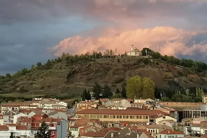
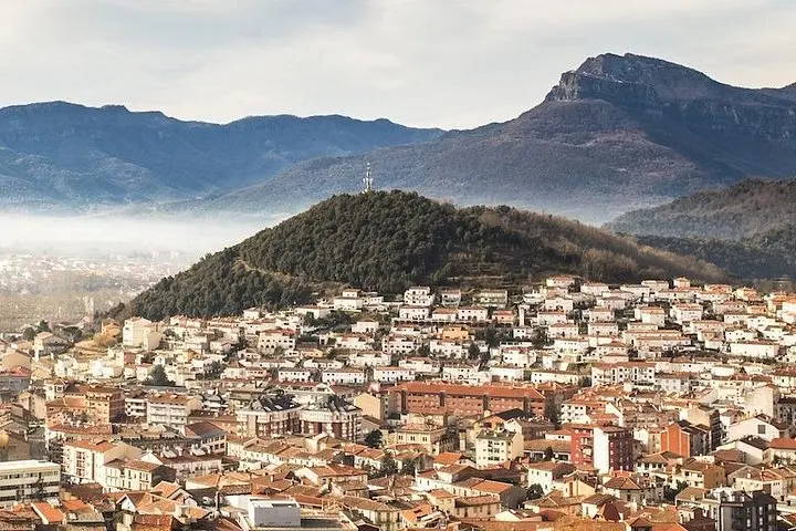
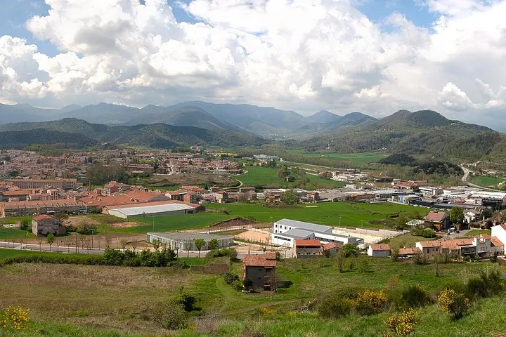
You step off a quiet street in Olot and find yourself at the base of a black cone. The city's roofs fall away as a narrow path climbs the outer flank of Montsacopa, volcanic rock crunching underfoot. Voices from your headphones mark each turn while the crater's rim opens to 360° views—green valleys below and the Pyrenees sketched on the horizon.
Verified experiences and guided adventures in the surrounding area.
Operated by VoiceMap Audio Tours · Olot, Catalonia
You step off a quiet street in Olot and find yourself at the base of a black cone. The city's roofs fall away as a narrow path climbs the outer flank of Montsacopa, volcanic rock crunching underfoot. Voices from your headphones mark each turn while the crater's rim opens to 360° views—green valleys below and the Pyrenees sketched on the horizon.
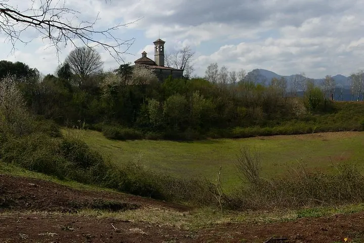
Montsacopa sits inside La Garrotxa Volcanic Zone, an area of roughly 40 volcanic cones and more than 20 lava flows formed during the Quaternary. The crater you walk around last erupted about 100,000 years ago; over time locals built terraces and even a church within the hollow, blending human use with volcanic geology. Basalt and scoria make up the cone; watchtowers and cobbled steps are remnants of past defensive and religious roles.
The VoiceMap audio guides the standard one-hour loop (roughly 1 km, ~60–80 m elevation gain), pointing out geological clues, gardened plots on the slopes, and the cultural reasons a chapel occupies the crater. Terrain alternates paved streets, cobblestone steps and short dirt sections—expect uneven ground and short flights of stairs to viewpoints.
Practical notes: download the app and offline map before you go, wear stable shoes, and bring water. The walk is a compact, accessible taste of volcanic terrain that rewards a measured pace and a quiet ear for the landscape’s stories.
The self-guided audio loop lasts about 60–75 minutes, though you can pause and spend more time at viewpoints.
No entrance fee is required—the trail around the cone is public, but check local signs for any temporary closures.
No; the route includes cobblestone paths and steps that make it unsuitable for strollers or wheelchairs.
The tour is delivered via the VoiceMap app; language availability varies—check the app listing for current language options before booking.
VoiceMap Audio Tours operates guided outdoor trips and adventures with an emphasis on safety, stewardship, and memorable experiences.
You step off a quiet street in Olot and find yourself at the base of a black cone. The city's roofs fall away as a narrow path climbs the outer flank of Montsacopa, volcanic rock crunching underfoot. Voices from your headphones mark each turn while the crater's rim opens to 360° views—green valleys below and the Pyrenees sketched on the horizon.
You step off a quiet street in Olot and find yourself at the base of a black cone. The city's roofs fall away as a narrow path climbs the outer flank of Montsacopa, volcanic rock crunching underfoot. Voices from your headphones mark each turn while the crater's rim opens to 360° views—green valleys below and the Pyrenees sketched on the horizon.
Montsacopa sits inside La Garrotxa Volcanic Zone, an area of roughly 40 volcanic cones and more than 20 lava flows formed during the Quaternary. The crater you walk around last erupted about 100,000 years ago; over time locals built terraces and even a church within the hollow, blending human use with volcanic geology. Basalt and scoria make up the cone; watchtowers and cobbled steps are remnants of past defensive and religious roles.
The VoiceMap audio guides the standard one-hour loop (roughly 1 km, ~60–80 m elevation gain), pointing out geological clues, gardened plots on the slopes, and the cultural reasons a chapel occupies the crater. Terrain alternates paved streets, cobblestone steps and short dirt sections—expect uneven ground and short flights of stairs to viewpoints.
Practical notes: download the app and offline map before you go, wear stable shoes, and bring water. The walk is a compact, accessible taste of volcanic terrain that rewards a measured pace and a quiet ear for the landscape’s stories.