THE ADVENTURE COLLECTIVE® · Independent discovery and booking for outdoor travel

Walk the caldera rim from Fira to Oia and trade narrow alleys and whitewashed roofs for cliff-top views of the Aegean. This four-hour hike combines geology, village culture, and sweeping sea panoramas across roughly 10 km.
Walk the caldera rim from Fira to Oia and trade narrow alleys and whitewashed roofs for cliff-top views of the Aegean. This four-hour hike combines geology, village culture, and sweeping sea panoramas across roughly 10 km.
You step out of the narrow alleys of Fira and the cliff immediately changes tempo: white houses recede, the caldera drops away in a raw vertical that seems to breathe salt and heat. The path runs along that rim — sometimes broad flagstones through villages, sometimes a narrow dirt ribbon where gusts of Aegean wind test your balance — and the sea keeps pace below, daring you to keep looking down.
Verified experiences and guided adventures in the surrounding area.
Operated by Pigaia travel · Fira, South Aegean
You step out of the narrow alleys of Fira and the cliff immediately changes tempo: white houses recede, the caldera drops away in a raw vertical that seems to breathe salt and heat. The path runs along that rim — sometimes broad flagstones through villages, sometimes a narrow dirt ribbon where gusts of Aegean wind test your balance — and the sea keeps pace below, daring you to keep looking down.
The trail between Fira and Oia traces the rim carved by the catastrophic volcanic eruption more than 3,000 years ago that collapsed the island’s center and left the steep cliffs you walk today. Geology here reads like a layered diary: pumice and ash pockets, compacted lava, and terraces hewn into cliff faces. Human history sits on top of it — Venetian watchtowers, Byzantine chapels with blue domes, and villages that reoriented from fishing to wine and tourism over centuries.
The walk is both cultural promenade and coastal hike. You pass Firostefani’s tidy lanes, where cafe terraces hover over the caldera; Imerovigli, where Skaros Rock juts out and once sheltered a medieval stronghold; and, finally, Oia, with its castle ruins and steep steps down to Ammoudi Bay. Along the way you’ll spot evidence of local life: sun-hardened terraces of Assyrtiko vines, whitewashed chapels with gleaming crosses, and shop doors that still close for a midday siesta.
Physically the route covers just over 10 km (about 6 miles) and takes roughly four hours with pauses. Expect a mix of paved pedestrian streets and dirt trails with modest cumulative climbs and short, steep sections near viewpoints and village steps. The surface can be uneven; cobbled streets become heat mirrors in summer and channels for the wind in winter.
Practical planning tips: start early to dodge the midday heat and the biggest crowds, and carry at least 1.5–2 liters of water per person — bottled water is often provided on organized tours, but don’t count on public taps. Wear sturdy shoes with good traction; sandals are common but uncomfortable on the dirt stretches and stone steps. A light wind shell and layered sun protection are essential: the Aegean sun is relentless and the rim can be deceptively cool when the wind picks up.
Respect the trail and local communities: stay on marked paths to avoid erosion, carry out trash, and time your visit to avoid peak sunset crowds in Oia if you want a quieter finish. When you reach Oia, plan an hour to explore Ammoudi Bay or the castle ruins before your transfer back — the islands often give the most memorable views to those who linger.
The organized route covers just over 10 km (about 6 miles) and takes around four hours including short stops.
Families with older children who are comfortable walking distances can manage it; it’s not recommended for those with mobility issues or serious back/heart problems.
Yes—cafes and small shops in Firostefani, Imerovigli and Oia sell refreshments, but bring water for the trail stretches and hotter months.
You can hike independently—signposted public paths exist—but guided tours offer transfers, local insights, and bottled water.
Some viewpoints have limited barriers and steep drops; stay on the path, supervise children, and avoid the edge in strong winds.
Early morning (golden hour) and late afternoon provide warm light and softer crowds; sunset in Oia is iconic but very crowded.
Pigaia travel operates guided outdoor trips and adventures with an emphasis on safety, stewardship, and memorable experiences.
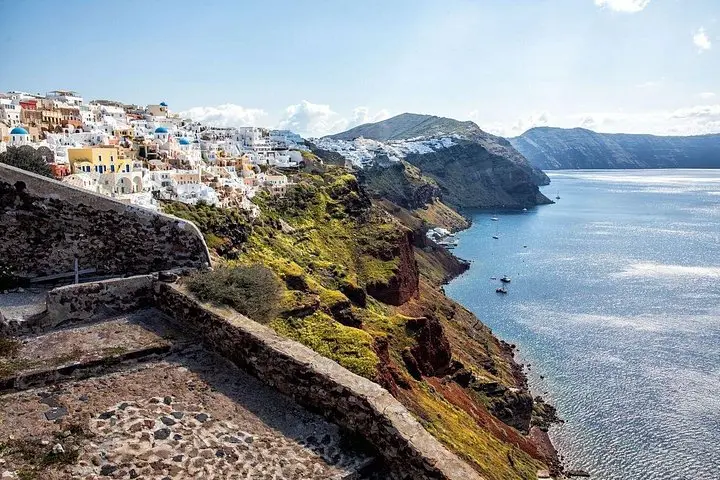
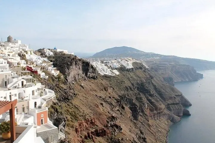
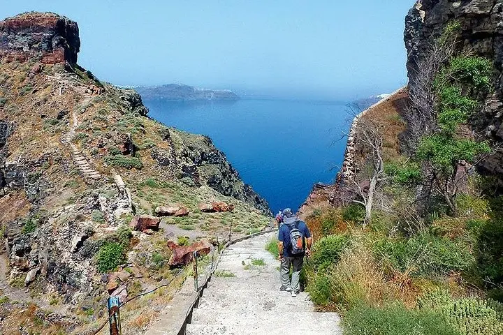
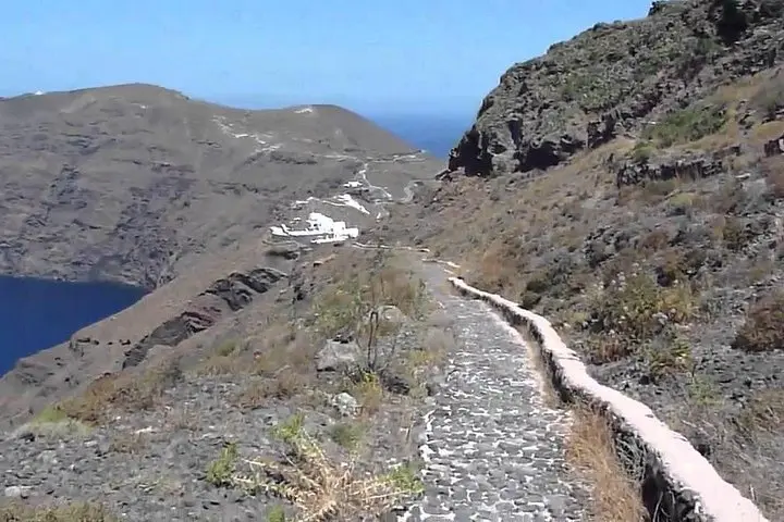
You step out of the narrow alleys of Fira and the cliff immediately changes tempo: white houses recede, the caldera drops away in a raw vertical that seems to breathe salt and heat. The path runs along that rim — sometimes broad flagstones through villages, sometimes a narrow dirt ribbon where gusts of Aegean wind test your balance — and the sea keeps pace below, daring you to keep looking down.
You step out of the narrow alleys of Fira and the cliff immediately changes tempo: white houses recede, the caldera drops away in a raw vertical that seems to breathe salt and heat. The path runs along that rim — sometimes broad flagstones through villages, sometimes a narrow dirt ribbon where gusts of Aegean wind test your balance — and the sea keeps pace below, daring you to keep looking down.
The trail between Fira and Oia traces the rim carved by the catastrophic volcanic eruption more than 3,000 years ago that collapsed the island’s center and left the steep cliffs you walk today. Geology here reads like a layered diary: pumice and ash pockets, compacted lava, and terraces hewn into cliff faces. Human history sits on top of it — Venetian watchtowers, Byzantine chapels with blue domes, and villages that reoriented from fishing to wine and tourism over centuries.
The walk is both cultural promenade and coastal hike. You pass Firostefani’s tidy lanes, where cafe terraces hover over the caldera; Imerovigli, where Skaros Rock juts out and once sheltered a medieval stronghold; and, finally, Oia, with its castle ruins and steep steps down to Ammoudi Bay. Along the way you’ll spot evidence of local life: sun-hardened terraces of Assyrtiko vines, whitewashed chapels with gleaming crosses, and shop doors that still close for a midday siesta.
Physically the route covers just over 10 km (about 6 miles) and takes roughly four hours with pauses. Expect a mix of paved pedestrian streets and dirt trails with modest cumulative climbs and short, steep sections near viewpoints and village steps. The surface can be uneven; cobbled streets become heat mirrors in summer and channels for the wind in winter.
Practical planning tips: start early to dodge the midday heat and the biggest crowds, and carry at least 1.5–2 liters of water per person — bottled water is often provided on organized tours, but don’t count on public taps. Wear sturdy shoes with good traction; sandals are common but uncomfortable on the dirt stretches and stone steps. A light wind shell and layered sun protection are essential: the Aegean sun is relentless and the rim can be deceptively cool when the wind picks up.
Respect the trail and local communities: stay on marked paths to avoid erosion, carry out trash, and time your visit to avoid peak sunset crowds in Oia if you want a quieter finish. When you reach Oia, plan an hour to explore Ammoudi Bay or the castle ruins before your transfer back — the islands often give the most memorable views to those who linger.