THE ADVENTURE COLLECTIVE® · Independent discovery and booking for outdoor travel

See the dramatic landforms left by the 1959 Hebgen Lake earthquake from the best possible vantage: the air. This 30-minute West Yellowstone flight pairs pilot narration with window seats for close-up views of Quake Lake, landslide scars, and Yellowstone’s volcanic plateau.
See the dramatic landforms left by the 1959 Hebgen Lake earthquake from the best possible vantage: the air. This 30-minute West Yellowstone flight pairs pilot narration with window seats for close-up views of Quake Lake, landslide scars, and Yellowstone’s volcanic plateau.
From the moment the propeller whispers and the plane peels away from West Yellowstone, the landscape reorganizes beneath you—rivers compress into threads, ridgelines sharpen, and the scar of 1959 becomes legible. Window-seat views turn valleys into diagrams of force: landslide blocks, overturned forests, and the sudden bowl of Earthquake (Quake) Lake that formed when a hillside slammed into the Madison River.
Verified experiences and guided adventures in the surrounding area.
Operated by Fly Yellowstone · West Yellowstone, Montana
From the moment the propeller whispers and the plane peels away from West Yellowstone, the landscape reorganizes beneath you—rivers compress into threads, ridgelines sharpen, and the scar of 1959 becomes legible. Window-seat views turn valleys into diagrams of force: landslide blocks, overturned forests, and the sudden bowl of Earthquake (Quake) Lake that formed when a hillside slammed into the Madison River.
This concise aerial tour follows the epicenter of the Hebgen Lake earthquake, one of North America’s most powerful recorded quakes. Pilots point out the vast volcanic plateau of the Yellowstone region, lava-flow shaped highlands, and the ways tectonic uplift and erosion continue to reshape the scene. Culturally, the American West around West Yellowstone carries a history of early Park concessionaires, Montana ranching, and search-and-rescue stories tied to seismic risk.
Practical guidance: the flight lasts about 30 minutes and is narrated by an experienced local pilot, making it ideal for first-time flyers and geology fans alike. Bring a camera with a fast shutter and a lightweight warm layer—mornings are brisk at elevation. Expect modest turbulence when following valleys; noise-reducing headsets are provided and every passenger gets a window seat.
Timing matters—early light reveals topographic relief, while late-afternoon sun flattens it. Weather cancels for safety; check local forecasts and the operator’s cancellation policy. The tour is a compact, high-impact way to contextualize Yellowstone’s volcanic and seismic story from the only vantage that fully reveals how earth-moving forces carve this rugged country.
The tour is a fixed 30-minute scenic flight with live pilot narration.
Small aircraft have limited accessibility; contact the operator in advance to discuss needs and boarding assistance.
Flights cancel for unsafe weather and typically offer full refunds if canceled at least 24 hours prior; operators may reschedule when possible.
Infants must sit on laps and infant-sized headsets are not available; check weight and safety limits before booking.
Fly Yellowstone operates guided outdoor trips and adventures with an emphasis on safety, stewardship, and memorable experiences.
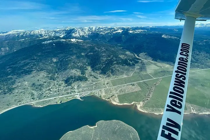
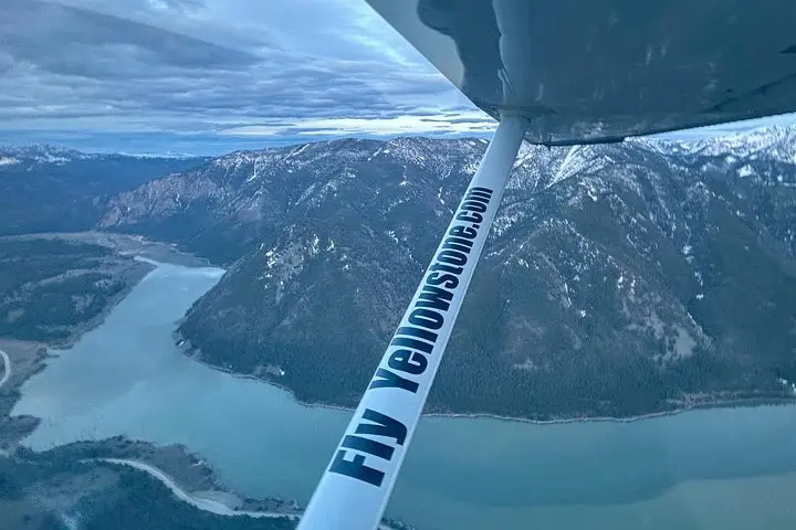
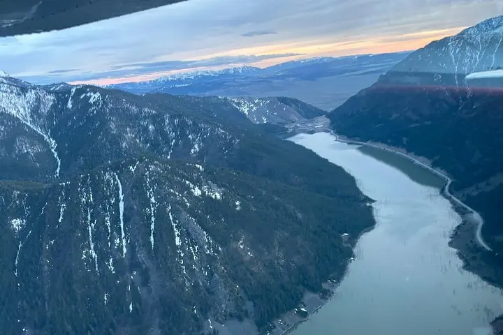
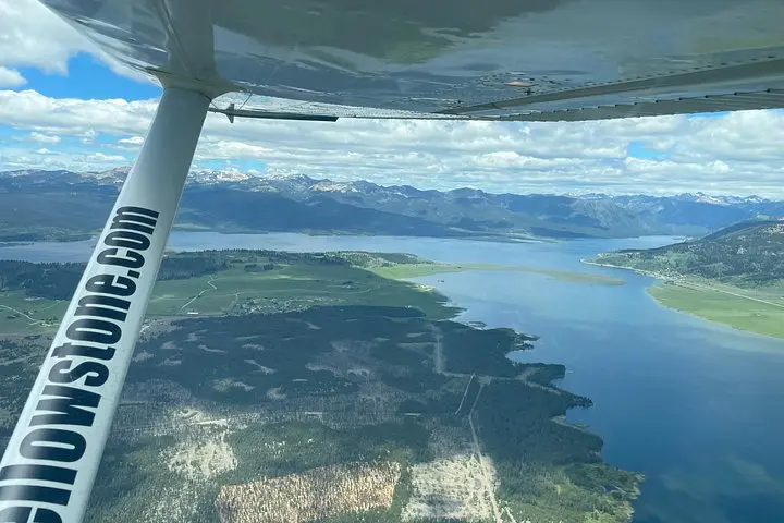
From the moment the propeller whispers and the plane peels away from West Yellowstone, the landscape reorganizes beneath you—rivers compress into threads, ridgelines sharpen, and the scar of 1959 becomes legible. Window-seat views turn valleys into diagrams of force: landslide blocks, overturned forests, and the sudden bowl of Earthquake (Quake) Lake that formed when a hillside slammed into the Madison River.
From the moment the propeller whispers and the plane peels away from West Yellowstone, the landscape reorganizes beneath you—rivers compress into threads, ridgelines sharpen, and the scar of 1959 becomes legible. Window-seat views turn valleys into diagrams of force: landslide blocks, overturned forests, and the sudden bowl of Earthquake (Quake) Lake that formed when a hillside slammed into the Madison River.
This concise aerial tour follows the epicenter of the Hebgen Lake earthquake, one of North America’s most powerful recorded quakes. Pilots point out the vast volcanic plateau of the Yellowstone region, lava-flow shaped highlands, and the ways tectonic uplift and erosion continue to reshape the scene. Culturally, the American West around West Yellowstone carries a history of early Park concessionaires, Montana ranching, and search-and-rescue stories tied to seismic risk.
Practical guidance: the flight lasts about 30 minutes and is narrated by an experienced local pilot, making it ideal for first-time flyers and geology fans alike. Bring a camera with a fast shutter and a lightweight warm layer—mornings are brisk at elevation. Expect modest turbulence when following valleys; noise-reducing headsets are provided and every passenger gets a window seat.
Timing matters—early light reveals topographic relief, while late-afternoon sun flattens it. Weather cancels for safety; check local forecasts and the operator’s cancellation policy. The tour is a compact, high-impact way to contextualize Yellowstone’s volcanic and seismic story from the only vantage that fully reveals how earth-moving forces carve this rugged country.