


Running the Eno River Trails in Durham
9.4
Running the Eno River Trails in Durham
The Eno River Trails offer some of the most scenic and diverse running routes in Durham, North Carolina. With a mix of technical terrain, stunning river views, and peaceful forested paths, these trails provide an excellent experience for runners of all levels. Whether you're looking for a short, smooth run or a challenging elevation gain, the trails at Eno River State Park and its surrounding areas deliver.
Adventure Guide to Running the Eno River Trails
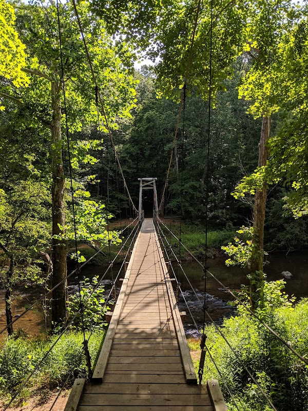
Cox Mountain Trail
- Distance: 3.8 miles
- Terrain: Moderate to challenging, with steep inclines and a suspension bridge crossing.
- Why Run It: This loop offers an engaging mix of inclines and river views. The 400-foot elevation gain provides a rewarding challenge, and the scenic footbridge over the Eno River adds character to the route.
- Local Insight: The first mile is the steepest; pacing yourself early will make the return more enjoyable.
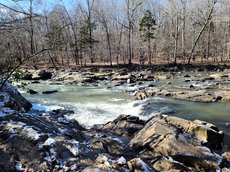
Laurel Bluffs Trail
- Distance: 6.1 miles (one way)
- Terrain: Rolling single-track with roots and occasional rocky sections.
- Why Run It: This section provides a quiet, less-traveled path along the river, with occasional clearings offering water views.
- Key Features: This route connects to other trails, allowing for customizable distances. It’s a great option for runners who enjoy peace and solitude.
- Local Insight: Watch for remnants of historic mill sites along the trail, hinting at Durham’s past industry.
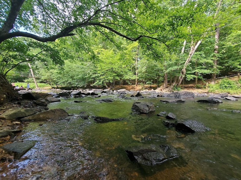
Buckquarter Creek Trail
- Distance: 1.5-mile loop
- Terrain: Well-maintained single-track with moderate difficulty.
- Why Run It: A shorter but scenic option, starting from the Park Office access point. The route follows the river for beautiful views, making it perfect for speed workouts or relaxed runs.
- Key Feature: Plenty of creekside spots to pause and soak in the setting.
- Local Insight: This trail is excellent in early morning light, offering cool temperatures and golden reflections on the river.
Visitor Tips
- Best Time to Run: Late fall through spring for cooler temperatures; avoid mid-summer afternoons due to heat and humidity.
- What to Bring: Trail-running shoes with good grip, water (no refill stations on trails), bug spray in warmer months.
- Directions: From downtown Durham, take I-85 N to Exit 173, then follow Cole Mill Road for about 10 minutes to the park entrance.
Rating:
9.4