Crater to Canyon: Overlanding Adventure Across Arizona's Geologic Giants
Traverse the wild heart of Arizona on a 70-mile overlanding route from volcanic craters to the rim of the Grand Canyon. This adventure pairs rugged terrain with sweeping views, perfect for those seeking a hands-on experience among the state’s remarkable geologic landmarks.
Trail Tips
Pack Adequate Water and Snacks
With limited access to potable water on this remote route, carry at least 3 liters per person and energy-rich snacks to maintain stamina during long stretches.
Check Vehicle Readiness
Ensure your 4x4 is in top shape—check tire pressure, fluids, and fuel. Some sections include rocky and steep terrain requiring dependable traction and clearance.
Start Early to Maximize Daylight
Begin your journey at first light to avoid the midday heat and allow ample time for breaks and photo stops before sunset.
Wear Layered Clothing
Elevation changes bring temperature swings; layer moisture-wicking and insulating fabrics so you stay comfortable from warm valleys to cool crater rims.
Crater to Canyon: Overlanding Adventure Across Arizona's Geologic Giants
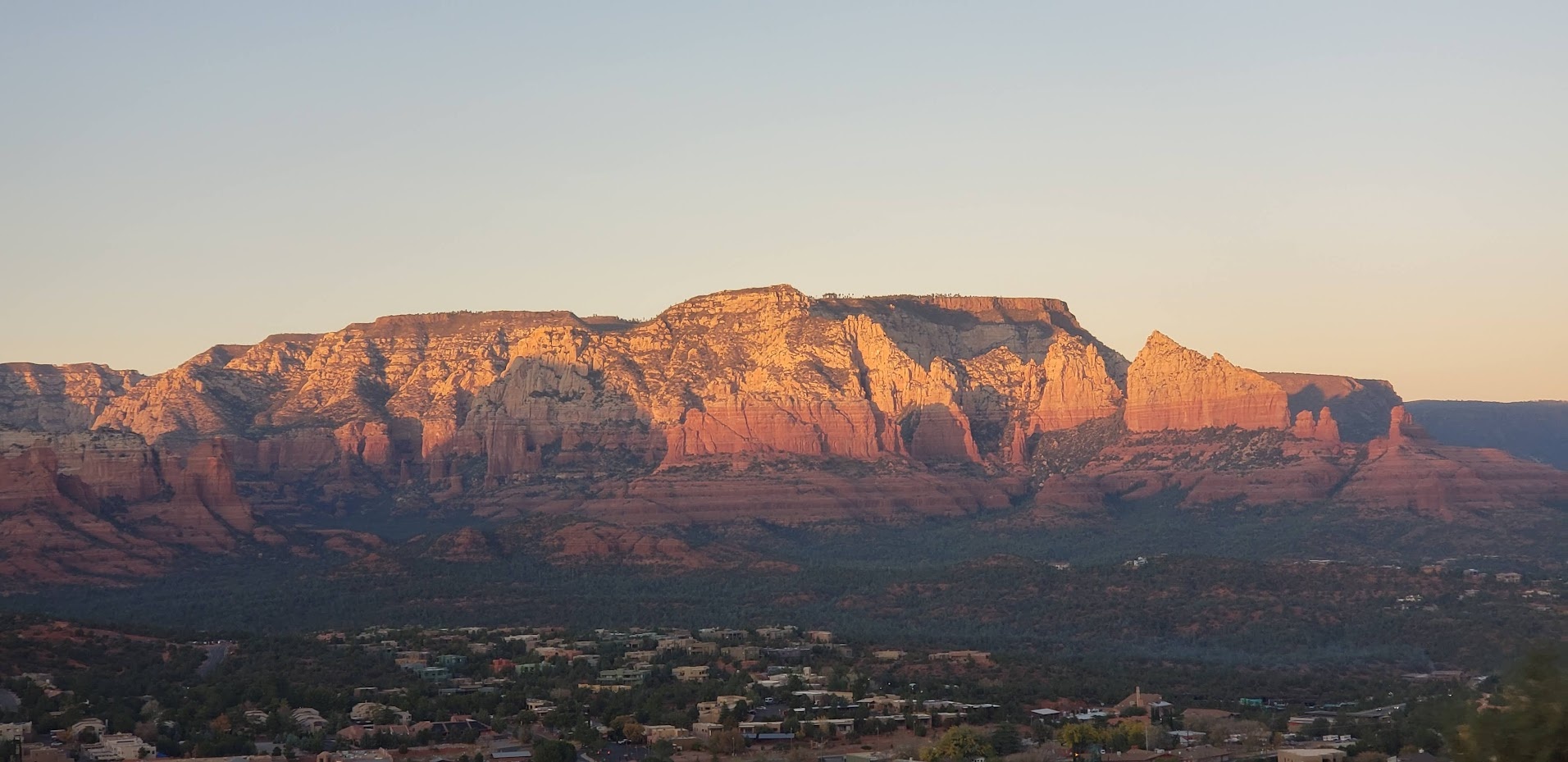
Arizona stretches out like a canvas of earth’s deep history, and few journeys capture its raw power better than the Crater to Canyon overlanding adventure. Beginning at the edge of the ancient Painted Desert and winding through volcanic craters before dropping into the vast embrace of the Grand Canyon, this route invites you to engage with landscapes fiercely themselves.
Start at Sunset Crater Volcano National Monument, where the blackened lava fields challenge your wheels and the breeze seems to murmur tales of fiery eruptions thousands of years ago. The trail covers about 70 miles of mixed terrain: lava rock, forested patches, dirt roads, and slickrock sections demanding a careful but confident drive. Elevation swings from about 6,500 to nearly 8,000 feet, gradually peeling away higher forests of ponderosa pine into the scrubby high desert.
Your vehicle becomes a partner as you navigate through cinder cones and across ridges, dodging sagebrush that almost dares you to follow its scent deeper. From here, descend toward the Colorado Plateau, where the ground opens wide and the Grand Canyon dares you to look over its edge. This final leg trails along less-traveled forest roads and overlooks claustrophobic canyons softened by centuries of water carving.
Daylight fades across red rocks and aged junipers, making timing vital. The climb and descent are gentle in parts but demand steady concentration; this isn’t a race but a measured conversation with the landscape. Water is scarce; carrying ample supply and careful rationing is non-negotiable. Sturdy boots for exploring rocky patches and layered clothing to manage elevation-related chill round out smart preparation.
This journey isn’t about conquering the earth but moving alongside forces that have molded it — volcanic fury giving way to patient canyon shaping. Adventure meets practicality here in terrain that tests your skills, rewards your eyes, and broadens your appreciation for Arizona’s geologic giants.
Recommended Gear
All-Terrain Tires
Tires designed for rocky and uneven surfaces reduce the risk of punctures and improve traction on volcanic rock and slickrock patches.
null specific
Portable Water Filter
In case of extended trips or emergency situations, a reliable water filter allows you to purify from natural sources.
null specific
Layered Clothing System
Adjust insulation from cool mornings to warmer midday temperatures and back to chillier evenings.
spring|fall|winter specific
High-Quality GPS Device
Reliable navigation helps avoid missed turns and keeps you safe when cell service disappears deep in the backcountry.
null specific
Frequently Asked Questions
Is this route accessible for stock vehicles?
Most of the trail requires a high-clearance 4x4 vehicle due to rocky terrain and steep or loose sections. Stock SUVs may struggle, especially after rain or in rough patches.
Are permits or fees required to travel this route?
Sunset Crater Volcano National Monument charges a small entrance fee. Other parts traverse public forest roads generally open without permits, but check local regulations before your trip.
Can I camp along the route?
Yes, dispersed camping is allowed within surrounding national forest lands. Always camp at least 200 feet from water sources and follow Leave No Trace principles.
What wildlife might I encounter?
Expect to see mule deer, elk, and a variety of birds such as ravens and red-tailed hawks. Keep an eye out for rattlesnakes in warmer months on rocky stretches.
How should I prepare for emergencies?
Bring a first-aid kit, extra food and water, a satellite communication device if possible, and let someone know your itinerary and expected return.
Are guided tours or rental vehicles available for this adventure?
Some regional outfitters provide guided overlanding tours and offer rentals of 4x4 vehicles equipped for this terrain. Booking in advance is recommended.
Local Insights
Hidden Gems
- "Wupatki Pueblo ruins located near the northern approach offer an unexpected cultural stop with ancient dwellings."
- "Lava River Cave, a mile-long lava tube, presents a unique, cool underground exploration spot accessible off the main route."
Wildlife
- "Watch for the elusive ringtail cat at dusk and early night, a small mammal often mistaken for a fox."
- "Birdwatchers can spot the brightly colored Arizona woodpecker, uncommon outside select forested areas."
History
"The route crosses lands once inhabited by ancient indigenous peoples, including the Sinagua, whose agricultural terraces and ruins pepper the region, revealing a deep connection to the land."