The Great Arizona Gravel Loop: Taming 200 Miles of Backcountry Bikepacking
Experience 200 miles of Arizona’s rugged backcountry on the Great Arizona Gravel Loop—a demanding bikepacking route that blends high desert challenge with sweeping landscapes. Whether you’re dialing up your endurance or seeking to explore off-the-beaten-path vistas, this loop invites you to meet the land on its own terms.
Trail Tips
Plan Water Resupply Points Carefully
Water is scarce along portions of the Loop—carry ample reserves and know exact locations of natural water sources for refilling.
Choose Wide-Tread Tires for Traction
The mix of gravel and loose rock demands tire widths of at least 38mm to maintain grip and reduce punctures.
Prepare for Rapid Weather Changes
From warm desert days to chilly mountain nights, layering your clothing lets you adjust efficiently on the trail.
Use GPS Alongside Maps
Signal gaps are common; carry a physical map and compass as backups to your digital navigation tools.
The Great Arizona Gravel Loop: Taming 200 Miles of Backcountry Bikepacking
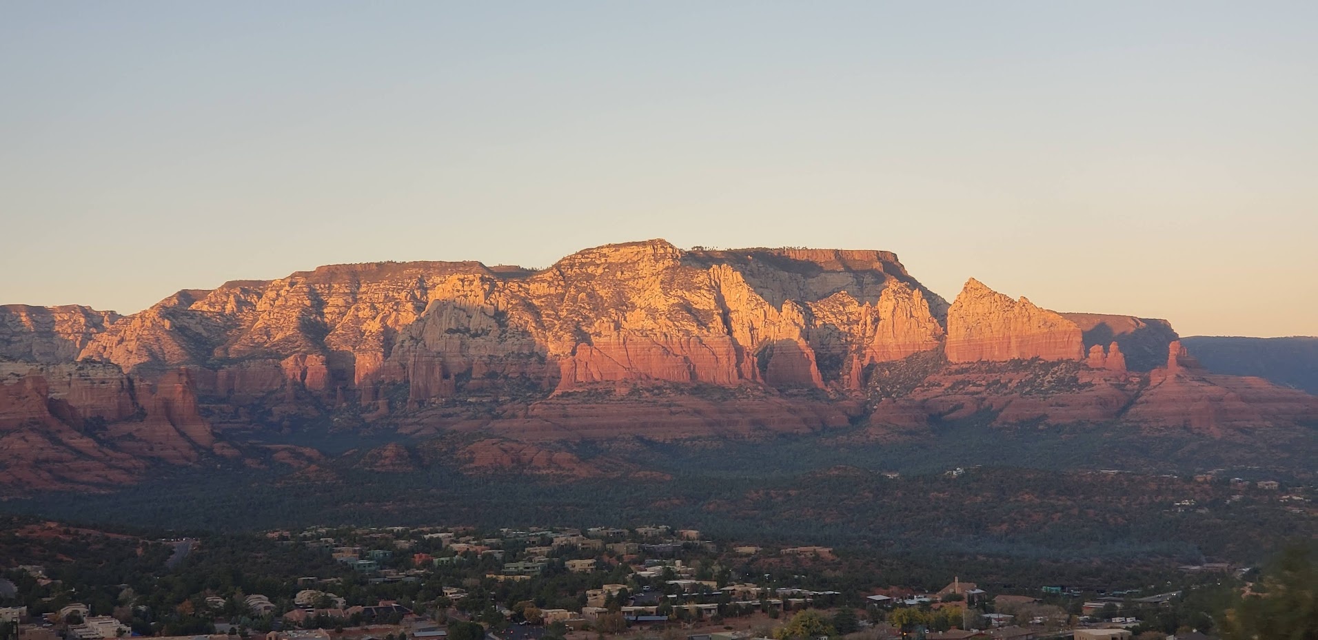
The Great Arizona Gravel Loop challenges riders to traverse 200 miles of rugged backcountry that is as fiercely authentic as the open desert air. This route cuts through the beating heart of Arizona’s varied landscapes, from rocky plateaus to forested ridges. Every pedal stroke is a conversation with shifting terrain—gravel washes daring tires to keep grip, and dry creek beds whisper historic secrets beneath the sun’s relentless gaze.
Starting near Flagstaff, the loop invites riders into a cycle of climbs and descents that test endurance and skill. Elevation varies dramatically, summing to over 15,000 feet of ascent, offering moments where wide sky frames the route beneath you, and stretches where the land tightens into canyons challenging balance and resolve. The trail surface is a mix of compacted dirt, packed gravel, and loose rock, demanding a bike setup tuned for durability and comfort.
Riders encounter the wild conversation of nature here: wind pushing through ponderosa pines, rivers that refuse to lie still, relentless sun tempered by pockets of shade. Each section requires thoughtful hydration strategy; water sources are infrequent but reliably found near certain creek crossings if planned diligently.
This route is best tackled with gear focused on reliability—wide tires for traction, multi-layered clothing for the extremes of desert heat and cool mountain mornings, and navigation tools both digital and analog. Timing is crucial; spring and fall offer temperate weather and fewer hazards, while summer’s heat can turn the journey into a trial of survival and careful pacing.
Beyond physical preparation, expect the mental engagement of negotiating a terrain that never offers easy passage. The environment here holds its ground rigorously—respect it and stay vigilant. Yet the great reward is access to backcountry vistas that feel uncompromised by human touch, expansive horizons framed by ancient buttes and relentless skies.
For those craving more than just a ride, the loop weaves into local culture and history. Old mining routes and forgotten settlements peek from the scrub, reminding riders they traverse land written by human hands as much as nature's. It's an adventure that balances the thrill of exploration with respectful presence in a place fiercely itself.
Recommended Gear
Wide Gravel Tires (38mm+)
Provides necessary grip and durability over gravel and rocky stretches, reducing flat tires.
null specific
Hydration System with Minimum 3L Capacity
Sustained access to water is crucial; high-capacity hydration systems reduce the risk on lengthy, dry segments.
summer specific
Layered Clothing including Windbreaker and Thermal Layer
Adjusting for temperature swings between cold mornings and warmer afternoons maintains rider comfort and safety.
fall,winter specific
Navigation Tools: GPS Device and Physical Map
Digital devices combined with paper maps ensure you can find your way even when signals drop.
null specific
Frequently Asked Questions
Is the Great Arizona Gravel Loop suitable for beginners?
This loop is best suited for intermediate to advanced riders due to its length, elevation changes, and technical terrain. Beginners might find the combination of distance and variable surfaces challenging without prior gravel riding experience.
Where can I resupply food and water during the loop?
The route passes near a few small towns such as Flagstaff and Pine, where you can resupply before or after segments. On-trail resupply options are limited, so plan to carry enough food and water for long stretches between these points.
What kind of bike is recommended for this ride?
A gravel bike with wide, durable tires (38mm or more) and stable handling is ideal. Suspension is not necessary but a comfortable frame capable of handling rough surfaces will enhance the experience.
Are there camping spots along the loop?
Yes, dispersed camping is allowed in most parts of the surrounding national forests. Designated campgrounds exist near some segments, but it's essential to follow Leave No Trace principles and verify local regulations.
How should I prepare for emergencies on the trail?
Bring a comprehensive first aid kit, repair tools, and a communication device such as a satellite messenger. Sharing your itinerary with someone before departure and knowing the closest access points for emergency services is critical.
What wildlife might I encounter on the loop?
Common sightings include mule deer, coyotes, and a variety of birds such as ravens and hawks. Rattlesnakes are present in warmer months; be cautious when stopping or walking near rocks and brush.
Local Insights
Hidden Gems
- "Vista point overlooking the Mogollon Rim along the northwestern stretch"
- "Historic mining ruins near Mormon Lake, offering a glimpse into past settlements"
Wildlife
- "Elusive Mexican Spotted Owls inhabiting forested canyon areas"
- "Seasonal populations of pronghorn antelope crossing parts of the eastern segments"
History
"The loop passes through lands historically used by Native American tribes such as the Navajo and Hopi, as well as remnants of 19th-century mining activity that shaped local development."