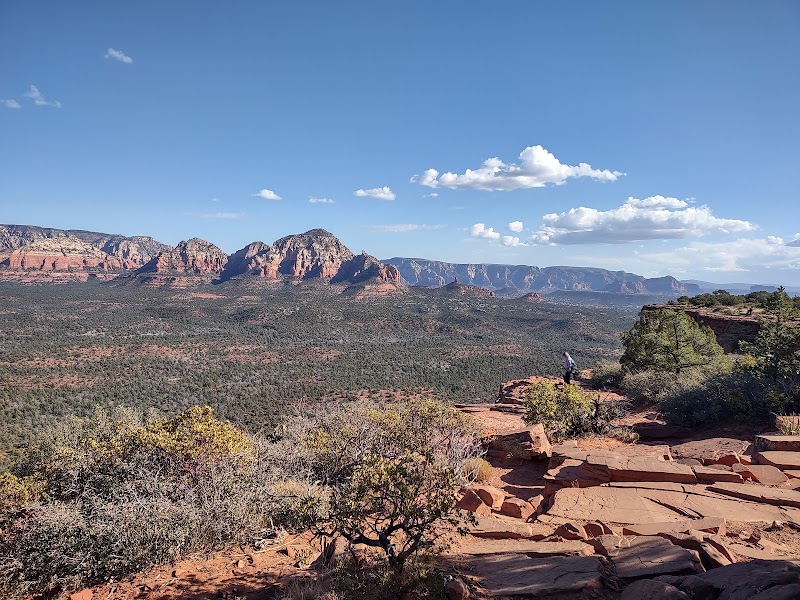
Hiking Doe Mountain Trail in Sedona

Hiking Doe Mountain Trail in Sedona
Hiking the Doe Mountain Trail offers a remarkable escape to Sedona's breathtaking desert landscape. This trail is renowned for its relatively short yet rewarding ascent to a flat mesa, presenting panoramic views of the surrounding red rock formations, wilderness, and pine-studded mesas. It's a favorite for hikers seeking a moderate and manageable trek combined with extraordinary vistas.
Adventure Guide to Hiking Doe Mountain Trail
-
Trailhead Location and Key Information The Doe Mountain Trailhead is situated off Boynton Pass Road, approximately 20 minutes from Sedona’s town center. The trail spans 1.5 miles round trip, with a 400-foot elevation gain, making it ideal for intermediate hikers or those with moderate fitness levels. Its compact size ensures you can complete the hike in about 2 hours, including time spent enjoying the summit.
-
What Makes Doe Mountain Special The trail culminates at an expansive mesa, offering a 360-degree view of iconic landmarks such as Bear Mountain, Courthouse Butte, and the towering red cliffs of the Coconino National Forest. Unlike many trails in Sedona, the flat mesa top allows hikers to wander and discover different perspectives that vary with the light of day. It's also one of the few hikes where you'll experience a quieter, less trafficked terrain compared to other popular Sedona trails.
-
Flora, Fauna, and Geological Features Along the path, you'll encounter sandstone rock formations, desert scrub, juniper trees, and vibrant wildflowers during spring. Keep an eye out for lizards, birds like falcons or ravens, and diverse plant life along your trek. The 2.5-million-year-old sedimentary layers of red rock add a spectacular geological backdrop to your experience.
Local Insights
Doe Mountain is part of the Coconino National Forest, and its flat top was historically used by Native American tribes as an observation point. Watching the sunset from the mesa is particularly spectacular, casting dramatic red and orange hues across the landscape.
Visitor Tips
- Best Times to Visit: Aim for early morning or late afternoon to avoid the midday heat and crowds. Autumn and spring offer the most pleasant temperatures.
- What to Bring: Carry 1-2 liters of water, sunscreen, sturdy hiking shoes, and a camera to capture the views.
- Driving Directions: From Sedona, take State Route 89A west to Dry Creek Road, then head to Boynton Pass Road. The trip takes 20 minutes. Parking requires a Red Rock Pass, available onsite.


