Hiking the Thunderbolt Trail in The Berkshires
Hiking the Thunderbolt Trail in The Berkshires
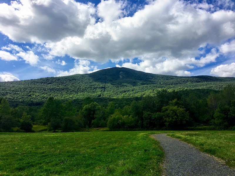
Hiking the Thunderbolt Trail is a distinctive outdoor activity in The Berkshires, Massachusetts. This trail, renowned for its steep ascent and breathtaking views, traces the route of a historic ski race and offers hikers a unique blend of physical challenge and natural beauty. With such an environment, it stands out, attracting both casual walkers and seasoned adventurers alike.
Adventure Guide To Hiking the Thunderbolt Trail
-
Trailhead Location: Mount Greylock State Reservation, 30 Rockwell Rd, Adams, MA
- What Makes It Special: The Thunderbolt Trail features a steep ascent of approximately 2.5 miles, leading to the summit of Mount Greylock, the highest peak in Massachusetts. Once at the top, hikers are rewarded with stunning views that stretch across the entire region, making it a perfect spot for photography and reflection.
-
Seasonal Highlights: The trail is particularly vibrant during the fall when foliage paints the landscape in vivid hues. Spring also presents a magnificent display of wildflowers and lush greenery.
-
Key Features: The trail is well-marked with blue blazes, ensuring easy navigation. Along the route, you’ll find scenic overlooks and resting spots to appreciate the expansive vistas.
Local Insights
The Thunderbolt Trail carries historical significance as it was originally used for skiing. The annual Thunderbolt Ski Race once showcased this unique path, establishing a local tradition. The area is also part of the Mount Greylock State Reservation, which encompasses a rich biodiversity.
Visitor Tips
- Best Times To Visit: Late spring through early fall offers ideal hiking conditions. However, fall provides the most spectacular views.
- What To Bring:
- Sturdy hiking boots
- Sufficient water and snacks
- A camera for the views
- Weather-appropriate clothing
- Driving Directions: From the Berkshires Region, take MA-8 N for about 30 minutes to reach the Mount Greylock entrance. Park at the visitor center and follow the signs to the Thunderbolt Trailhead.
The Thunderbolt Trail is not only a hike but an experience that captures the dramatic landscape and rich history of The Berkshires.
Adventure Map
Reviews