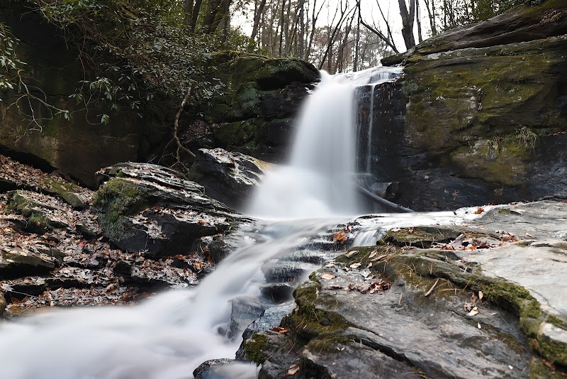
Explore Waterfall Hiking Trails near Greenville, SC

Explore Waterfall Hiking Trails near Greenville, SC
Welcome to Your Adventure!
Greenville, South Carolina, is surrounded by splendid natural landscapes and offers an array of trails perfect for those seeking adventure. Notably, the region boasts some fantastic waterfall hikes that are approximately 5 miles in length and categorized as moderate in difficulty. Whether you're a local or a visitor, these hikes promise breathtaking views and the tranquility of nature.
Top Waterfall Hikes
1. Jones Gap State Park - Rainbow Falls Trail
- Distance: 3.5 miles (round trip)
- Difficulty: Moderate
- Elevation Gain: 400 feet
Located just about 30 minutes from Greenville, this trail is part of the Blue Ridge Escarpment, which is known for its lush landscapes and diverse ecosystems.
Trail Highlights:
- The trail leads to Rainbow Falls, a stunning 100-foot cascade that captivates hikers.
- Along the way, you'll encounter a variety of wildlife, and the sounds of the flowing water provide a serene backdrop.
- Expect rocky terrain, so sturdy shoes are recommended.
Visitor Tips:
- Arrive early to avoid crowds, especially on weekends.
- Bring plenty of water and snacks for the hike.
- Consider visiting during the spring for vibrant wildflowers or in the fall for breathtaking foliage.
Driving Directions: From Greenville, take I-385 S and exit onto SC-11 N toward Cleveland. This scenic drive will lead you directly to the park entrance.
2. Caesars Head State Park - Raven Cliff Falls Trail
- Distance: 4 miles (round trip)
- Difficulty: Moderate
- Elevation Gain: 600 feet
Known for its sweeping views and rugged landscape, this hike is about 45 minutes from Greenville.
Trail Highlights:
- The trail culminates in a view of the Raven Cliff Falls, dropping over 400 feet and visible from an overlook.
- The first half of the trail consists of a series of switchbacks, and hikers should prepare for some steep sections.
- Unique rock formations and diverse flora add to the trail’s charm.
Visitor Tips:
- The trail can be slippery after rain, so use caution.
- Pack your camera; the overlook offers some of the most stunning photography options in the region.
- Visit the Caesars Head lookout point for panoramic views of the surrounding area.
Driving Directions: Travel west on US-29, then take SC-11 N. Follow signs to Caesars Head State Park, located near the state line with North Carolina.
3. Sliding Rock Falls (Paddle Creek Trail)
- Distance: 5 miles (round trip)
- Difficulty: Moderate
- Elevation Gain: 300 feet
Located in Pisgah National Forest, about 1 hour from Greenville, this trail features a series of small waterfalls and a unique rock formation where visitors can slide down.
Trail Highlights:
- The Sliding Rock is a famous attraction, where visitors can experience a natural water slide.
- Along the trail, you’ll find plenty of opportunities to take photographs of the cascading streams and lush greenery.
- Perfect for families, as there are suitable spots for less vigorous nature walks.
Visitor Tips:
- Bring bathing suits during warmer months if you plan to slide down the rocks.
- Arrive early to enjoy less crowded conditions, especially during weekends.
- Be cautious of slippery rocks and children near water.
Driving Directions: Head west on US-25 N to US-276 N, following the signs for Pisgah National Forest.
Summary
These three waterfall hikes near Greenville, SC, offer a fantastic blend of nature, adventure, and scenic beauty. Each trail provides a unique experience, whether it's the towering Rainbow Falls, the breathtaking Raven Cliff, or the thrill of Sliding Rock Falls. Be sure to plan your visit, dress appropriately, and carry adequate supplies for your hike.
Adventure awaits in the stunning landscapes right outside Greenville! Explore these trails and create lasting memories in the great outdoors.


