

What the day feels like
You round the last black ridge and the bay opens like a secret—water the color of old glass, banded with living reef, a band of coral so sharp it looks painted onto the sea. A lone white obelisk perches on the shoreline below, small and stubborn against basalt cliffs: the Captain Cook Monument. Kealakekua Bay reads like a concentrated lesson in Hawai‘i’s contradictions—sacred place and public playground, a national historic site and one of the island’s richest coral systems. It’s a place where the Pacific seems intent on testing your intentions: will you stay on shore and read the plaque, or will you get into the water and meet the reef on its own terms?
The monument marks the spot where, in February 1779, Captain James Cook was killed after tense encounters with local Hawaiian chiefs. But long before European contact this slice of shoreline was known by its Hawaiian name, Kealakekua—“the pathway of the gods”—a fitting phrase for a bay that funnels mantas, spinner dolphins and green sea turtles as if through a holy door. Geology gives this drama its stage: cliffs of pahoehoe and aā lava tumble straight into the Pacific, and the bay’s crescent shape concentrates nutrients and light, feeding a dense, colorful reef below.
How you arrive colors the story. Most travelers arrive by water—kayak, small powerboat or commercial snorkeling vessel—because the buoyed marine life conservation district keeps the reef accessible but protected. For others the trail is a more intimate entrance: the Captain Cook Monument Trail (sometimes called the Napo‘opoo Trail) carves a 2.5-mile route down to the bay with roughly 800 feet of elevation change. It’s not a technical scramble, but the grade is relentless in places and the footing is Hawaiian volcanic rock—uneven, sometimes loose, and often hot underfoot. The descent reads like a slow reveal: more native plants, a few dryland seabirds, and at last the splash of the bay below.
Once you arrive, the personality of the place takes over. Spinner dolphins often patrol early mornings in a playful, dare-you-to-keep-up way; honu (green sea turtles) are slow and inscrutable, letting you approach only on their terms. The reef is lively and healthy in many places—parrotfish, butterflyfish, and trumpetfish weave through cauliflower coral and towering staghorn. The water will demand respect: currents shift, surge runs may make shore landings tricky, and the reef is sharp and alive—don’t stand on it, don’t touch it, and keep the sunscreen reef-safe.
Practicalities are part of the beauty here. If you’re paddling in, plan for roughly 1.5–3 miles each way depending on launch point; commercial boat trips typically drop you at a slip near the monument so you swim straight into the action. The trail is 2.5 miles one way, with dense sun exposure on the return climb. There are no facilities at the bay—bring water, snacks, and a plan for shade after you’ve been in the sun. Cell service is spotty; if conditions are marginal, so too will be your options to call for help. Local operators know the bay intimately—if you’re uncertain about currents or your fitness level, a guided kayak or snorkel trip is the sensible choice.
Good timing makes everything easier. Mornings tend to be calmest, the water glassier and visibility higher. Winds pick up in the afternoon and can make open-water paddling choppy; afternoon snorkels sometimes find more surge near the reef. Respect closures: the bay is part of a Marine Life Conservation District and state historic sites—anchoring on the reef is forbidden, and there are orbital rules around the monument. Dress for coral: reef shoes or sturdy water sandals and a sun-protective shirt let you move more confidently in and out of the water.
Beyond the natural draw, the area connects to Kona’s culture. The nearby village of Captain Cook has coffee farms, tiny galleries, and a farmers market where you can sit under a mango tree and taste kona coffee that does as much to anchor the island experience as the sea. Local guides will weave in Hawaiian history and protocol—how to approach a wahi kapu (sacred place), how to leave an offering if tradition calls for it—adding layers that make a visit feel less like tourism and more like a respectful passage.
If you go: leave no trace, use biodegradable sunscreen, and give wildlife the space it needs. In a place where a single monument can stand for centuries of story, your smallest actions—using reef-safe sunscreen, not chasing a dolphin, pulling your trash from the shore—matter more than usual. Kealakekua rewards patience. The best moments here are quiet ones: a sun-warmed back on a snorkel break, a turtle’s slow exhale, the monument like a punctuation mark at the waterline.
Whether you hike down with water in your pack or launch from a kayak at dawn, Kealakekua Bay teaches the same lesson the Polynesian voyagers knew: travel here is measured not by distance, but by attention. The water will tell you when it’s ready; if you listen, you’ll find the bay is generous in return.
Trail wisdom
Small choices, better day.
Start at dawn
Morning launches mean calmer ocean conditions and better snorkel visibility; expect winds to pick up by midday.
Wear reef-safe sunscreen
The bay is a marine conservation district—choose non-nano, reef-safe formulas to protect coral.
Prepare for a steep return
The trail back is uphill and exposed; bring at least 1 liter of water for the hike and an extra layer for wind.
Respect marine life distances
Don’t chase dolphins or touch turtles—observe quietly and give animals space to choose interactions.
Local knowledge
Read the place, not just the route.
Watch for native species including Green sea turtles (honu), Spinner dolphins.
Keep an eye out for wildlife during the transition between areas and habitats. Respect distance guidelines.
Kealakekua Bay is a Marine Life Conservation District—visitors must avoid touching coral, use designated anchorages, and follow local guidelines to protect fragile reef ecosystems.
Follow the guide's instructions on size limits, ethical handling, and leave-no-trace practices.
Poke and kona coffee stands near Captain Cook town for post-trip refreshment. Small offshore rock outcrops south of the bay that attract schooling fish and quieter snorkel spots
Locally recommended viewpoints and quiet spots known best to local operators.
The monument marks where Captain James Cook was killed in 1779; Kealakekua Bay’s Hawaiian name means “the pathway of the gods.”
Maritime roots and regional tradition shape the waterways and working coasts.
Seasonal guide
Four versions of the same landscape.
Spring
Best forcalmer seas · clear water visibility · fewer crowds
Challengesintermittent rains · variable swell
Spring offers stable water and good snorkel visibility; mornings are typically best.
Summer
Best forwarm water · consistent snorkeling · kayaking
Challengesstronger sun · occasional trade winds
Summer is prime for snorkeling and paddling—expect warmer seas and more traffic on weekends.
Fall
Best forquieter trails · good visibility · manta sightings off nearby reefs
Challengesresidual summer swell · occasional storms
Fall can bring quieter shorelines and clear water, but keep an eye on swell forecasts.
Winter
Best fordramatic coastal scenery · fewer kayaks
Challengeslarger swell · rougher ocean conditions · cooler mornings
Winter makes the bay more dramatic but also riskier for open-water paddling—guided trips are recommended.
Pack with intention
What to bring.
Good to know
Common questions.
You can reach the monument by kayak or boat from nearby launch points (commercial charters operate from Keauhou and Honokohau), or hike the Captain Cook Monument Trail from Napo‘opoo—a 2.5-mile descent with about 800 feet of elevation change.
Plan the edges
The details that make the day easier.
Kealakekua Bay’s name means “the pathway of the gods,” and the Captain Cook Monument marks the site where Captain James Cook died on February 14, 1779.
Pair your visit with a stop in Captain Cook town for kona coffee tastings, poke bowls from local stands, and small art galleries showcasing contemporary Hawaiian and traditional work.
Use reef-safe products, avoid standing on coral, respect wildlife distances, and support local guides who practice low-impact tourism.
Explore by topic
Follow the threads.
Keep exploring
Make the story part of the trip.
 Related story
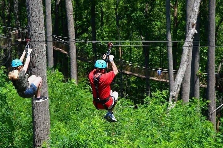
Less than two hours from Nairobi, Kereita Forest pairs hands-on canopy adventure with quiet montane trails and a sobering colonial history—perfect for families, teams, and curious travelers seeking a full-day pulse of nature.
Set out from Bass Harbor for a private, customizable day on Blue Hill Bay — lighthouses, puffins, seals, and the chance to feel Acadia from the water. Small groups, local captains, unforgettable views.
In four hours you can move from shaded canyon ferns to wind-scoured coastal ridgelines, guided by someone who knows where the light—and the hidden views—live. This private half-day hike on the Monterey Peninsula or Big Sur is compact, curated, and perfect for travelers who want depth without a multiday commitment.