
What the day feels like
Morning slides in on the shoulders of the Flatirons, a soft gold washing the sandstone ribs above town. The Boulder Creek Path hums to life—joggers finding rhythm, commuters clicking through gears, cottonwoods shrugging off last night’s breeze. You clip in, press down, and the creek answers with a low, insistent murmur, daring you to follow. That’s the start line energy of Bike-n-Hike (Embassy), a compact three-hour burst that braids together smooth spinning along the water and a short, steep hike to Boulder’s own red rocks and a skyline that feels close enough to pocket.
The path is a ribbon of ease, paved and friendly, where the creek pushes east and you let it set the tempo. Past pocket parks and riverside eddies, under bridges that frame the day like camera apertures, you’ll tuck into a pace that feels conversational—a place where a guide can point out the best local happy hours and the route gold seekers followed up this very canyon in 1859. This is history you pedal, geology you can touch later on the hike—Boulder’s sandstone isn’t just scenic, it’s the 300-million-year-old Fountain Formation, the same red bones that hold up the Flatirons.
If you want a primer on Boulder in one sweep, this is it. A friendly, small-group vibe, helmets buckled and smiles easy. The route sticks to the Boulder Creek Path’s forgiving grades, making it accessible to most riders. The current pulls, the cottonwoods applaud, and your tires hum a sure answer. It’s the kind of ride that clears the mind while quietly stacking miles. When you’re ready to lock up the bikes, the day pivots—from the glide of the creek to the pulse of a sandstone hill.
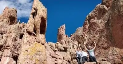
The hiking half is short and honest. The trail tips up quickly, the red rocks standing ahead like an invitation. Here, sandstone ledges draft breezes; the city spreads beyond in tidy blocks with the plains rolling out like a map in relief. This is Boulder’s red rocks—not the music venue an hour south—more intimate and playful, a place where kids scamper and adults rediscover joy in scrambling a few feet for a better angle. Stand still long enough and the rock warms your back, shouldering the sun. Hawks ride thermals overhead, and the creek’s sound fades to a hush.
Take a breath and the view clarifies everything: the Flatirons to your left like a serrated skyline; downtown straight ahead, ordered and bright; prairie running to the horizon. Boulder turns from place to pattern. You can feel why this city was founded here, where water meets foothills, where gold once flashed in a pan and sandstone still holds court.
While this experience has an easygoing spirit, the team keeps it smart. Hydration is non-negotiable at altitude. The guides are tuned to the group’s pace, checking in, offering locally made energy snacks, and sharing insider picks on where to eat and raise a glass once the wheels stop turning. If you’re curious about electric bikes or fat bikes, ask ahead—both are available for an extra fee. Spanish-speaking guides can be arranged, and the mood stays flexible without losing the day’s rhythm.
What makes the Bike-n-Hike sweet spot tick is its balance: enough distance to feel like you’ve traveled, enough elevation to put a little fire in the legs, and all of it wrapped in a compact window that fits a morning or afternoon without dominating your day. It’s family-friendly, date-worthy, and equally solid for solo travelers aiming to meet local riders and walkers. In a half-day you get the greatest hits: creekside cruising, red rock scrambling, and a lens on Boulder’s culture—from its outdoor-forward lifestyle to its dining scene, where a well-earned burger or chilled teahouse patio waits two blocks from the path.
If you’re building an itinerary, start here. The route beautifully introduces Boulder’s system of open space and bike infrastructure—more than 300 miles of bike lanes and multi-use paths link neighborhoods, trailheads, and parks with enviable grace. Along the way, your guide will point out small details that make locals proud: a shady bend perfect for picnics at Eben G. Fine Park, a downtown mural that changes with the light, a cafe with cold brew that could power a time trial. When you’re ready to book or learn more about the guides behind this seasoned route, connect with the local pros through this Boulder bike and hike experience at <a href="https://app.advcollective.com/local-experts/bike-n-hike-embassy" target="_blank">Bike-n-Hike (Embassy)</a>. The booking page is your portal for availability, add-ons like e-bikes, and practical details.
Pragmatically speaking, plan on roughly 6–8 miles of gentle pedaling and a short, steep hike of about a mile round-trip, gaining in the ballpark of 300–400 feet. The paved path makes the bike section welcoming for newer riders, while the huff of the red rocks ascent gives everyone just enough challenge to feel accomplished at the top. Good shoes with tread matter here; sandstone can be dusty and slick if you get lazy with foot placement. Bring a light layer—even summer mornings can carry a cool edge off the creek—and watch for those classic Colorado patterns: bluebird skies that sometimes morph into quick afternoon showers.
For photographers, this route is a canvas. Early and late light drapes the rocks in copper, and the path offers reflections and leading lines galore. Wide-angle lenses capture both rock texture and city sprawl; a polarizer cuts glare from water and intensifies those high-altitude blues. If you want to scout the exact look and feel before booking, or pin down seasonal nuances and guide availability, explore the details at <a href="https://app.advcollective.com/local-experts/bike-n-hike-embassy" target="_blank">this Bike-n-Hike overview</a>.
By the time you coast back through the West End, you’ll have the day wired: where to eat, where to toast, and how to keep the adventure rolling into sunset. The creek will keep talking, always in motion, nudging you forward. And you’ll know exactly where to go the next time Boulder calls—back to the path, up to the rocks, guided by a team that keeps it light, local, and dialed in. Learn more or reserve a spot here: <a href="https://app.advcollective.com/local-experts/bike-n-hike-embassy" target="_blank">Bike-n-Hike (Embassy)</a>.
Trail wisdom
Small choices, better day.
Hydrate High, Hydrate Often
Boulder sits over 5,000 feet—start well hydrated, bring a full bottle, and sip regularly throughout the ride and hike.
Wear Grippy Footwear
The hike is short but steep; shoes with tread make the sandstone ledges safer and more fun to scramble.
Watch the Sky
Colorado afternoons can spin up quick showers; pack a light shell and consider a morning start to avoid storms.
Pace For Altitude
Even fit hikers feel the grade at elevation—move steadily, keep breathing easy, and take micro-breaks as needed.
Local knowledge
Read the place, not just the route.
Watch for native species including Mule deer in the foothill brush, Red-tailed hawks riding thermals above the rocks.
Keep an eye out for wildlife during the transition between areas and habitats. Respect distance guidelines.
Stay on established trails to prevent erosion and respect seasonal wildlife closures posted by Boulder Open Space and Mountain Parks. Ring your bell and yield appropriately on shared paths.
Follow the guide's instructions on size limits, ethical handling, and leave-no-trace practices.
Eben G. Fine Park’s shady picnic nooks beside Boulder Creek. A quick perch on the upper red rock ledge for a quieter view over downtown
Locally recommended viewpoints and quiet spots known best to local operators.
Boulder’s 1859 gold rush sent prospectors up Boulder Canyon and into nearby mining camps like Gold Hill; the city grew where water and foothills meet. The red rocks and Flatirons belong to the Fountain Formation, about 300 million years old.
Maritime roots and regional tradition shape the waterways and working coasts.
Seasonal guide
Four versions of the same landscape.
Spring
Best forCool mornings · Wildflower edges along the path
ChallengesUnpredictable storms · Snowmelt-slick trails
Fresh leaves pop along the creek and temperatures are crisp. Expect variable weather and occasional muddy patches near the red rocks.
Summer
Best forLong daylight · Post-ride creek lounging
ChallengesAfternoon thunderstorms · Midday heat
Start early to beat heat and crowds; the creek offers cooling breezes and shade, but storms can roll through after lunch.
Fall
Best forGolden cottonwoods · Stable weather
ChallengesShorter days · Cool evenings
Fall brings dry trails, mellow temps, and great light on the sandstone. Pack a layer for chilly starts and sunsets.
Winter
Best forQuiet paths · Crisp, clear views
ChallengesIcy spots · Cold wind off the creek
On sunny days, the path rides well; watch for ice in shaded sections and wear traction-friendly shoes for the hike.
Pack with intention
What to bring.
Good to know
Common questions.
Plan on roughly 6–8 miles of easy riding on the Boulder Creek Path and a short, steep hike of about a mile round-trip with 300–400 feet of gain.
Plan the edges
The details that make the day easier.
Boulder’s red rocks and the iconic Flatirons are part of the Pennsylvanian-age Fountain Formation, deposited about 300 million years ago and later tilted upright by uplift along the Rocky Mountain Front.
Post-ride, stroll West Pearl for tacos, burgers, or craft beer patios; the Boulder Dushanbe Teahouse near the creek is a local icon for tea flights and seasonal fare. For a treat, grab artisan ice cream a short spin from the path.
- Closest airport
- Denver International (DIA), about 45 miles. Trail access: Boulder Creek Path with a short hike to the red rocks above downtown. Driving time from central Boulder: 5–10 minutes to most meeting points. Cell service: Generally strong in town; spotty in shaded canyons. Permits: No permits required for this guided outing; follow Boulder OSMP rules and posted closures.
Share the multi-use path courteously—yield to pedestrians, announce passes, and keep right. Pack out all trash, stay on designated trails to reduce erosion, and respect wildlife closure signs around sensitive nesting areas.
Explore by topic
Follow the threads.
Keep exploring
Make the story part of the trip.
 Related story
Aksla is the small mountain that makes Ålesund legible: 418 steps, sweeping panoramas, and a short tour that threads architecture and coastline into 90 minutes of memorable sightlines. Perfect for anyone who wants a quick, high-reward encounter with Norway’s west coast.
 Related story
The New York Public Library’s Main Branch is more than a photo stop—it's a civic living room, an architectural landmark, and a waypoint for walking tours that stitch together Midtown’s history, films, and holiday rituals. Here's how to make the most of a visit.
 Related story
Five miles of riverfront walking that reveal NYC’s quieter rhythms—Riverside Park pairs easy urban hiking with history, birdlife and a front-row view of the city’s climate resiliency efforts. Walk a stretch or follow the Greenway; either way, the Hudson makes its presence felt.