

What the day feels like
Early morning in Ohakune tastes like cold metal and steeping tea. A low, volcanic fog clings to the pines and the air smells faintly of wet earth and wood smoke. The Old Coach Road— once the artery that ferried mail, timber and settlers across the central North Island—lies like a peeled ribbon through this landscape, a path that still remembers the clop of hooves and the rasp of iron wheels. On two tired tires it becomes immediate: the ridgeline opens, the track narrows, and the distant cone of Ruapehu watches as you pedal past moss-covered drystone walls and beech forest that leans in with bird song.
The Old Coach Road between Ohakune and Rangataua (and the nearby Horopito settlements) is less a manicured bike park and more a living slice of history. Built in the late 19th century as the easiest overland route through the volcanic high country, it stitched together remote communities and carried supplies before modern roads and rails made the coach obsolete. The route follows the ribs of rivulets and old cut-lines; you’ll still find the occasional bluestone culvert or compacted corduroy surfacing where coaches once rolled.
Geologically, this corridor sits in the shadow of some of New Zealand’s most active volcanic geology. The soil beneath your tires is a mix of pumice, silt and alluvial material washed from the slopes of Ruapehu and the other volcanic cones. That pumice gives the trail a springy feel in places, and a dusting of fine volcanic grit that finds its way into brake pads and boot treads. Moss and silver beech thrive here where the valley keeps moisture, and in sunnier clearings kanuka and regenerating native scrub crowd the edges—good habitat for native birds.
What makes the Old Coach Road special for cyclists is how it balances accessibility with a sense of remoteness. It’s not a high-consequence alpine ride; instead it’s an unrushed, technical-enough route that rewards steady cadence and an eye for lines. The trail is a mix of compacted gravel, packed earth and occasional rock gardens. There are short climbs that will remind you to shift early, and chutes of loose pumice where a steady front wheel can make or break a run.
Culturally, this place sits on whenua (land) that’s long supported Maori and settler histories. Nearby Ohakune grew around the railway and the mountain’s seasonal industries; today it’s a blend of mountain-town hospitality and rural enterprise—carrot farms give the town its quirky giant-carrot landmark. Locals still speak of winter snows on Ruapehu and the old coach lines that threaded isolated farms to market. A stop in town after the ride reveals a tight-knit community that supports local artisans, cafés and small breweries—perfect for a post-ride pint and a plate of kumara fries.
Practicalities matter when you plan this ride. The route from the edge of Ohakune to Horopito and Rangataua can be ridden as a 10–14 km out-and-back loop (depending on start points), with cumulative elevation changes in the 150–300 m range—enough to feel earned but not so much that it requires technical climbing gear. Expect 2–4 hours on the clock for a relaxed exploratory pace; faster riders will finish sooner. The surface ranges from hardpack to loose pumice and occasional wet clay after rain, so wider tires (28–2.2" depending on your bike type) and confident handling are assets. There are no formal facilities on the trail—pack water, a basic repair kit and a map or GPS. Mobile coverage can be spotty; tell someone your route and estimated return.
Timing makes the difference between a walk in the woods and an unforgettable day. Early spring and autumn paint the valley with color and softer light; summer gives long, dry days but also more trail traffic. Winter brings snow on the nearby slopes and a sharper edge to the breeze—dress in layers and be prepared for changing weather. Wildlife is part of the ride’s charm: keep an ear out for tui and fantail, and look up for kererū lumbering between beech trees.
If you have time, link the coach road with nearby mountain-bike trails or a stretch of the scenic Desert Road—the entire region is a playground of ridge rides, river runs and short hikes. Stop at Horopito to peer at the allotments of old rusting iron and the tiny local museum that tells the story of roadside life. In Ohakune itself, revive with coffee and something hearty, or if it’s late in the season, a bowl of lamb stew that tastes like the valley.
On the trail, be practical: ride with a modest toolkit, respect the foot traffic and farming lands you cross, and leave the track as you found it. The Old Coach Road isn’t about pushing limits; it’s about connecting with a landscape where human stories are layered over volcanic time. Pedal gently, listen, and you’ll feel the old road’s pulse under your tires—the steady, honest rhythm of country travel that has always moved this part of Aotearoa forward.
Where to begin: park in Ohakune, pick a clear weather window, and set out early to avoid afternoon winds. Bring a camera—sunrise or late afternoon casts the forest and distant peaks in a cinematic light—and give yourself time to get off the bike, walk a few stretches and read the old signboards. The Old Coach Road is a short ride that feels much longer in the best way: a few hours that fold history, geology and quiet wilderness into a single, rolling day.
Why go? Because it’s an accessible slice of New Zealand’s high-country story, rideable by anyone with moderate fitness and a love for quiet trails. It’s a place where the land still speaks—the road remembers—and every pedal stroke feels like a small conversation with the past.
Trail wisdom
Small choices, better day.
Start early to avoid afternoon winds
Morning roads are calmer and the light makes the ridgelines and Ruapehu more photogenic; wind and loose pumice pick up in the afternoon.
Use wider tires and a small repair kit
A 30–40 mm tire (or 28–2.2" depending on your bike) gives traction on pumice; pack a spare tube, multi-tool and chain link.
Respect farmland and signage
Parts of the route cross private land—keep gates as you find them and walk bikes if livestock is nearby.
Bring at least 1.5–2 liters of water
No potable water on the trail; filter or refill in Ohakune before you go, especially on warm days.
Local knowledge
Read the place, not just the route.
Watch for native species including tūī, kererū (New Zealand pigeon).
Keep an eye out for wildlife during the transition between areas and habitats. Respect distance guidelines.
The corridor benefits from local track maintenance and DOC oversight in adjacent areas—ride with minimal impact and stay on formed tracks to protect native regeneration.
Follow the guide's instructions on size limits, ethical handling, and leave-no-trace practices.
Horopito Motors (vintage car collection) and roadside curiosities near Horopito. Quiet lookout spots along the eastern ridgeline with views toward the volcanic plateau
Locally recommended viewpoints and quiet spots known best to local operators.
The Old Coach Road was a key 19th-century overland route linking remote settlements before modern roads and rail transformed travel in the region.
Maritime roots and regional tradition shape the waterways and working coasts.
Seasonal guide
Four versions of the same landscape.
Spring
Best forwildflower displays · moderate temperatures · fewer cyclists
Challengesmuddy sections after rain · unpredictable showers
Spring thaws the high country—expect wet patches but rewarding wildflower and bird activity.
Summer
Best fordry trail surfaces · long daylight hours · linking nearby rides
Challengesincreased trail traffic · hot midday sun
Summer offers the driest conditions and long days; ride early to avoid heat and busy weekends.
Fall
Best forcrisp light for photos · cooler riding temperatures · clearer vistas
Challengesshortening daylight hours · possible early frosts
Autumn delivers steady weather and beautiful light—pack layers for cool mornings and warm afternoons.
Winter
Best forsnow-capped vistas on Ruapehu · solitude · cozy town cafés afterwards
Challengescold, icy patches and shorter days · more unpredictable weather
Winter can be atmospheric with snow on the peaks; be prepared for cold winds and check conditions before heading out.
Pack with intention
What to bring.
Good to know
Common questions.
A typical out-and-back exploring the main historic sections is roughly 10–14 km depending on where you start and finish; plan 2–4 hours at a relaxed pace.
Plan the edges
The details that make the day easier.
Ohakune is famous for its giant carrot landmark and long history of carrot farming; the town celebrates its vegetable heritage with annual events and local produce markets.
Ohakune blends mountain-town hospitality with rural farming culture—sample kumara dishes, local craft beers and seasonal produce at cafés and markets after your ride.
- Trail type
- mixed gravel
- earth; distance
- ~10–14 km round-trip; facilities: limited; cell coverage: intermittent; best for: half-day rides, historical exploration.
Stick to formed tracks, avoid pushing through regenerating native scrub, and pack out all waste—these simple actions help protect bird habitat and prevent erosion on fragile pumice soils.
Explore by topic
Follow the threads.
Keep exploring
Make the story part of the trip.
 Related story
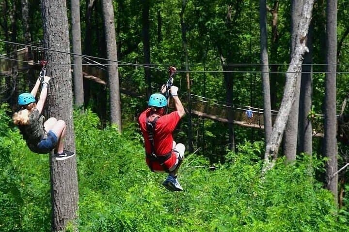
Less than two hours from Nairobi, Kereita Forest pairs hands-on canopy adventure with quiet montane trails and a sobering colonial history—perfect for families, teams, and curious travelers seeking a full-day pulse of nature.
Set out from Bass Harbor for a private, customizable day on Blue Hill Bay — lighthouses, puffins, seals, and the chance to feel Acadia from the water. Small groups, local captains, unforgettable views.
In four hours you can move from shaded canyon ferns to wind-scoured coastal ridgelines, guided by someone who knows where the light—and the hidden views—live. This private half-day hike on the Monterey Peninsula or Big Sur is compact, curated, and perfect for travelers who want depth without a multiday commitment.