Navigating Launch and Meeting Points for Back Bay Salt Marsh Fishing in Southern NJ
Explore the practical side of back bay salt marsh fishing in Southern New Jersey with a clear guide on launch and meeting points. From Isle of Wight to Dennis Creek, discover how tides, terrain, and timing shape your fishing adventure in this wild, saltwater environment.
Plan Around Tide Schedules
Tide timing dictates access to many launch points and fishing spots; consult local tide charts and aim to fish during rising tides for better access and fish activity.
Use Waterproof Navigation Tools
Salt marshes shift with the tide and weather, so bring GPS devices or apps capable of offline use to avoid getting stranded or lost among inlets and channels.
Wear Appropriate Footwear
Muddy and wet trails at launches demand waterproof, quick-drying boots or shoes with good traction to maintain safety while carrying gear.
Establish Clear Meeting Points
Agree on distinctive landmarks, such as isolated trees or signage, and share coordinates with your group to ensure smooth rendezvous and reduce delays.
Navigating Launch and Meeting Points for Back Bay Salt Marsh Fishing in Southern NJ

Evening Striper 4-Hour Charter
1-2 Passengers • 4 hours • Special evening charter perfect for catching stripers
Join Jersey Cape Guide Service for a memorable 4-hour evening fishing trip targeting striped bass off Sea Isle City. Perfect for both beginners and seasoned anglers, this adventure captures the beauty of sunset fishing and the excitement of landing big fish.
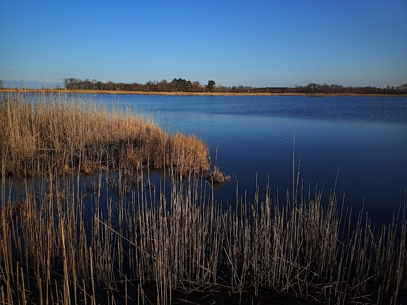
Southern New Jersey’s back bay salt marshes present a unique challenge and thrill for anglers seeking both solitude and saltwater bounty. These marshes are spaces where the tide governs the flow, currents beckon, and the water hides the secrets of striped bass, flounder, and bluefish just beneath its shimmering surface. Your adventure begins long before the first cast—the key lies in selecting and navigating the right launch and meeting points amid the marsh’s shifting channels and tidal creeks.
Start your journey at Isle of Wight Nature Preserve, one of the most accessible launch spots. This site offers gentle water entry points and parking areas equipped for kayaks and small boats. The approach to the launch involves a short walk from parking, over firm dirt trails lined with thick marsh grasses and the occasional call of marsh wrens. The terrain here is flat but can be muddy during low tide, so waterproof footwear is advised.
If you’re aiming for deeper saltmarsh waters, the Dennis Creek launch in Cape May County provides a practical base. The creek challenges fishermen with its narrow inlets and tidal pulls that can swiftly rearrange channels. Familiarize yourself with the tides—high tide grants access to the more secluded ponds where fish feed in sheltered waters, while low tide unveils mudflats where wading becomes a real test. Meet-up points here often double as informal navigation markers: look for the large oak tree standing apart near the creek mouth and the distinctive wooden signpost marking the boat ramp.
Meeting points tend to be laid-back but require timing and local knowledge. The salt marsh system is fiercely dynamic—rising tides may flood paths you intended to follow, and sudden winds can shift safe landing spots. Before heading out, check local tide charts and weather updates to avoid surprises. If traveling in a group, designate clear rendezvous points with GPS coordinates or well-known natural features. Waterproof maps or apps with offline capabilities prove invaluable here.
Beyond logistics, the marsh is alive. The reeds sway with purpose, daring you to read their signs. Herons stalk with restless patience, and schools of baitfish shimmer beneath the water’s surface, flushed by persistent currents. This is a place where nature tests your preparation and respect, but rewards you with authentic and raw fishing experiences.
Remember to pack the practical essentials: tide information, waterproof bags for gear, navigation aids, and durable, quick-drying clothing. Opt for early mornings when the tide is favorable, and the marsh wakes slowly, catching that perfect light and calm waters. As the sun climbs, winds often pick up, making return navigation more complex.
Mastering the launch and meeting points along Southern NJ’s back bay salt marshes is an achievement in itself. It’s a pragmatic adventure—measured steps through nature’s rhythm, requiring awareness and flexibility. With preparation and respect for the marsh’s pulse, you’ll find yourself rewarded with days rich in sight, sound, and the thrill of the catch.
Nearby Trips
All Adventures
Boat Charters
Water Activities
Adventures near Cape May
Discover the unique and memorable adventures that make Cape May special.
Frequently Asked Questions
What are the safest launch points for beginners?
Isle of Wight Nature Preserve offers gentle access with clear trails and parking nearby, making it ideal for beginners unfamiliar with salt marsh terrain or tide-dependent launches.
How do tides affect fishing conditions in the back bay salt marshes?
Tides control water depth and fish movement; rising tides flood new feeding areas for fish while low tides expose mudflats and can restrict navigation. Timing your fishing trips around tide changes improves success and safety.
Are dogs allowed at the launch sites?
Many access points in Southern NJ’s back bay salt marshes welcome dogs on leash, but always verify specific preserve rules and bring ample water for pets, especially during warm months.
Can I fish from shore or do I need a kayak or boat?
Shore fishing opportunities exist but are limited due to marshy terrain. For the best fishing experience and to reach prime spots, a kayak, canoe, or small boat is recommended.
What wildlife should I expect to see during a salt marsh fishing trip?
Herons, egrets, ospreys, and occasionally river otters frequent this environment. The area is also a stopover for migratory birds during spring and fall, making for rich wildlife observation opportunities.
Are there any environmental regulations I should be aware of?
Yes, respecting protected marsh vegetation and wildlife habitats is crucial. Follow Leave No Trace principles, avoid disturbing nesting birds, and adhere to fishing regulations set by the NJ Division of Fish and Wildlife.
Recommended Gear
Waterproof Boots
Protect feet from mud and water at launch sites and riverbanks.
Tide Chart or Tide App
To monitor tidal movements and plan fishing around optimal water levels.
Quick-Drying Clothing
Keeps anglers comfortable in warm, humid conditions and dries fast if splashed.
Waterproof Dry Bags
Protects fishing gear and electronics from water and unexpected splashes.
Local Insights
Hidden Gems
- "A tucked-away sandbar near the mouth of Dennis Creek that offers both safe anchorage and a unique vantage for birdwatching."
- "An old, twisted oak tree distinguished near the launch sites serves as a reliable natural landmark for meeting points."
Wildlife
- "Glossy ibis are rarer visitors but can be spotted in early summer."
- "Listening closely, you might catch the rasping call of salt marsh sparrows early in the morning."
History
"The back bay salt marshes in Southern NJ have been a critical natural habitat and fishing resource for indigenous peoples and later local communities. The area’s network of creeks and channels was historically used for transport and small-scale commercial fishing."