Mount Mansfield stands as Vermont’s tallest peak, offering hikers a network of trails lined with forest, rock, and wind-shaped tundra. Discover routes suited to various skill levels and prepare to be rewarded with sweeping mountain views, a refreshing sense of wilderness, and practical tips to ensure your ascent is safe and enjoyable.
Start Early to Avoid Afternoon Weather
Summer afternoons can bring sudden thunderstorms on Mansfield; begin hikes early in the day to reduce risks of storms and enjoy cooler morning temperatures.
Wear Traction-Friendly Hiking Boots
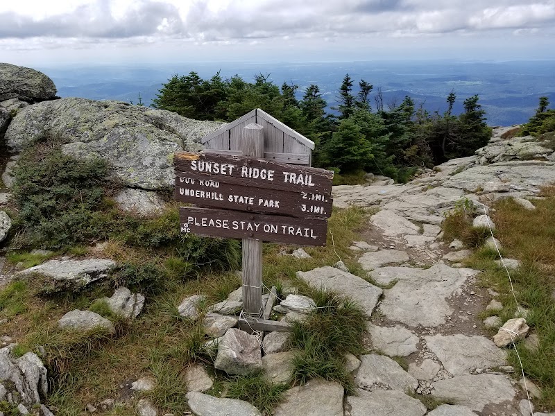
Trails are rocky and often steep; boots with solid grip prevent slipping on loose scree and damp roots, especially on the Sunset Ridge Trail segment.
Hydration Is Key
Carry at least 2 liters of water per person, as natural sources near the summit are limited and exposed to elements that may compromise water quality.
Layer Up Against Wind and Temperature Changes
Summit ridge temperatures can drop quickly; bring breathable layers, a windbreaker, and be ready for rapid weather shifts.
Trailblazing Mount Mansfield: Vast Vistas and Rugged Paths of Vermont’s Tallest Peak
Mount Mansfield, Vermont’s highest summit at 4,393 feet, commands attention with miles of intertwining trails and panoramic views that shift with each step you take. Starting from the forest floor, where towering pines and rugged birch trees push aside patches of sunlight, the trails challenge your stamina with a steady 2,600 feet of elevation gain before reaching the summit ridge, a broad spine often swept by brisk winds that dare you forward.
The Long Trail, which crests Mansfield’s summit, offers roughly 7 miles of rocky outcrops, alpine tundra, and forested corridors to explore. The terrain shifts dynamically—from loose rock and roots underfoot to smoother sections peppered with moss and lichens that seem to grip tightly to the mountainside. Trails like the Sunset Ridge Trail provide a direct but steeper ascent (2.8 miles, 2,000 feet elevation gain), rewarding hikers with open ledges overlooking the expansive Green Mountains and Lake Champlain far below.
From the peak, the vista unfolds in layers: rolling forests stretching westward, the shimmering water to the north, and, on clear days, the jagged Adirondacks forming a blue horizon. The air here is brisk, pushed by winds that whip across rocky slabs polished by years of weather, a reminder that nature on Mansfield is fiercely itself. Expect occasional gusts that cool the skin and thick fog that blurs outlines, demanding respect and readiness.
Plan your hike with water and sturdy footwear that handles slippery roots and loose scree. Early morning starts beat afternoon crowds and afternoon thunderstorms, common in summer months. Remember: the mountain communicates clearly through its changing conditions—listen and respond, whether that means layering up or turning back.
Mount Mansfield isn’t just about the summit. Side trails lead to quieter spots where small streams spill and taunt you with crisp, cool refreshment, while moss-cradled boulders invite short rests. This mountain offers an integrated experience—physical challenge met with thoughtful engagement, a place where adventure blends practical planning with raw natural beauty.
Nearby Trips
All Adventures
Boat Charters
Water Activities
Adventures near Stowe, Vermont
Discover the unique and memorable adventures that make Stowe, Vermont special.
Frequently Asked Questions
What is the best trail to reach Mount Mansfield’s peak?
The Sunset Ridge Trail is popular for a direct summit approach, about 2.8 miles with a 2,000-foot climb, offering dramatic views. For a longer, less steep option, the Long Trail runs across the summit ridge with more gradual ascents.
Are dogs allowed on Mount Mansfield trails?
Yes, dogs are allowed but should be kept on a leash, especially to respect wildlife and other hikers. Bring ample water and be cautious with exposed ridge sections.
When is the safest time to hike Mount Mansfield?
Late spring through early fall provides the safest hiking conditions, with July to September being ideal. Avoid winter without proper gear and experience due to snow and ice hazards.
How difficult is the hike to the summit of Mount Mansfield?
The hike is challenging due to elevation gain and rocky terrain but accessible to hikers with moderate experience and fitness. Preparation and pacing are key.
Are there facilities or water sources on the trail?
There are no reliable water sources above tree line and only limited facilities near trailheads; hikers must carry all necessities, including water.
Can you camp overnight on Mount Mansfield trails?
Backcountry camping is allowed with proper permits in designated areas along the Long Trail but not directly on the summit. Follow Leave No Trace principles to protect the fragile alpine environment.
Recommended Gear
Sturdy Hiking Boots
Crucial for ankle support and grip on steep, rocky surfaces and mixed trail conditions.
Layered Clothing
Quick-drying, breathable layers plus windproof jacket help adapt to variable and windy summit weather.
Hydration System or Water Bottles
Sufficient water supply is vital as natural sources are scarce above tree line.
Map and Compass or GPS Device
Reliable navigation tools help track trails and summit paths, especially when fog or weather obscures markers.
Local Insights
Hidden Gems
- "Cliff edge overlooks near the Bingham Falls trail provide dramatic views with fewer crowds."
- "Quiet fern-filled hollows along the Spruce Peak Trail where rare birds sometimes linger."
Wildlife
- "White-tailed deer and black bears trek the lower slopes, while alpine zones host rare bird species like the Bicknell’s thrush."
- "Keep an eye out for timber rattlesnakes in rocky areas during early spring."
History
"Mount Mansfield holds significance for local Abenaki people, who regarded it as a landmark and spiritual place. The mountain’s name is said to derive from its profile resembling a man’s face, embodying cultural stories tied to the landscape."