
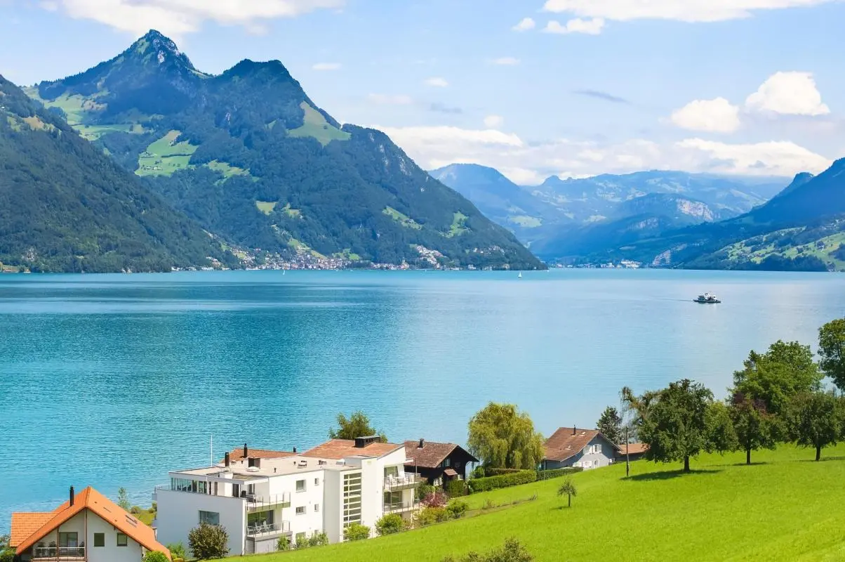
What the day feels like
You arrive in a small ferry’s wake and the lake answers with a pale, cold whisper; the water slips away from the hull and clings to the cliffs. On the opposite shore the Churfirsten peaks stand like a serrated spine—vertical slabs of limestone and dolomite that have watched the Walensee for millennia. The first step off the dock is a reminder: this is not a postcard lake with gentle beaches. It is a mountain lake hemmed by steep rock, where trails climb quickly into open ridgelines and waterfalls fling themselves into hidden basins.
Lake Walen—Walensee in German—sits at the crossroads of geology and human scale. It occupies a narrow valley between the cantons of St. Gallen and Glarus, a deep glacial trough carved during the last Ice Age and now filled with icy blue water. The teal of the lake is cradled by the Churfirsten chain to the north and the rugged Glarus Alps to the south; from the Leistkamm ridge you can watch clouds spool across those teeth and then tumble down into the valley below. For travelers who want water views without sacrificing alpine grit, Walensee is an elegant compromise: boat mornings and ridge afternoons.
Local history is folded into the land. The Romans passed through this corridor, and villages such as Weesen and Walenstadt grew as trade and travel hubs between Zurich and the eastern Alps. The region’s geology is also internationally important—nearby the Sardona zone is a UNESCO World Heritage Site that records rock thrashings and plate collisions from hundreds of millions of years ago. Today the valley is dotted with alpine farms, small steakhouses serving raclette and rösti, and a handful of chocolate ateliers where Swiss craft is a living trade.
The real draw here is motion: the water daring you to boat across, the waterfalls pushing like arguments down the mountainside, and trails that insist you climb them. The Leistkamm Ridge hike—a full-day, guided outing frequently run from Zurich—gives a succinct primer on what Walensee is about. Expect 12–14 km of trail, roughly 1,000 m of elevation gain, and a day that alternates between shaded forest switchbacks and open, wind-buffed ridgelines with sweeping views of the lake and Churfirsten. The route is not technical but it demands steady legs and sure footing; in return you’ll get rare, quiet outlooks that most visitors never see.
If your itinerary favors a softer tempo, private panorama tours that include a viewpoint above Walensee and visits to nearby cascades—Seerenbach Falls and the Diesbach Falls—deliver spectacle with comfort. Those trips mix short walks with interpretive stops: a guide will point out the best angles for photographs, explain how the glaciers shaped the valley, and often finish with a local tasting—cheese, chocolate, or a mountain picnic with raclette if schedules allow.
Practicalities matter here. Walensee is best accessed by Swiss public transport: trains from Zurich to Weesen or Walenstadt connect reliably, and local buses or ferries complete short hops along the shore. If you’re coming from Zurich for a day, expect a 1–1.5 hour travel window each way. Weather can flip quickly on a ridge—mornings might be satin and still, afternoons brisk and blown-out—so plan an early start, carry layers, and give yourself flexibility.
Footwear and pacing are the simple hacks that will turn a good day into a great one. Trails on Leistkamm can be steep and rocky; hiking boots or sturdy trail shoes with ankle support make a difference. Hydration matters—the climb feels long because the views keep you stopping, and stopping cools your muscles until they stiffen. If you book a guided hike, your guide will handle route-finding and often carry a little local lore: the names of peaks, the history of alpine farming, and where to find the best espresso after a day on the trail.
Seasonal choices change the character of Walensee. Late spring and early summer bring powerful waterfalls—Seerenbach is at its most dramatic then—while summer and early fall offer the most stable hiking weather and the warmest lake temps for brave swimmers. Winter opens up a different palette: snow transforms the ridgelines into silent sculpture, but many summer trails are icy and require winter skills.
This is a lake for people who like a little altitude with their water. It isn’t designed for languid beach days; instead, it rewards those who pair boat time with a climb, coffee with a waterfall, and a small village inn with a long view. The effect is cumulative: one boat crossing, one ridgeline, one lunch on a terrace that looks directly at the Churfirsten line, and you’ll find why locals call it the Blue Lake. For travelers seeking a concise Swiss alpine day—accessible from Zurich, rich in geological story, and intimate enough to feel personal—Walensee is an elegant, immediate choice.
Trail wisdom
Small choices, better day.
Start early for the best light
Morning light along the Leistkamm ridge is clearer and winds are typically lighter—start before 8am when possible to avoid afternoon gusts and clouds.
Wear supportive footwear
Expect rocky switchbacks and occasional scree on ridgelines—sturdy trail shoes or light boots reduce ankle injuries.
Use public transit
Trains to Weesen/Walenstadt are frequent and drop you close to trailheads and ferries—parking can be limited in summer.
Plan for water and snacks
A 1,000 m gain day needs 2–3 liters of water and compact, high-energy snacks—there are few services on the ridge.
Local knowledge
Read the place, not just the route.
Watch for native species including chamois, golden eagle (occasionally).
Keep an eye out for wildlife during the transition between areas and habitats. Respect distance guidelines.
The region benefits from careful trail management and protected geological sites like the Sardona UNESCO zone—use public transit and stay on marked trails to limit erosion.
Follow the guide's instructions on size limits, ethical handling, and leave-no-trace practices.
Amden terraces above the lake for quiet panoramic coffee stops. Short walk to the Seerenbach viewpoint near Betlis for dramatic waterfall views
Locally recommended viewpoints and quiet spots known best to local operators.
Walensee’s villages were important alpine transit points; the area shows evidence of Roman-era routes and centuries of pastoral farming.
Maritime roots and regional tradition shape the waterways and working coasts.
Seasonal guide
Four versions of the same landscape.
Spring
Best forwaterfalls at peak flow · wildflowers on lower slopes
Challengesmuddy trails · variable late-season snow
Snowmelt boosts cascades like Seerenbach; lower-elevation trails can be muddy and higher paths may still have snow patches.
Summer
Best forstable hiking weather · boat crossings and lakeside stops
Challengescrowds on popular viewpoints · occasional thunderstorms
Warm, long days are ideal for combining a ferry ride with a full Leistkamm ridge hike—watch afternoon weather.
Fall
Best forcrisp air and clear visibility · fewer crowds
Challengesshorter daylight hours · cooler nights
Late summer into September offers the clearest mountain air and excellent color on the lower slopes—dress in layers.
Winter
Best forsnow-covered ridge views · quiet lakeside villages
Challengesicy trails, route closures · limited services
Snow turns the landscape cinematic but many summer trails are unsafe without winter gear and skills.
Pack with intention
What to bring.
Good to know
Common questions.
Take the train to Weesen or Walenstadt (about 1–1.5 hours); local buses and ferries connect lakeside trailheads and viewpoints.
Plan the edges
The details that make the day easier.
Walensee is framed by the Churfirsten mountain range and lies adjacent to the Sardona UNESCO World Heritage Site—a geologic type area that documents dramatic alpine thrusting.
Small lakeside inns serve alpine staples—raclette, rösti, and locally produced cheeses—while nearby chocolatiers (Bilten/Läderach) offer tastings; traditional alpine farms still graze livestock on summer pastures, and many hotels source ingredients locally.
- Nearest hub
- Zurich (1–1.5 hr by train). Best access points: Weesen, Walenstadt, Amden. Popular activities: Leistkamm ridge hike (12–14 km, ~1,000 m gain), waterfall viewpoints, ferry crossings. Languages: German; major services speak English.
Prioritize public transport, avoid off-trail shortcuts that cause erosion, pack out waste, and choose local guides to support community economies and preserve fragile alpine environments.
Explore by topic
Follow the threads.
Keep exploring
Make the story part of the trip.
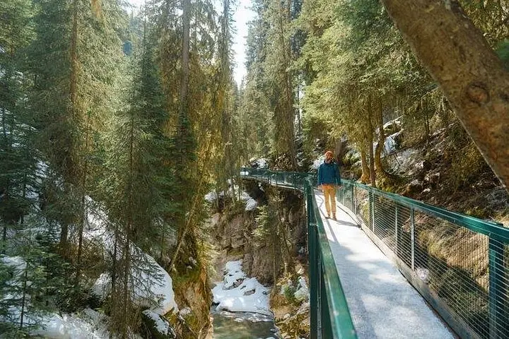 Related story
In eight efficient hours, experience the turquoise drama of Lake Louise and the cathedral-like icefalls of Johnston Canyon. This guided shuttle day trip from Banff/Canmore combines easy access, crisp winter scenery, and practical guidance for a high-reward Rockies outing.
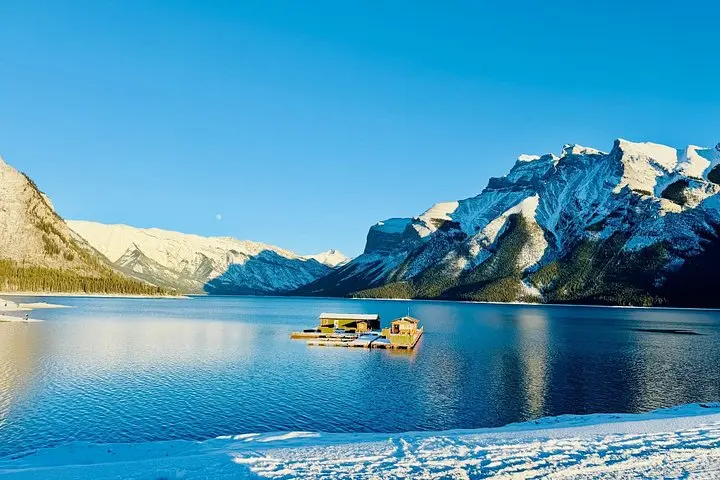 Related story
See Banff’s signature overlooks and hidden lakes in one compact, expertly guided 2.5-hour loop. Perfect for short-stay travelers who want big scenery without the driving.
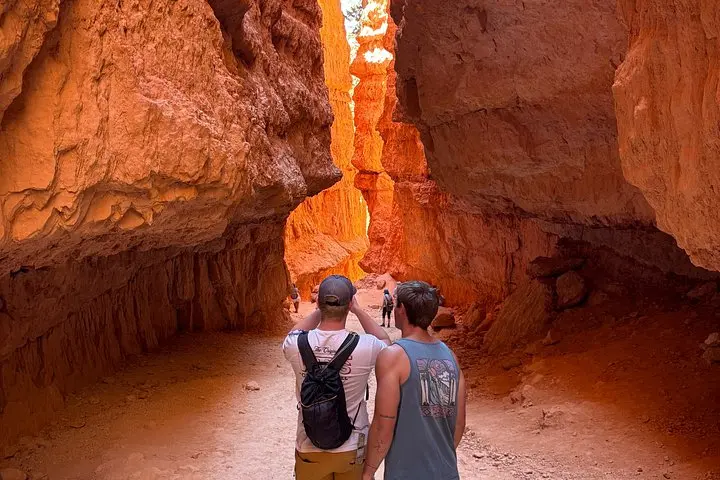 Related story
A guided sunrise hike down the Navajo Loop turns Bryce Canyon’s hoodoos from postcard scenery into an intimate geology lesson. Three miles, expert narration, and unforgettable light—this tour is the quickest way to understand how ice, time, and wind carved a city of stone.