
What the day feels like
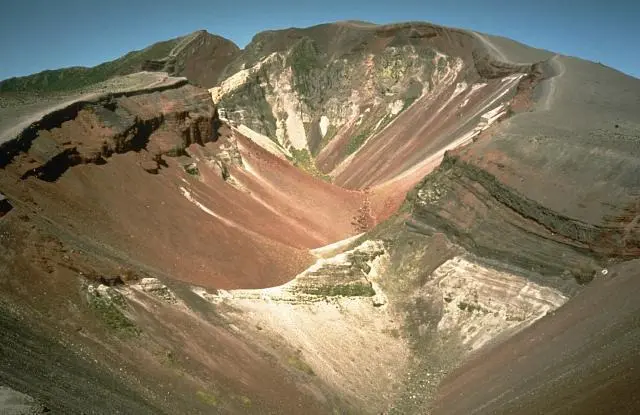
You step out of the helicopter and the world rearranges itself: the air is thinner, drier, and carries that faint metallic scent of old ash. Beneath your boots the ground is a mosaic of hardened lava flows, pumice fields and moss-furred cracks — a terrain that still remembers the violence of 1886. From the crater rim at Mt. Tarawera the North Island lays out in unexpected ways: shimmering lakes like mirrors, forested ridgelines that survived the blast, and the stitched scars of an eruption that remade the landscape overnight. This is not a tame alpine walk; it’s a chance to stand on a geologic headline.
Mt. Tarawera, rising roughly 1,111 meters above sea level on the outskirts of Rotorua, is less a lone peak than a dramatic, broken series of craters and domes. The mountain’s notoriety comes from the 1886 eruption — New Zealand’s largest in living memory — a cataclysm that destroyed Māori villages, reshaped lakes, and buried the world-renowned Pink and White Terraces. The terraces’ fate remains part science, part local memory: pieces were rediscovered under lake sediments in recent decades, but the narrative of loss and recovery still hums through Rotorua’s cultural life. The eruption also carved the Waimangu Volcanic Valley and left Tarawera Falls and adjacent crater lakes, features that read like a field guide to volcanic processes: maars, eruption fissures, hydrothermal vents and sinter terraces.
Most visitors encounter Tarawera from the air — and with good reason. Scenic flights from Rotorua or landings that include a guided walk let you compress a lot of context into a short window. Helicopter tours linger above the crater lakes and the Blue and Green Lakes, then set you down on a shelf of the rim for a 15–30 minute walk. On the ground you follow ash-hardened tracks, peer into a hollowed throat, and feel the mountain’s scale in the hush. Floatplane itineraries add a wet contrast: taxiing to a remote pier on Lake Rotoiti, you can switch from volcanology to thermal leisure with a visit to secluded hot pools only accessible by water. That combination — an aerial approach and a waterborne cooldown — is quintessential Rotorua: heat and water, steam and sky.
Geology is the practical poetry here. Tarawera is part of a complex volcanic system on New Zealand’s Taupo Volcanic Zone, a stretch of crust under stress at the edge of the Pacific Ring of Fire. When you look down from the aircraft you’re seeing not just one event but a stratigraphy of eruptions and hydrothermal remodeling. The crater lakes are often cobalt bright or muted green depending on mineral content and light angle; hot springs and steaming fumaroles send up occasional plumes that seem to dare you to come closer. Respect the thermal areas — boardwalks and signs are there to keep fragile microbial mats and human feet apart.
Practicalities: if you book a helicopter Mount Tarawera landing expect the entire experience to occupy 2–4 hours door-to-door from Rotorua, with the aircraft component around 20–40 minutes depending on routing. The walking element after landing is short (typically a guided 15–30 minute loop) but rocky and uneven — pumice, scoria and consolidated ash mean good ankle support is essential. Floatplane trips that include a hot-pool stop add a lake taxi and a relaxed 90-minute soak; those itineraries are ideal for packing a towel and swimwear in a small dry bag. Photography windows are best in the last two hours of daylight when the sun slants across crater rims and lake surfaces; morning flights can bring low cloud into the valleys, creating moodier light.
What to prepare for in the field: layers. Rotorua’s weather swings fast — sun, wind and showers can all appear in a single afternoon. Footwear should be substantial rather than token: trail shoes with good tread and ankle support will save your knees on pumice slopes and crater edges. For aerial tours, bring sunglasses and a windlayer; helicopters and seaplanes can put you into a draft even in good weather. If you plan to pair a scenic flight with a Waimangu or Orakei Korako visit, give yourself time: those geothermal reserves reward slow walking and careful observation more than rushed snapshots.
Culturally, Tarawera sits inside a landscape that is still read and sung by local iwi. Rotorua is a living cultural center where Māori narratives are part of the interpretive landscape: the mountain, lakes and geothermal features interweave with stories of settlement, loss, and renewal. Guides on both air and land tours often combine geology with oral histories — a balance that helps make the terrain legible and human. Practically, book your guided options in advance during summer or holiday windows: flights are weather-dependent, and operators will have strict safety cut-offs for wind, fog and volcanic advisories.
For the adventurous traveler who wants both a sweep of wilderness and reliable logistics, Mt. Tarawera is a perfect afternoon: a high, crisp view of the North Island’s lake district, a tactile lesson in volcanic mechanics, and for those who choose it, a warm dip in a lakeside hot pool afterward. Take away this image: you, on a volcanic rim, the sky low and clear, the distant sound of wind through regenerating forest — a place where the earth still tastes of fire, and the landscape remembers every event it has endured.
Trail wisdom
Small choices, better day.
Wear supportive boots
The crater rim is pumice, scoria and uneven rock — ankle-supporting trail shoes reduce slips and fatigue.
Bring a compact windlayer
Flights and ridge-top conditions can be windy and cool even on warm days; pack a lightweight windproof.
Time for golden hour photos
Book late-afternoon flights when light grazes crater edges and lake colors deepen for the best images.
Respect thermal warnings
Boardwalks and signs protect fragile geothermal features — stay off closed areas and follow your guide’s instructions.
Local knowledge
Read the place, not just the route.
Watch for native species including tūī (native honey-eating bird), pīwakawaka / fantail.
Keep an eye out for wildlife during the transition between areas and habitats. Respect distance guidelines.
Thermal features are fragile—stay on boardwalks and follow guide instructions to protect microbial terraces and delicate geothermal surfaces.
Follow the guide's instructions on size limits, ethical handling, and leave-no-trace practices.
Tarawera Falls viewpoint — an off-the-beaten photo stop downstream of the eruption zone. Secluded hot-pools on Lake Rotoiti reachable only by water taxi or floatplane
Locally recommended viewpoints and quiet spots known best to local operators.
The 1886 eruption of Mt. Tarawera destroyed several Māori settlements and the famed Pink and White Terraces; the resulting landscape formed Waimangu Volcanic Valley and changed local waterways.
Maritime roots and regional tradition shape the waterways and working coasts.
Seasonal guide
Four versions of the same landscape.
Spring
Best forwildflower regrowth · milder flight conditions · fewer crowds
Challengeschangeable rain · cool mornings · muddy access tracks
Spring brings regenerating native bush and fewer tourists; expect brisk mornings and occasional showers.
Summer
Best forstable flying weather · long daylight · lake soaks after flights
Challengeshigher demand · strong sun · occasional afternoon storms
Summer offers the most reliable flight windows and warm after-flight swims, but book early for slots.
Fall
Best forcrisp clear light · fewer crowds · leaf color shifts in surrounding forest
Challengescooler evenings · shorter days · potential low cloud
Autumn provides dramatic light for photography and quieter tours, though temperatures drop quickly after sunset.
Winter
Best formoody volcanic landscapes · clear winter air on cold days · affordable tour rates
Challengescold winds at altitude · weather cancellations · short daylight hours
Winter visits can be starkly beautiful but are most vulnerable to weather cancellations; layers are essential.
Pack with intention
What to bring.
Good to know
Common questions.
No — most visitors see Tarawera via scenic flights that include a short guided walk after landing on the crater rim; independent full ascents are less common and require local planning.
Plan the edges
The details that make the day easier.
The 1886 eruption of Mt. Tarawera destroyed the famed Pink and White Terraces, once called the "eighth wonder of the world," and also formed the Waimangu Volcanic Valley.
Rotorua blends Māori cultural centers, geothermal parks and lakefront cafés — try a hangi meal, visit Te Puia for carving and geothermal demonstrations, and sample locally farmed trout at lakeside restaurants.
- Nearest hub
- Rotorua (30–45 min transfer to flight bases). Book flights & floatplanes in advance. Expect 2–4 hour excursions; carry layers, ID and camera. Weather-dependent cancellations are common; pack patience.
Choose operators that follow DOC and iwi guidance, keep to boardwalks, and limit group sizes to reduce impacts on fragile geothermal and cultural sites.
Explore by topic
Follow the threads.
Keep exploring
Make the story part of the trip.
 Related story
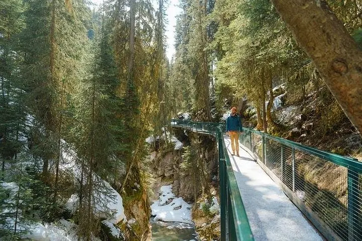
In eight efficient hours, experience the turquoise drama of Lake Louise and the cathedral-like icefalls of Johnston Canyon. This guided shuttle day trip from Banff/Canmore combines easy access, crisp winter scenery, and practical guidance for a high-reward Rockies outing.
 Related story
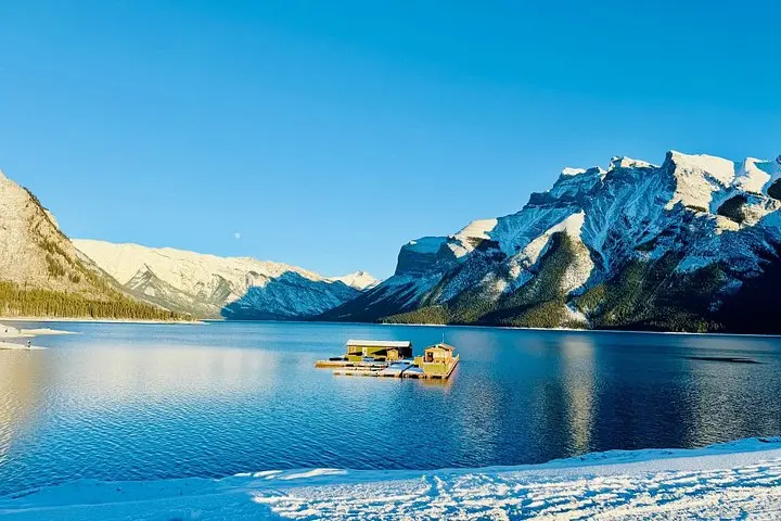
See Banff’s signature overlooks and hidden lakes in one compact, expertly guided 2.5-hour loop. Perfect for short-stay travelers who want big scenery without the driving.
 Related story
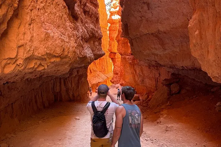
A guided sunrise hike down the Navajo Loop turns Bryce Canyon’s hoodoos from postcard scenery into an intimate geology lesson. Three miles, expert narration, and unforgettable light—this tour is the quickest way to understand how ice, time, and wind carved a city of stone.